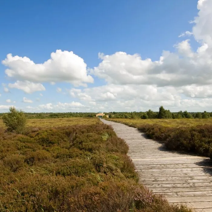



Hidden in the silent boglands of County Longford lies an exceptional archaeological discovery: an imposing wooden road built in 148 BC. At the Corlea Trackway Visitor Centre, an original section of this roadway, more than 2,000 years old, offers a journey back to Iron Age Ireland.
corleacoclellll
Corlea Bog – Kevin King – cc
Located a few kilometres from the village of Kenagh, the Corlea Trackway Visitor Centre protects one of Ireland’s most fascinating Iron Age remains. The site displays an authentic section of a vast wooden roadway built at a time when bogs were landscapes as difficult to cross as they were laden with symbolism.
Known locally as Danes’ Road, this ancient route is considered the largest structure of its kind discovered in Europe. An original 18-metre section is now on display in the interpretation centre.
The Corlea trackway was discovered in 1984 during work carried out in the bog. Archaeological investigations undertaken the following year revealed a prehistoric landscape far more complex than had been imagined. Several wooden routes had been laid across this wetland, probably to cross terrain that was unstable and difficult to negotiate.
The main roadway was made of heavy oak planks resting on wooden rails. Its construction required the felling, preparation and transport of a considerable quantity of material. A project on such a scale suggests an especially sophisticated level of collective organisation for the period.
Despite these efforts, the route appears to have been used for only a very short time. Under its own weight, the wood gradually sank into the peat. This made the roadway unusable, but it also preserved it for more than two millennia. The wet, oxygen-poor environment slowed the decomposition of the oak, turning Corlea into a true time capsule.
The exact purpose of this road remains a matter of debate. It may have facilitated the movement of people, livestock or goods between different territories. However, its scale and the resources needed to build it also suggest a ceremonial or political function.
Some historians believe it may have formed part of an important route linking the Hill of Uisneach, Ireland’s ancient ritual centre, with the royal site of Rathcroghan, in present-day County Roscommon. This interpretation remains a hypothesis, but it places Corlea within a landscape shaped by the beliefs, gatherings and powers of pre-Christian Ireland.
The centrepiece is an 18-metre section of the ancient roadway. It is displayed in a room specially designed to ensure its preservation. Visitors can examine the arrangement of the planks, their impressive dimensions and the techniques used by Iron Age builders.
This direct encounter with the original wood gives the site its full impact. It is not simply a decorative reconstruction, but part of the very structure travelled by men and women more than 2,000 years ago.
The centre also traces the discovery of the site, the excavation campaigns and the work required to preserve the wood. Audiovisual displays and archaeological explanations shed light on the formation of bogs, their role in preserving organic matter, and the challenges ancient communities faced in crossing them.
Access to the interpretation area and the preserved trackway is available only as part of a guided tour. It helps place the remains in their setting and distinguish established facts from the various hypotheses put forward by archaeologists.
Corlea offers an experience very different from Ireland’s major monumental sites. There is no spectacular castle or ocean-facing ruin here: the site’s appeal lies in a wooden structure preserved beneath the peat and in what it reveals about the society that built it.
The centre makes a particularly interesting stop for enthusiasts of archaeology, ancient history and bogland landscapes. Its accessible tour may also suit families wishing to discover the Iron Age through a tangible remnant.
The site has a picnic area, bicycle facilities and toilets accessible to people with reduced mobility. Dogs are permitted in outdoor areas provided they are kept on a lead.
Essential information to help you plan your visit, including key landmarks, access information, and booking options.
53.612515, -7.845447
Access to the centre and the archaeological trackway is available only as part of a guided tour. It is advisable to check opening times before visiting, particularly as the seasonal closure approaches or during Irish public holidays.
Check the opening hours and admission requirements before you leave, especially during peak season or on Irish public holidays.