Viator


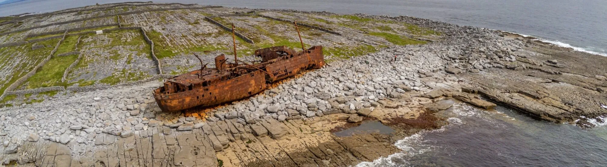
Resting on the rocks of Inis Oírr, the torn-open hull of the MV Plassy looks as though it had been cast ashore by a gigantic wave. This vessel, weighing almost 600 tonnes, ran aground off the smallest of the Aran Islands on 8 March 1960, during one of the fierce storms that regularly sweep across the entrance to Galway Bay.
The eleven sailors on board were saved thanks to the courage and skill of the islanders. The wreck, however, never left. Slowly driven inland by tides and storms, it has become one of Inis Oírr’s most recognisable landmarks, as well as an iconic image from the opening credits of the Irish series Father Ted.
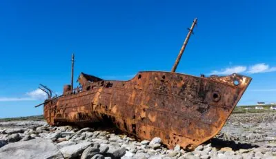
The MV Plassy on Inis Oírr – © Lothar
The MV Plassy lies at the eastern end of Inis Oírr, also known in English as Inisheer. Its reddish-brown hull stands out sharply against the island’s grey limestone, dry-stone walls and grasslands.
Its present condition may suggest that it was an old ship abandoned near the coast. Yet the Plassy was still in service when it was driven onto Finnis Rock, or Carraig na Finise, during the night of 7 to 8 March 1960.
The vessel did not immediately come to rest in the position seen today. It first ran aground on an offshore rock platform. Waves, spring tides and successive storms then gradually pushed it towards the shore, eventually leaving it completely out of the water.
The names Plassy and Plassey are both frequently used. Maritime records and documents relating to its final voyage chiefly use the form Plassy, which appeared on the vessel when it belonged to the Limerick Steamship Company.
The variant Plassey has become very common in tourist publications and on signs about the wreck. Both spellings therefore refer to the same ship.
Its name refers to Plassey, near Limerick, where the main campus of the University of Limerick and Plassey House are now located.
The ship was built in Beverley, Yorkshire, by the Cook, Welton & Gemmell shipyard. Launched in October 1940, it entered service with the Royal Navy in March 1941 under the name HMS Juliet.
It belonged to the Shakespeare class, a series of naval trawlers named after characters from the works of William Shakespeare. Contrary to some accounts, its main role was not anti-submarine warfare: HMS Juliet primarily served as a minesweeper, although it was armed and could carry depth charges.
The vessel initially operated in British waters. In 1942, it took part in Operation Torch, the Allied landings in North Africa, before continuing its service in the Mediterranean.
Just over 50 metres long, it had a displacement of around 545 tonnes. Its hull and sturdy design enabled it to withstand rough seas, but they were not enough to save it from the reefs of Inis Oírr.
After the Second World War, the vessel was no longer needed by the Royal Navy. In 1947, it was converted into a motor cargo ship, given an additional hold and renamed Peterjon.
The Limerick Steamship Company bought it in 1951 and renamed it Plassy. It became the first motor vessel operated by this Irish shipping company.
The Plassy was not confined to coastal waters. Operated as a versatile merchant vessel, it sailed as far as South Africa, Greece, Iceland, Finland and Russia. Its insulated holds were suited to carrying refrigerated goods, including fruit and fish.
It also served ports along Ireland’s west coast, including Limerick, Fenit, Galway, Westport, Sligo and Ballina, as well as several European ports such as Liverpool, Antwerp and Rotterdam.
On Monday 7 March 1960, the Plassy left Fenit harbour in County Kerry. It had just delivered a cargo of steel for the Liebherr factory in Killarney and was now bound for Galway with a range of goods.
The cargo ship was temporarily replacing another company vessel, the Derrynane, which was laid up in dry dock. The planned journey between Fenit and Galway was expected to take between twelve and fourteen hours.
Conditions quickly deteriorated. A deep depression crossed Ireland’s west coast, and the Valentia radio station issued gale warnings of force 8 to 9, with gusts reaching force 10. The night was pitch-black, rain severely reduced visibility and the sea became especially violent.
After rounding Loop Head, the Plassy headed towards Black Head. Its route was to take it through the South Sound, the narrow channel separating Inis Oírr from the County Clare coast.
Finnis Rock was a well-known hazard to sailors. This limestone platform, barely covered by the sea, extends offshore from Inis Oírr. At the time, its marker buoy was visible only during daylight hours.
In the darkness and rain squalls, the crew watched the lights of Inis Oírr lighthouse and Black Head to keep the correct course. The wind, swell and cargo stowed on deck nevertheless made navigation difficult.
At around 5.10am on 8 March, the hull struck Finnis Rock with tremendous force. The impact tore a breach beneath the ship, and water quickly flooded the engine room. The pumps could not keep up, the engine stopped and the lights went out.
Sailor Eddie Reidy was in the galley making tea and toast. The force of the impact threw him against the ceiling, a dramatic scene he recounted several years after the wreck.
The battery-powered emergency radio enabled Captain Thomas Wilson to send a distress message. The Plassy was rapidly taking on water and threatened to capsize or break up on the rocks.
The eleven crew members first attempted to leave the ship in the starboard lifeboat. The swell was so strong, however, that the boat rose and fell violently against the hull.
The captain feared that the lifeboat would be smashed on the rocks or crushed by part of the cargo. He therefore ordered the sailors back onto the Plassy. Shortly after they returned aboard, the ropes holding the boat gave way and it was swept out to sea.
Swimming ashore was out of the question. Despite its apparent proximity, the shore remained separated from the ship by freezing water, powerful waves and a particularly dangerous stretch of rocks.
At daybreak, two young boys out collecting seaweed spotted the ship in distress and ran to raise the alarm. The local rescue service was mobilised at once.
The necessary equipment was stored in the Rocket House, a small coastal station on the island. It included a rocket rescue apparatus and a breeches buoy, a type of buoy with canvas breeches suspended from a rope system.
At that time, Inis Oírr had neither cars nor horses. The heavy equipment had to be carried by hand on a cart for almost a kilometre along difficult tracks. Around sixty islanders came to help, while specially trained volunteers organised the rescue.
A first rocket was fired towards the ship at 9am to get a line aboard. It missed its target, as did the second. The third finally reached the top of the mast. A stronger cable could then be stretched between the shore and the Plassy.
The sailors climbed into the breeches buoy one by one and were hauled ashore. The cable sagged under their weight, and several men were partly submerged during the crossing. Despite the storm, all eleven crew members reached land alive. Captain Thomas Wilson was the last to leave the vessel.
The islanders then welcomed the survivors into their homes, gave them dry clothes and accommodated them for several days, as sea crossings remained suspended because of the weather.
The Plassy was carrying general goods destined for Galway and towns in the region. Accounts mentioning only a cargo of whisky are therefore incomplete.
Its holds contained around 50 tonnes of cotton, copper pipes, washbasins, toilets, lawnmowers, children’s pedal cars and several crates of Scotch whisky. The ship was also carrying a caravan and a boat on deck.
Two thousand cartridges for captive-bolt devices used by the meat industry were also part of the cargo. Their presence probably contributed to the many stories that circulated on the island after the wreck.
Some of the goods were recovered at low tide in the following weeks. Bales of cotton and various objects were nevertheless scattered along the shore.
Engineers from the Limerick Steamship Company and experts from Lloyd’s insurance company examined the vessel after the accident. Damage to the lower part of the hull was too extensive for refloating to be a realistic option.
The Plassy was therefore abandoned on Finnis Rock. In the following weeks, another storm lifted it and pushed it further towards the shore. Spring tides and heavy swells then continued to move it gradually above the high-water mark.
The wreck visible today is therefore no longer exactly where the ship ran aground in 1960. The ocean has moved it closer to the shore and turned it over the decades.
At the beginning of January 2014, Storm Christine battered the Aran Islands. The force of the waves moved the Plassy once again and noticeably distorted its hull.
This episode is a reminder that the wreck is not a fixed monument. The metal continues to rust, some plates are coming away and the structure is gradually losing its shape. Every major storm can alter its appearance or position.
It is therefore impossible to know how long the Plassy will retain its current silhouette. Its slow disappearance under the effects of salt and wind is now part of its story.
The Plassy owes part of its international renown to the Irish comedy series Father Ted, broadcast between 1995 and 1998. The wreck appears in the famous aerial opening credits introducing the fictional Craggy Island.
The island in the series does not really exist, and the episodes were filmed mainly in County Clare. The opening credits nevertheless bring together several landscapes from the west coast, including the wreck of Inis Oírr.
This brief appearance was enough to turn the Plassy into a place of pilgrimage for fans of the series. It is now often described as “the Father Ted wreck”, even though no main scenes were filmed aboard it.
The wreck is at the eastern end of the island, near the road leading to Inis Oírr lighthouse. It can be freely accessed year-round, with no ticket or opening hours.
It can be reached on foot or by bicycle from the village and ferry pier. Minibus and horse-drawn carriage tours available on ferry arrivals also pass nearby.
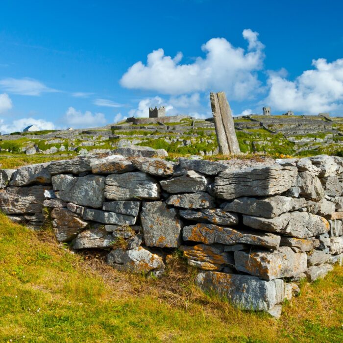
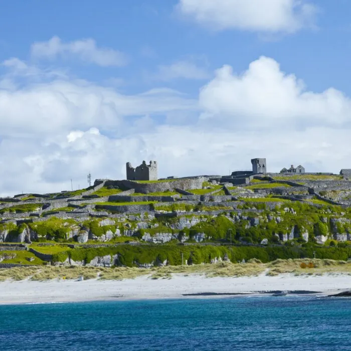
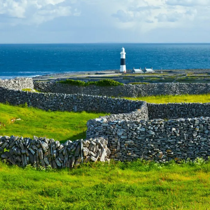
The route crosses a landscape typical of the Aran Islands, with tiny fields, dry-stone walls and limestone outcrops. Loch Mór, the island’s only freshwater lake, lies along the way.
The time needed depends on how you travel and how often you stop. As Inis Oírr is a small island of around 3km by 3km, the wreck can easily be included in a day of exploration that also takes in the lighthouse, O’Brien’s Castle and St Caomhán’s Church.
Do not enter the wreck or climb onto its hull. The Plassy is an abandoned ship, weakened by more than sixty years of corrosion and regularly battered by storms.
Metal plates can give way without warning. Openings in the hull have extremely sharp edges, while the interior floors are unstable and partly collapsed.
Pieces of metal, cables, bolts and mechanical fragments may also be found around the ship. Sturdy, closed-toe footwear is therefore essential. The area is unsuitable for bare feet or unsupervised young children.
Wind and waves can become dangerous when the weather worsens. It is best to stay on paths and dry rocks, rather than attempting to go around the wreck close to the water.
The Plassy can be freely photographed from the shore. The contrast between its rusting hull, pale limestone and the grasslands of Inis Oírr creates very different compositions depending on the light.
Stepping back a little makes it possible to show the wreck in its setting and better understand its strange position above the sea. In clear weather, the Cliffs of Moher can be seen beyond the channel separating the island from County Clare.
Side light early or late in the day brings out the contours of the hull, but visitors on a day trip must take careful note of their ferry departure time. Crossings may also be altered according to sea conditions.
The silhouette of the Plassy has immediate visual impact, but the site’s real importance lies in the human story it preserves. The wreck recalls the violence of Atlantic storms, the hazards of navigating Galway Bay and the essential role once played by coastal rescue teams.
On 8 March 1960, the fate of the eleven sailors depended on volunteers carrying by hand a rescue apparatus that had never before been used on the island. Their command of the equipment and the mobilisation of dozens of islanders ensured that there were no fatalities.
Rusting, broken apart and now inseparable from the landscape, the wreck of the MV Plassy is as much a reminder of a successful rescue as of a shipwreck.
Essential information to help you plan your visit, including key landmarks, access information, and booking options.
53.055820, -9.503764
30 minutes
Compare tickets, guided tours, and excursions available through our partner platforms.