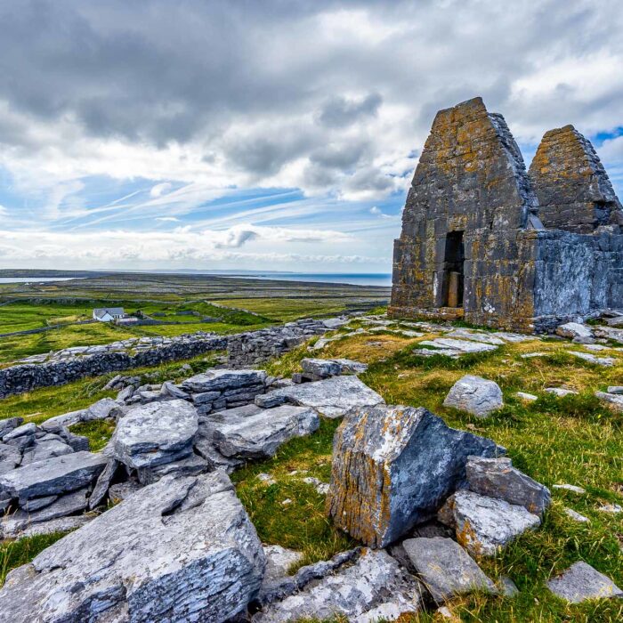


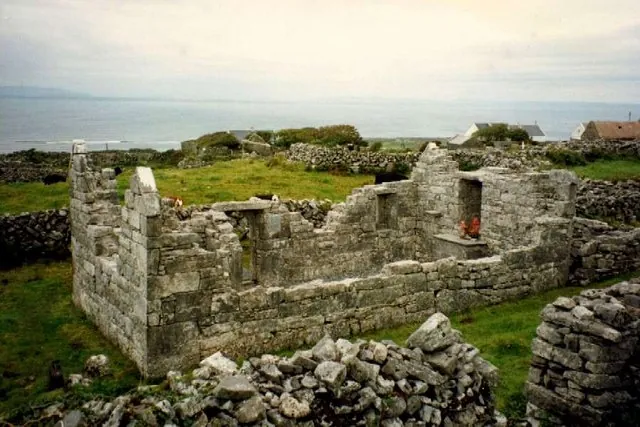
In the centre of Inis Mór, near Corrúch, a small roofless church blends into the network of stone walls. Its pointed-arch doorway is the first detail that sets it apart. Its name, Teampall an Cheathrair Álainn, means the church of the ‘four beautiful saints’, which island maps also call the Church of the Four Beauties. Behind this unusual name lie grave slabs, a well and stories handed down on the island.
The building visible today is generally dated to the 15th century. Its pointed-arch doorway is the most distinctive feature of its Gothic architecture. On a building of this size, the shape of the opening is immediately apparent. Then look up towards the eastern wall. The window brought light in on the altar side, whose position can still be made out among the ruins. Looking at these two openings reveals how the space was arranged, from the entrance towards the sanctuary.
The church is also best understood in the context of its enclosure. The chapel walls are its most visible remains, but the slabs on the ground and the nearby well bear witness to the uses and stories associated with its surroundings. It is easy to pass these features by when simply looking for a building to photograph. The stop becomes more meaningful when you take time to see how the standing stones, flat slabs and field boundaries are arranged around the chapel.
The Seven Churches, in the west of Inis Mór, comprise several buildings grouped together on a single religious site. At Corrúch, the interest lies in a small church and the traditions attached to its immediate surroundings. The two sites illuminate different aspects of the island’s heritage. One allows you to read a whole complex of ruins; the other is discovered through a handful of details, sometimes easier to miss than to see.
Local accounts associate the four saints with slabs in an enclosure east of the church. A plaque names Conall, Berchán, Brendan of Birr and Fursa, also known as Fursey. This identification is based on tradition. The slabs and the place name alone do not establish the identity of those who may have been buried here. The stories also attribute healing powers to them, a belief that forms part of the site’s history.
The English name Church of the Four Beauties may come as a surprise when encountered on a map. It translates the Irish expression referring to the four figures honoured here. The forms Teampall an Cheathrair Álainn and Teampall an Ceathrar Álainn appear depending on the source. They are two ways of finding the same church at Corrúch in guidebooks and on maps.
South of the church, tradition places Tobar an Cheathrair Álainn, the Well of the Four Saints, in a field. It is associated with stories of healing. According to the Aran Islands tourism website, the stories linked to the well inspired John Millington Synge’s The Well of the Saints. This literary connection adds another dimension to the stop. The well and the slabs reflect a way of telling the landscape in which a water source or a stone could carry a story known far beyond the field that contained it.
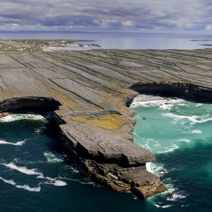
The map of Inis Mór places the church in the area around Dún Eochla. The two sites can be combined on an outing from Kilronan. The circular fort invites you to look at the contours of the land and the fields stretching around it. At the church, the scale changes. A doorway, a window and a few slabs are enough to reveal another use of the same stony landscape.
On site, the doorway arch is the best landmark. Then look at the eastern wall, followed by the surroundings of the enclosure from accessible paths. The grave slabs can be viewed on site. The well lies in a neighbouring field, and access conditions should be checked before heading there. For a day ending with a ferry from Kilronan, this stop and the fort already make for an itinerary in their own right.
Essential information to help you plan your visit, including key landmarks, access information, and booking options.
53.12935, -9.71581
No official opening hours identified. Please follow access guidance on site.
Check the opening hours and admission requirements before you leave, especially during peak season or on Irish public holidays.
No ticketing or official charge identified.