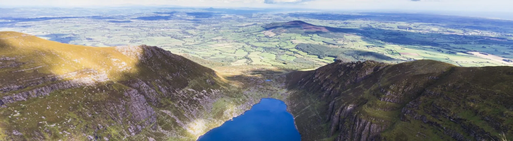
In the Comeragh Mountains, the land suddenly opens out into a vast rocky basin. At its foot, Coumshingaun Lough gathers the sky’s reflections across dark waters, almost still when the wind drops. Steep walls enclose the landscape on three sides, while grassy slopes and scattered boulders line the approach. This lake in County Waterford offers one of the most striking sights in the range, with a presence that photographs struggle to convey.
To discover it, you need to walk. Yet two very different outings lie behind the name Coumshingaun: the out-and-back walk to the lake and the mountain circuit along the ridges above it. The first allows you to admire the corrie from below; the second crosses steep, exposed terrain and is for walkers with genuine mountain experience. Choosing the right route is the first step towards a rewarding visit.
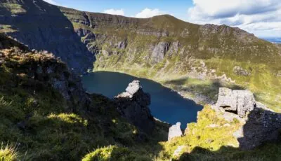
Coumshingaun Lough, County Waterford — © Denis
Coumshingaun lies in a glacial corrie. During the Ice Ages, ice carved out and reshaped this mountain hollow. After it retreated, water filled the depression, leaving a landscape whose broad outlines still reveal the glacier’s work.
From the lake’s edge, take in the shape of the basin: its walls close off the back of the corrie, while its opening faces the lower-lying land. Boulders and glacial landforms complete the scene. For children curious about geography, it is a life-sized classroom: you can look together for where the ice accumulated and imagine the landscape before the lake appeared.
The light quickly transforms the place. Under cloud, the water appears almost black and the cliffs merge into a mass of grey. A break in the cloud reveals the folds of the rock and the shades of the slopes. There is no need to reach the ridges to feel the scale of the corrie: from below, its walls are already impressive.
The usual approach is from the eastern side of the Comeraghs, in the Kilclooney area, reached from the R676 linking Dungarvan and Carrick-on-Suir. Kilclooney Woods car park is a commonly used starting point. Some route descriptions, however, begin near Kilclooney Bridge: check which one applies to your route, as the distances and directions are not interchangeable.
Enter the location of your chosen car park into your navigation app, rather than simply searching for the lake. Once there, park without blocking forest access roads, gates or through routes. The approach passes through rural and mountain areas: follow local signs and any access restrictions.
Before leaving the car, consult a detailed map and identify your destination. A downloaded track can help, but it is no substitute for understanding the terrain. Mobile reception can be patchy, so keep your map available offline and conserve your phone battery.
The out-and-back walk to the lake lets you discover the site without tackling the circuit on the heights. The climb requires some effort and may include wet, stony or uneven sections. This is not a stroll along a surfaced path: footwear with good grip remains essential.
As a guide, Dungarvan Tourism describes a short walk from Kilclooney Bridge of around 4 kilometres, 250 metres of ascent and 2 hours 30 minutes. These details apply to that specific starting point. Adjust your plans to your route, pace and the day’s conditions, allowing extra time for breaks.
On reaching Coumshingaun Lough, take time to observe the walls from a stable spot, away from steep slopes and slippery banks. A pause lets you watch the clouds drift above the corrie and wind ripples move across the water. Bring a warm layer to put back on when you stop walking.
With children, choose this outing only if it suits their experience and the weather conditions. Keep open the option of turning back before reaching the lake: the success of the day is measured by the pleasure of walking together, not by the obligation to reach a point on the map.
The full circuit climbs the slopes around the corrie before reaching the heights above the lake. It offers the famous commanding views, but also includes steep climbs, rocky sections that may at times require the use of your hands, and exposed stretches. The descent requires as much attention as the ascent.
For the full route, Dungarvan Tourism gives an indication of around 8 kilometres, 700 metres of ascent and 5 hours of walking. Other variations give different figures. Before setting out, check the exact route: a relatively short distance can conceal significant difficulty.
This circuit is suitable for experienced walkers who can navigate in mountain terrain and make their way across steep sections. If you are new to mountain walking, opt for the approach to the lake or go with a guide who knows the range.
On the heights, keep a generous distance from cliff edges, especially when taking photographs. Do not attempt to reach the lake by descending directly into the corrie: the slopes may lead to rock faces. Your return should follow a planned route suited to the terrain.
To make the most of the landscape, choose a day with good visibility, little wind and stable conditions. Pleasant weather in Dungarvan does not guarantee the same conditions in the Comeraghs: cloud can envelop the plateau while the lower land remains clear.
For the ridge circuit, fog, strong gusts, frost or soaking-wet rock can make progress significantly more difficult. Check the forecast for the range, set a return time and leave early enough to keep a margin before nightfall. If conditions deteriorate, deciding against going up onto the heights is sensible.
Take a waterproof jacket, an insulating layer, water, food and a head torch. For a mountain route, a map, compass and the ability to use them are part of your preparation. Also let someone know your route and expected return time.
Stay on existing paths where possible, close gates behind you and take all your rubbish home, including food scraps. Avoid moving stones or building new cairns: these small actions can alter the environment and create misleading markers for other walkers.
Do not plan this walk with a dog: Dungarvan Tourism states that dogs are not permitted on mountain routes in the Comeraghs, in order to protect livestock and wildlife. Also follow any instructions displayed at access points.
Swimming should not be undertaken on the spur of the moment in this mountain lake: the cold water and distance from rescue services require specific preparation. For a first visit, stay on dry land and enjoy the landscape from accessible areas.
To prepare for your walk, consult the Comeragh Mountains walk descriptions published by Dungarvan Tourism and advice from Mountaineering Ireland. Always check access conditions and the weather before setting out.
Essential information to help you plan your visit, including key landmarks, access information, and booking options.
dans les Comeragh Mountains, Carrigcastle, County Waterford, Republic of Ireland, Tourist sites in Ireland
52.250539, -7.524765