

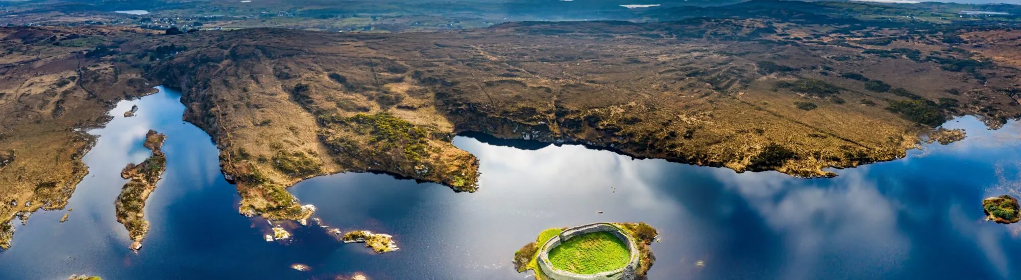
Set on a small island in the middle of Loughadoon, Doon Fort appears almost to float on the dark waters of Donegal. This massive dry-stone enclosure stands near Ardara, in a landscape of bogs, hills and narrow roads that retains a deeply wild character.
Doon Fort is not a castle in the conventional sense, but a large circular stone fort, also known as a cashel. It belongs to the family of Western Stone Forts, fortifications typical of western Ireland, distinguished by their particularly high, thick walls.
Doon Fort should not be regarded as a freely accessible tourist attraction. The monument stands on an island surrounded by private land, and there is no regular public service for crossing the lake.
In the past, small boats were reportedly available locally during the summer season. This former option is still mentioned on many websites, but no regular hire service or official price is confirmed. You should therefore not travel there assuming that you will automatically be able to hire a boat.
According to the information currently available, access must be arranged in advance with the Donegal GAP Heritage and History Group and depends on the landowner’s permission, conservation work and weather conditions.
It is also inadvisable to follow directions found on old blogs or forums without question. The approach road is very narrow, parking is limited, and the fort cannot be seen directly from the main road.
Doon Fort occupies almost the entire surface of its island. Its slightly oval enclosure is made up of thousands of stones fitted together without mortar. This building technique relies on the careful selection of stones, their weight and their arrangement.
The wall measures around four metres thick at its base on average and still reaches almost five metres in external height in places. These dimensions give the monument a particularly imposing silhouette, very different from the earthen ringforts far more commonly found in the Irish countryside.
A narrow entrance once led into the interior space. Steps and terraces built into the thickness of the walls provided access to the top of the enclosure. The route along the wall-top probably made it possible to watch over the island, the lake and the surrounding land.
The central area would have contained domestic buildings made from perishable materials such as timber and thatch. These have long since disappeared, unlike the powerful stone enclosure.
The exact date of Doon Fort’s construction remains uncertain. Early interpretations sometimes linked it to the late Iron Age, while its architectural form is more consistent with the large stone forts developed during Ireland’s early medieval period.
Archaeologists now consider that it may have been built or extensively altered during the early centuries of the Middle Ages, probably after the 6th century. The site may, however, have undergone several phases of occupation and transformation.
This uncertainty calls for caution: it is not possible to state that the entire fortification visible today dates specifically from the 5th century. The walls have been repaired, altered and partly rebuilt at different times.
Local tradition first associates Doon Fort with the Breslin clan, which is said to have occupied the site from the 5th century. It was later reportedly controlled by the O’Boyles, an important Gaelic family established in western Donegal.
The connection with the O’Boyle chieftains is strong enough for the monument to be known at times as O’Boyle’s Fort. It is thought to have served as a fortified residence, a centre of local power and a visible symbol of the authority exercised by its occupants.
The lake naturally strengthened its defences. Anyone wishing to reach the fort needed a boat and knowledge of the routes to the island. This setting made it possible to control movement while protecting the occupants from attacks by land.
Doon Fort’s function was not, however, exclusively military. Like many large Irish ringforts, it also conveyed social status, wealth and a chieftain’s ability to mobilise enough labour to build such a massive enclosure.
Doon Fort is ancient, but part of its present silhouette is the result of restoration campaigns. Major work was carried out in 1954 by Bord Fáilte, notably to prevent the monument from disappearing.
Over the decades, the growth of ivy, water ingress and movement within the masonry have weakened several sections. Some stones have shifted, while parts of the wall have begun to collapse.
In 2016, the Donegal GAP Heritage and History Group included Doon Fort in the national Adopt a Monument programme, in collaboration with the landowner. An environmental report, topographical surveys, a geophysical survey and a conservation programme were progressively put in place.
Recent interventions have focused in particular on stabilising the tops of the walls, the parapet and the former wall-walk. Further funding was also announced in 2026 to continue repairs and secure the most vulnerable sections.
This work does not turn Doon Fort into a fully restored tourist monument. Its aim is to stabilise the existing masonry while preserving traditional techniques and materials as far as possible.
The first step is to contact the Donegal GAP Heritage and History Group at [email protected]. The group can advise whether a visit, heritage outing or supervised access may be possible at the time of your stay.
Permission remains essential before crossing private property, reaching the shore or landing on the island. Using a kayak, paddleboard or personal boat never removes the need to obtain the landowner’s consent.
Attempting to reach the island by swimming is strongly discouraged. The water can be very cold, the weather changes quickly, and there is no permanent monitoring or rescue service on the lake.
Where a crossing has been expressly authorised and arranged, wearing a life jacket is essential. Sturdy footwear is also recommended, as the banks, the island and the interior of the fort can be wet and uneven.
There are no toilets, shelter or food facilities on the island. The site is not accessible to wheelchair users, and landing can also be difficult for young children or visitors with mobility issues.
Doon Fort’s walls may appear extremely solid, but their balance remains fragile. Do not climb on sections undergoing restoration, walk on parapets without permission, or remove any stone, even if it appears to be loose.
Visitors should not pull up vegetation either. It is removed in a controlled manner to avoid causing the collapse of stones to which certain roots are attached.
Photography is possible provided that instructions given on site are respected. The use of a drone, however, requires the landowner’s permission and compliance with Irish aviation regulations.
The village of Ardara makes an excellent base for exploring the area. Known for its tweed, pubs and traditional music festivals, it offers easy access to several natural and archaeological sites.
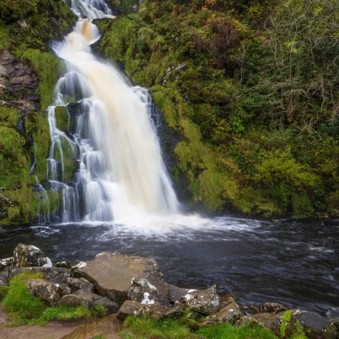
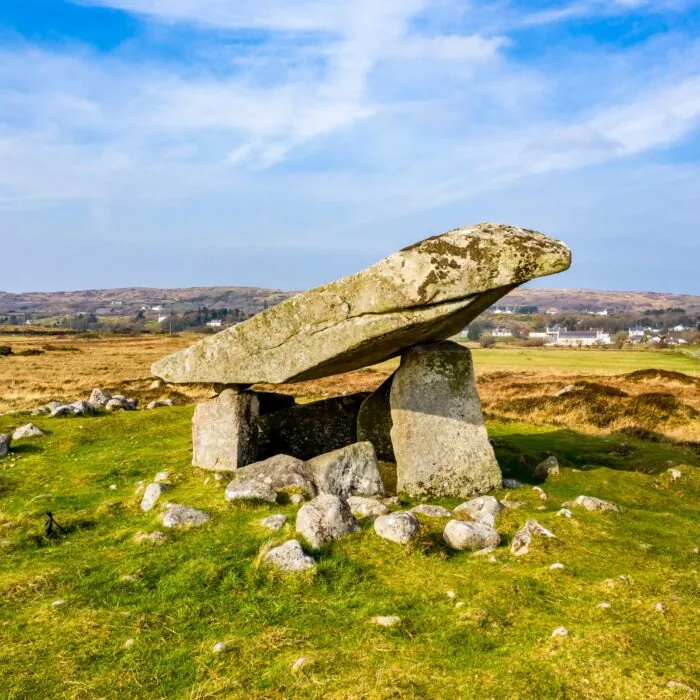
The Kilclooney dolmens offer another journey into Ireland’s past. You can also continue to Maghera Beach and Caves, Assaranca Waterfall or the spectacular Glengesh Pass road.
Want to extend your visit without having to rush around? Here are a few well-located places to stay near the must-see attractions.
Essential information to help you plan your visit, including key landmarks, access information, and booking options.
Naran, Ardara, County Donegal, Republic of Ireland, Tourist sites in Ireland
54.829060, -8.464194
45 minutes