Viator


At the edge of a limestone plateau, the walls of Dún Aonghasa (or Dun Aengus) appear to end abruptly at the Atlantic. No rampart closes off the monument on the seaward side: only an 87-metre vertical cliff separates the prehistoric fort from the waves. This dramatic setting makes Dún Aonghasa one of Ireland’s most striking archaeological sites.
Set on Inis Mór, the largest of the Aran Islands, the monument is more than 3,000 years old. Its dry-stone walls, ancient dwellings and impressive chevaux de frise tell a far more complex story than that of a simple fortress. Dún Aonghasa was occupied, altered and reinforced in turn by communities whose organisation archaeologists are still trying to understand.
Dún Aonghasa – © Chris Hill Photographic
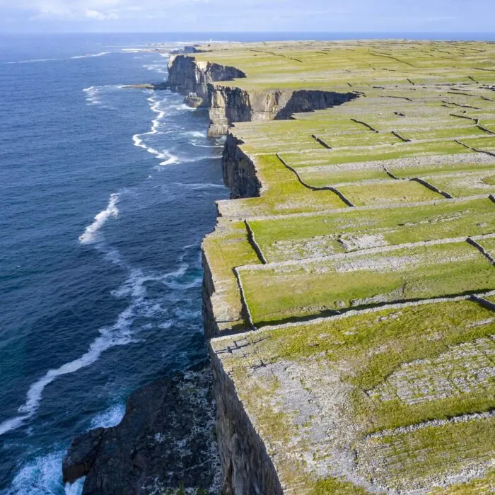
Dún Aonghasa stands on the southern coast of Inis Mór, in County Galway. It occupies the summit of an 87-metre cliff overlooking a particularly exposed stretch of the Atlantic.
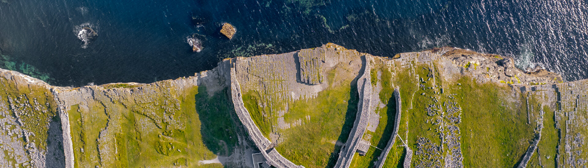
The monument is the largest surviving prehistoric stone fort on the Aran Islands. Its enclosures form several arcs backed against the precipice, creating an approximately semi-circular shape when viewed from above.
This appearance is not necessarily the result of an ancient half of the fort collapsing into the ocean. Researchers have long debated this possibility, but no archaeological evidence establishes that Dún Aonghasa once formed a complete circle. The cliff may have been incorporated into the monument’s design from the outset.
Dún Aonghasa is the official spelling in Irish. The word dún means a fort or fortified place, while Aonghasa is the genitive form of the name Aonghus. The name can therefore be understood as ‘Aonghus’s fort’.
The forms Dun Aengus and Dún Aengus remain very common in French- and English-language guidebooks. They refer to exactly the same site.
The identity of the Aonghus after whom the monument is named remains unknown. Later traditions associate it with legendary figures or ancient rulers, but none of these attributions can be historically confirmed.
Archaeological excavations have revealed that the plateau was visited as early as around 1500 BC, during the Bronze Age. The first dwellings and fortified structures are thought to have appeared around 1100 BC.
The site underwent a particularly important phase of development around 800 BC. The enclosures were reinforced, and the arrangement of upright stones known as the chevaux de frise was probably installed during this period.
Dun Aengus has not remained unchanged since prehistory, however. The complex went through different periods of occupation, abandonment and reconstruction. It was notably fortified again between the 7th and 9th centuries AD.
This long chronology means the fort cannot be regarded as the result of a single building project. The walls visible today retain the traces of several generations of builders, sometimes separated by centuries.
Excavations have uncovered the foundations of circular houses built against the wall of the inner enclosure. These remains confirm that a population genuinely lived at the top of the cliff.
Tools, pottery fragments, personal ornaments and food remains have also been found. Evidence of bronze-working indicates that metalworking activities took place on site, a specialised and valuable skill in the society of the time.
Several burials have also been identified. One contained the remains of a young man accompanied by objects, while other human deposits bear witness to funerary practices whose meaning remains difficult to establish.
The scale of the fortifications and the presence of specialised activities suggest that Dún Aonghasa held a major place in island society. The fort may have been associated with a dominant community, or have served as a political, economic and symbolic centre extending beyond the domestic sphere.
The exact function of Dún Aonghasa has not been fully established. Its massive walls and chevaux de frise gave it genuine defensive capacity. Its elevated position also offered extensive views over the ocean and much of Inis Mór.
The monument cannot, however, be reduced to a military outpost. The houses, burials, craft activities and organisation of the space show that it accommodated a range of social practices.
A stone platform near the cliff has sometimes been interpreted as a ceremonial area. This hypothesis is plausible, but it does not establish that the site was occupied by druids. No archaeological evidence demonstrates such a presence.
Dun Aengus may have combined several functions: the residence of an important group, a refuge, a place of exchange, a centre of power and a space dedicated to community rites.
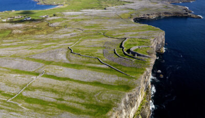
The fort consists of three large defensive enclosures formed by concentric walls. The stones were assembled dry, without mortar, using a technique emblematic of the Aran Islands.
The inner enclosure protects an area around 50 metres in diameter. Its wall reaches almost 5 metres high in places and is of considerable thickness. Steps, passages and terraces built into the masonry made it possible to move between different levels.
The two outer enclosures progressively enlarge the protected area. They follow the uneven limestone plateau and meet the cliff on either side of the monument.
Part of the walls has been restored to stabilise the site and make it easier to understand. Despite these interventions, Dún Aonghasa remains a vulnerable monument: its stones must not be moved, climbed on or used to make small cairns.
Outside the central enclosure lies one of the fort’s most remarkable features: a wide area covered with pointed limestone stones, set vertically or arranged at irregular angles.
This arrangement is known as a chevaux de frise. It was intended to slow people approaching the fort, disrupt a group of attackers and make any rapid advance towards the walls extremely difficult.
Contrary to a frequently repeated explanation, its role was not solely to stop horses. Above all, the stones formed a dangerous obstacle for fighters on foot. Their density still requires visitors to follow the designated paths today.
The feature extends from one edge of the cliff to the other. Its exceptional preservation conveys the scale of the collective work needed to protect the monument nearly three millennia ago.

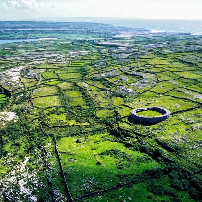
Aerial view of Dún Aonghasa – © timursalikhov
Dún Aonghasa’s semi-circular shape results from its dramatic setting. The enclosures end at the edge of the drop, while the rock face plunges almost vertically into the ocean.
This position offered impressive natural protection. It also made the fort visible from afar. In prehistoric societies, such a massive monument could serve as much to defend a territory as to display the power and organisational capacity of those who occupied it.
The landscape visible from the inner enclosure is now one of the highlights of a visit. In clear weather, the view stretches across Inis Mór’s limestone plateau towards the Connemara coast, the other Aran Islands and the vast Atlantic.
The visitor centre is the compulsory starting point for a visit. Following major works funded in particular by the Office of Public Works and Fáilte Ireland, it reopened in 2026 with a new exhibition devoted to the fort and the history of the Aran Islands.
The exhibition presents the principal archaeological discoveries, the different phases of construction and the way of life of the communities that occupied the plateau. A multilingual digital app also accompanies self-guided visits.
Guides are present on site and can provide additional explanations. Their availability, along with the times of guided tours, may vary according to the season and visitor numbers.
From the visitor centre in Cill Mhuirbhigh, it is around 1 km on foot to reach the fort. The path climbs gradually between dry-stone walls before reaching the plateau.
The final section crosses a natural limestone surface that is uneven and sometimes slippery. The ascent generally takes between 20 and 30 minutes, depending on fitness, weather and visitor numbers. The return follows the same route.
Allow between 1 hour and 1 hour 30 minutes for the full visit, including the exhibition. Travellers who wish to take time to examine the remains, speak with a guide and enjoy the scenery can easily stay longer.
Walking shoes or trainers with good grip are strongly recommended. Sandals, smooth-soled shoes and heels are not suitable for the terrain.
The cliff edge is not protected by any fencing. It can be difficult to judge the drop, particularly in strong winds or when attention is focused on a camera.
Keep well back from the edge, supervise children at all times and never step backwards towards the precipice to frame a photograph. The limestone can become slippery in rain, and gusts can arrive suddenly even when conditions seem calm at village level.
Lying near the edge, as some visitors do to look at the sea below, does not remove the danger. A cautious approach remains essential, and instructions given by staff must always be followed.
In high winds, heavy rain or poor visibility, access to the monument may be restricted for safety reasons. It is best to check conditions with the visitor centre before beginning the ascent.
Access to the fort is considered difficult. The incline, uneven stones and final section across natural rock make the monument inaccessible to most wheelchairs and poorly suited to people with significant mobility difficulties.
The visitor centre and its exhibition nevertheless make it possible to discover the site’s history without completing the entire ascent. Contacting the team before visiting is recommended in order to find out exactly which facilities and assistance options are available.
Young children who can walk can follow the route under close supervision. A standard pushchair cannot comfortably negotiate the upper section of the path.
The plateau has virtually no shelter. A waterproof, windproof jacket is useful in every season, including summer. Several layers of clothing make it easier to adapt to rapid changes in temperature.
Also bring water, sun protection and sturdy footwear. The wind can mask the sensation of heat, but sun exposure remains significant on the pale, shadeless limestone.
Drones are prohibited throughout the site in order to protect visitors, staff and the monument. Dogs are allowed on leads, subject to the rules displayed on site.
Dún Aonghasa is neither simply a viewpoint nor an accumulation of old walls. The climb gradually reveals a landscape shaped by stone: field walls, limestone slabs, prehistoric enclosures, then the abrupt line of the cliff.
The absence of guardrails and dramatic visitor infrastructure preserves a direct relationship with the monument, but demands great care. Facing the Atlantic, the mass of the walls gives a sense of what building such a complex represented in a society three millennia ago.
The site alone makes the journey to western Inis Mór worthwhile. The new exhibition, opened in 2026, now provides the historical context needed to move beyond simple contemplation and better understand this exceptional archaeological landscape.
Essential information to help you plan your visit, including key landmarks, access information, and booking options.
53.12554704195218, -9.766869259304245
45 minutes
The route between the visitor centre and the fort is around 1 km and must be completed on foot. Allow between 1 hour and 1 hour 30 minutes for the full visit.
Opening times may change due to weather conditions. Check the official Dún Aonghasa information before travelling.
Check the opening hours and admission requirements before you leave, especially during peak season or on Irish public holidays.
Admission may be free for travellers staying at least one night in participating accommodation on Inis Mór. Ask your accommodation provider about the arrangements before heading to the site.
The ticket includes access to the new exhibition at the visitor centre and the route leading to the fort. The Heritage Card is accepted.
As prices may change, check them on the official Heritage Ireland website.
Compare tickets, guided tours, and excursions available through our partner platforms.