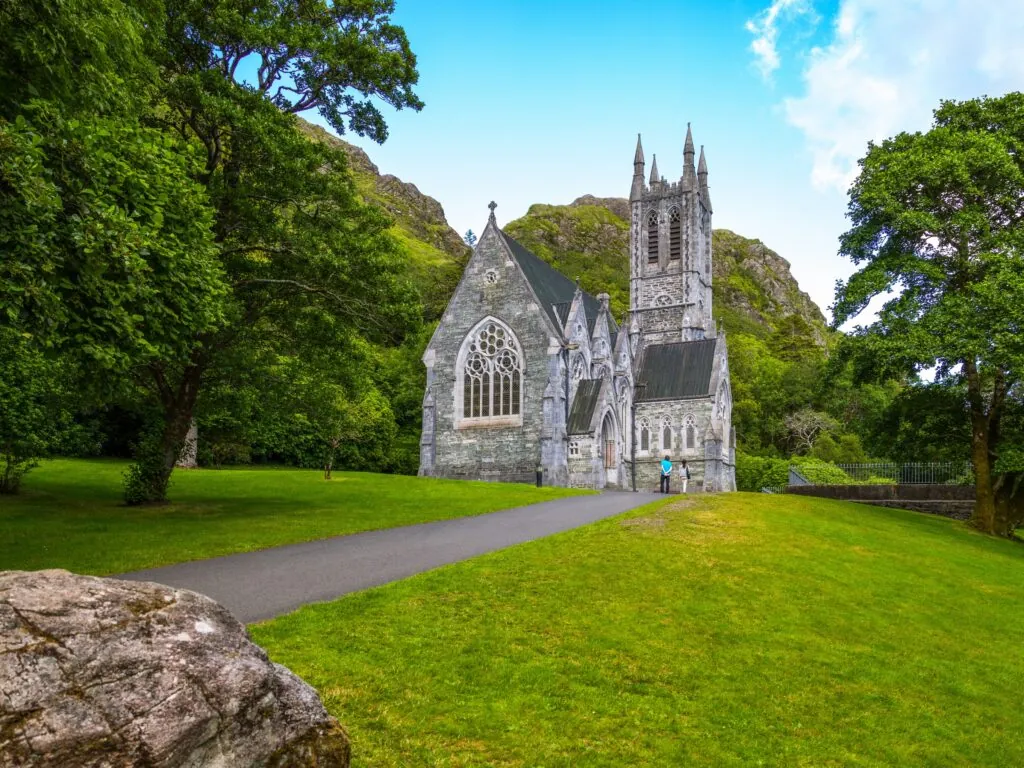
Kylemore Abbey
Kylemore Abbey is a Benedictine abbey based in the former Kylemore Castle in the heart of Connemara since 1920. The site remains…


 Tourist attractions
 Irish Restaurants and Pubs
 Partner Accommodations
 Campgrounds and Lodging
Kylemore Abbey is a Benedictine abbey based in the former Kylemore Castle in the heart of Connemara since 1920. The site remains…
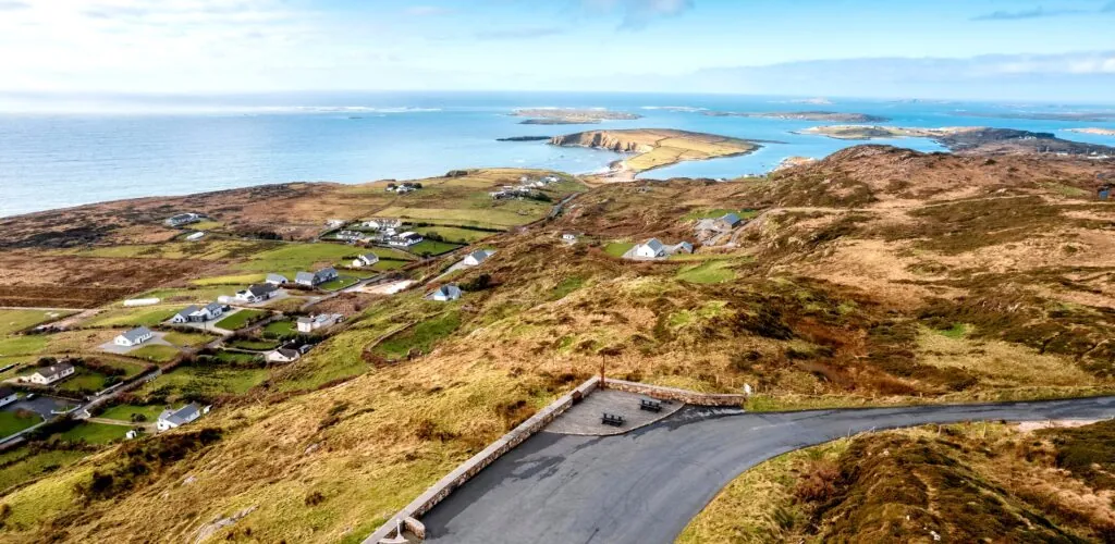
West of Clifden, the Sky Road forms a spectacular loop between the hills of Connemara and the Atlantic Ocean. Over roughly 16…
Built on the shores of Lough Pollacapall, amid the wild landscapes of Connemara, Kylemore Castle seems to sit between water, woodland and…
Want to explore Connemara on foot? Don’t hesitate to take the Connemara Way, a 78-kilometer circuit that starts in Oughterard in County…
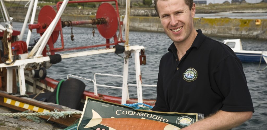
Overlooking the Atlantic, on Bunowen Pier near Ballyconneely, Connemara Smokehouse keeps a rare craft alive. Since 1979, the Roberts family has been…
Diamond Hill is one of the most accessible and spectacular walks in Connemara National Park. From the visitor centre in Letterfrack, a…
Clifden Castle is an ancient ruined manor house located to the west of the town of Clifden in Ireland. Lost in the…
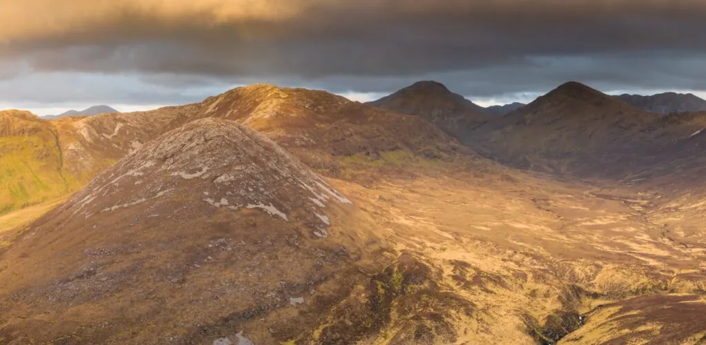
In the heart of Connemara, the Inagh Valley unfolds across an almost mineral landscape. The road winds between the dark outlines of…
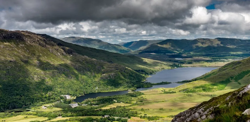
Kylemore Lough is a Connemara lake near Letterfrack. It is on the shores of this lake that the famous "Kylemore Castle" was…
Head to Connemara to admire Derryclare Lough, an Irish lake like no other, lost in the middle of mountains and moors. A…
In Ireland, there's a stone called Connemara Marble. Its green color makes it an ideal souvenir to bring back from your trip to Ireland.
West of Galway, Connemara unfolds across mountains, bogs, lakes and Atlantic coves. Here is how to choose your stops and discover this Irish-speaking region, far larger than its national park.
 County Carlow
Discover
 County Clare
Discover
 County Cork
Discover
 County Donegal
Discover
 County Dublin
Discover
 County Galway
Discover
 County Kerry
Discover
 County Kildare
Discover
 County Kilkenny
Discover
 County Laois
Discover
 County Leitrim
Discover
 County Limerick
Discover
 County Longford
Discover
 County Louth
Discover
 County Mayo
Discover
 County Meath
Discover
 County Monaghan
Discover
 County of Cavan
Discover
 County Offaly
Discover
 County Roscommon
Discover
 County Sligo
Discover
 County Tipperary
Discover
 County Waterford
Discover
 County Westmeath
Discover
Find a comfortable place to stay and make the most of your trip to Ireland.
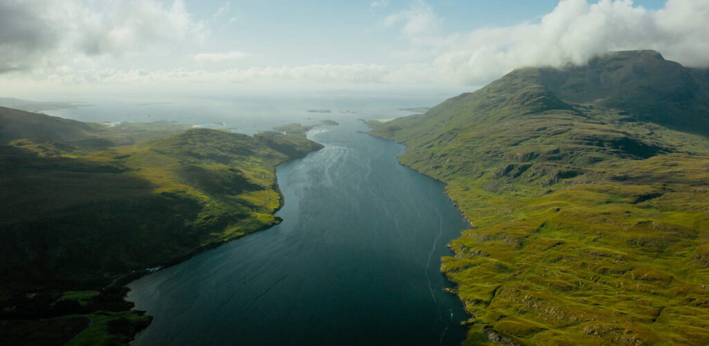
An Irish landscape has joined Lonely Planet’s global Best in Travel 2027 selection. Nestled between Connemara and County Mayo, Killary Fjord has…
West of Galway, Connemara is far more than a succession of lakes or its national park. It is a whole region, defined more by geography and culture than by administration, where the Atlantic shapes the coast while the Twelve Bens, the Maumturks, bogs and valleys structure the interior. Visitors come for the scenery, certainly, but also for the villages, the Irish language, traces of a turbulent history and the rare feeling of travelling through a place that still sets its own pace.
Connemara requires a little planning. Distances look modest on a map, but winding roads, scenic stops and highly changeable weather can easily lengthen a day. The best way to discover it is not to add up stops: choose an area, allow plenty of time and accept that a break in the clouds may change the plan. This guide provides the essentials for understanding the region, choosing a base and putting together a coherent stay, while the linked pages explore each village, walk and visitor site in greater detail.

On a Connemara road – © Roberto Medeiros
Connemara occupies western County Galway, between Lough Corrib and the Atlantic Ocean. It has no official capital and is not an administrative division. Clifden is nevertheless its main tourist centre, while Oughterard, Roundstone, Letterfrack, Carna and Leenane provide access to very different landscapes.
Connemara National Park represents only a small part of the region. Located near Letterfrack, it protects around 2,000 hectares of mountains, bogs, heathland, grassland and woodland, as confirmed by National Parks of Ireland. Do not confuse it with all of Connemara: the coastal roads, beaches, Gaeltacht villages, Inagh Valley, Renvyle Peninsula and the area around Clifden lie beyond the park.
Much of western and southern Connemara lies in the Gaeltacht, the areas where Irish remains a community language. Road signs may favour the Irish name: An Clochán is Clifden, An Spidéal is Spiddal, Ros Muc is Rosmuck and Ros an Mhíl is Rossaveel. Not all navigation apps display both versions equally clearly; recognising these equivalents before setting off prevents unwelcome detours on narrow roads.
English is easy to use when travelling, but Irish is not merely a decorative feature here. It is read, heard and passed on. Using local names when you know them, listening to their pronunciation and seeing villages as living places rather than simple backdrops are all part of discovering Connemara.
Immediately west of Galway, the coastal road passes through Barna, Spiddal, Inverin and Rossaveel before continuing towards Costelloe, Rosmuck and Carna. The terrain is less dramatic than in the Twelve Bens, but it tells another story of Connemara: ports facing the Aran Islands, coves, islets, scattered houses, craft workshops and a strong Irish-language presence.
This area suits travellers who want to slow down and stay close to the sea. Rossaveel is the main year-round departure port for the Aran Islands. Further west, Roundstone makes a pleasant stop, with its small harbour, Errisbeg mountain and pale-sand beaches.
Between Maam Cross, Recess and Letterfrack, the road crosses one of western Ireland’s most recognisable landscapes. Lakes lie between the slopes of the Twelve Bens and the Maumturks; bogs take on the colours of the sky; rocks emerge from the heath. The road, shifting light and viewpoints are already the experience.
Inagh Valley offers one of the region’s most striking drives. Derryclare Lough and Lough Inagh are edged by steep uplands, but the verges do not allow stopping everywhere. Use existing parking areas.

Derryclare Lough in the heart of Connemara – © fstopphotography
Clifden is the easiest base for a first stay, with accommodation, restaurants, pubs, shops and services. It provides quick access to the Sky Road, the ruins of Clifden Castle and Derrigimlagh, associated with Marconi’s wireless telegraphy installations and Alcock and Brown’s arrival after the first non-stop transatlantic flight in 1919.
South of Clifden, Ballyconneely and Roundstone open onto a more maritime Connemara. The beaches at Dog’s Bay and Gurteen Bay are known for pale sand and turquoise water in fine weather. Use marked access routes and protect the fragile dunes.
Northern Connemara brings together several major sites within a relatively compact area. Letterfrack provides access to the national park and Diamond Hill. Nearby, Kylemore Abbey combines the former Victorian home, Benedictine abbey, neo-Gothic church and large walled garden. Further on, Renvyle Peninsula offers quieter coastal scenery.
Towards Leenane, the landscape narrows around Killary Harbour, often described as Ireland’s only true fjord. Aasleagh Falls and the roads towards County Mayo naturally extend the journey towards Westport.
For a first visit, the main landmarks are the national park, Diamond Hill, Kylemore Abbey, Clifden and the Sky Road. You can then focus on the beaches around Roundstone and Ballyconneely, Inagh Valley, Renvyle, Killary Harbour or the villages of the Irish-speaking south.
Kylemore, Letterfrack and Renvyle form a logical group for one day; Clifden, the Sky Road and Derrigimlagh form another. Adding the southern Gaeltacht to either soon turns the trip into a motoring rally.
The region preserves castles, houses and places associated with Ireland’s political, religious and scientific history. Aughnanure Castle, near Oughterard, recalls the power of the O’Flahertys. At Ros Muc, Patrick Pearse’s cottage illuminates the connection between the Easter Rising leader, the Irish language and this region where he came to write and teach.
The four waymarked trails around Diamond Hill allow visitors to choose a woodland walk, a lower loop or a more demanding ascent. The upper route offers wide views over Letterfrack, Kylemore, the coast and the Twelve Bens. Check the Diamond Hill page and park information before choosing your route.
The Twelve Bens, the Maumturks and long-distance routes such as the Connemara Way require mountain-walking experience, an appropriate map and full equipment. Away from developed trails, the ground may be waterlogged, signage limited and visibility can vanish quickly.
Clifden has the widest choice of restaurants, pubs, shops and accommodation. Several bus routes connect it with Galway and Letterfrack. Booking ahead is advisable from June to September, especially at weekends and during the Clifden Connemara Pony Show.
Letterfrack is practical for the Diamond Hill trails and Kylemore. Renvyle Peninsula is better suited to those who favour peace, the coast and evenings away from the main tourist flows.
Oughterard, on the western shore of Lough Corrib, is quickly reached from Galway and is a good gateway to the interior. Roundstone suits lovers of the coast, beaches and small harbours. Staying in the Irish-speaking south allows a slower immersion in a lively part of the Gaeltacht.
The N59 links Galway with Oughterard, Recess and Clifden, then continues to Letterfrack, Leenane and Westport. The R336 serves the southern Connemara coast. On secondary roads, the carriageway may be narrow, lined with stone walls and shared with cyclists, walkers or sheep.
Bus Éireann route 419 and Citylink route 923 link Galway with Oughterard and Clifden; some services continue to Letterfrack. The national park also indicates a connection from Westport on route 423. Check timetables and stops directly with operators before every journey.
In Connemara, Irish is spoken at home, at school, in the media and in community life. According to the Central Statistics Office’s 2022 census, the County Galway Gaeltacht has the highest proportion of daily speakers among Gaeltacht areas.
Blanket bogs are characteristic environments of Connemara. They long supplied fuel, but they are also fragile habitats and important carbon stores. In protected areas, stay on authorised routes and take nothing away.
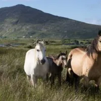
The region is associated with the Connemara pony, sheep farming, wool work and Connemara green marble. On the coast, fishing, shellfish farming and fish smoking continue an old connection with the Atlantic.
For the park and Kylemore, the north is the most logical base; for the Sky Road and western beaches, Clifden or Ballyconneely simplify a stay; for Lough Corrib, Oughterard is a good base. In high season, the best-located accommodation fills early.
Smoked fish, mussels, oysters, crab, lamb, chowder, brown bread and dairy products appear regularly on menus. Connemara Smokehouse, near Ballyconneely, provides an insight into smoking expertise when visits are offered.
Roads pass through villages, farms and private property. Use designated places to stop, close gates, do not cross fences and keep your distance from animals. In the national park, dogs must be kept on leads, fires are prohibited, and only experienced walkers should leave developed routes for isolated uplands.
Check the weather before every outing, carry water and waterproof clothing, and adapt your plans if visibility worsens. Connemara rarely offers the exact day imagined from the comfort of home; that is often when the region best reveals its landscapes, light and living culture.