Viator


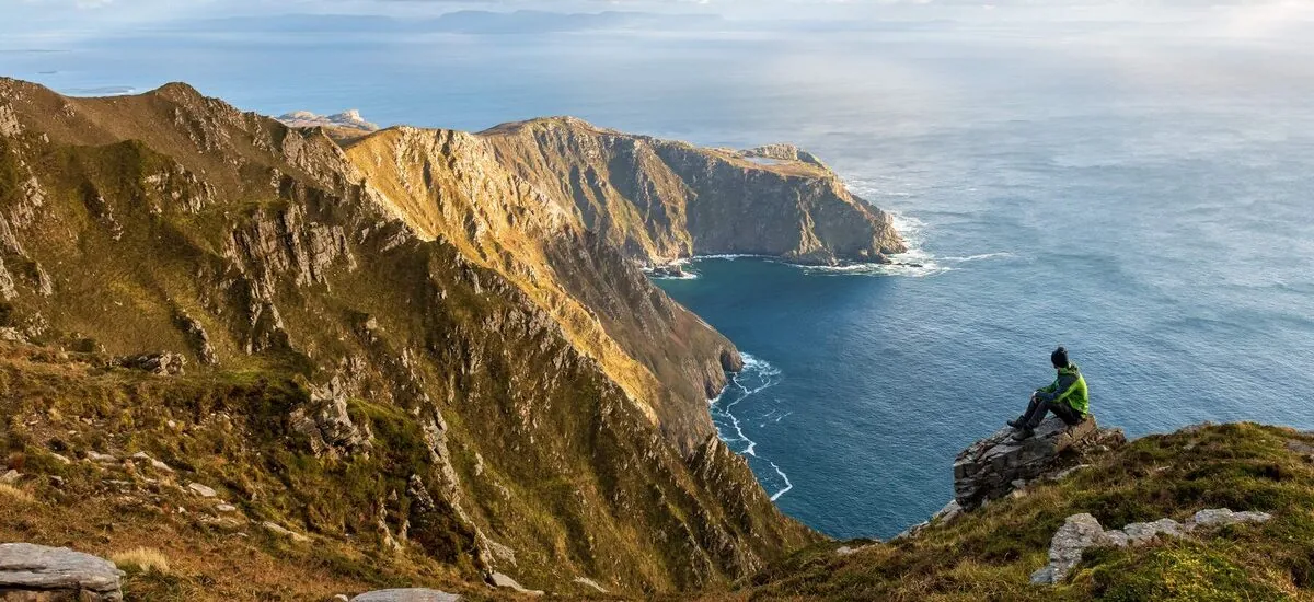
The Sliabh Liag cliffs, also known by their English name, Slieve League, are among the highest accessible sea cliffs in Europe. Located in south-west Donegal, they rise above the Atlantic Ocean and Donegal Bay to a height of more than 600 metres. Their summit reaches around 601 metres, almost three times the height of the Cliffs of Moher.
However, contrary to a claim often repeated in tourist guides, Sliabh Liag does not hold the title of Europe’s second-highest cliffs. Other European cliffs are higher, notably in Norway, the Faroe Islands and on some Portuguese islands. This does nothing to diminish the power of the landscape: the slopes of Sliabh Liag plunge dramatically towards the Atlantic, offering one of the most spectacular views on the Wild Atlantic Way.
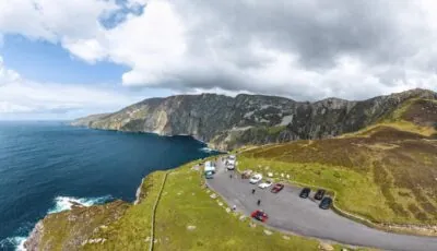
Slieve League – © Gareth Wray Photography
Slieve League lies on Donegal’s wild coast, near the villages of Teileann, known in English as Teelin, and Carrick. The site is one of the Wild Atlantic Way’s major attractions, yet its setting is far more mountainous and remote than that of the Cliffs of Moher.
The main viewing point, known as Bunglass Viewpoint, lets visitors admire the cliffs without undertaking a long walk. On a clear day, views stretch across Donegal Bay, towards the Sligo mountains and sometimes as far as the uplands of neighbouring counties.
The weather can, however, completely transform the experience. Within minutes, the cliffs can disappear behind cloud, mist or Atlantic showers. It is therefore best to allow some flexibility in your itinerary and check weather conditions before setting out on the trails.
Older descriptions advising visitors to open a gate and drive freely up to the viewpoint are now out of date. Road access is managed to limit traffic on the narrow Bunglass road and protect the site.
The recommended starting point is the Sliabh Liag Visitor Centre in Lergadaghtan, near Teelin. Its large car park is free. From the Visitor Centre, visitors can reach the viewpoint by shuttle bus or walk the four kilometres to the cliffs.
A second car park, known as Ranger Station Car Park, is around two kilometres from the viewpoint. In 2026, parking costs €10 for two hours or €15 for the day. Payment is made at the designated machines.
During the high season, vehicle access to the upper car park and Bunglass Viewpoint is restricted. This section of road is mainly reserved for shuttle buses, local residents, authorised vehicles and people requiring accessible access. Outside the busiest periods, cars may sometimes drive up to the viewpoint after paying for parking. It is advisable to confirm this with the Visitor Centre before continuing along the road.
A shuttle bus links the Sliabh Liag Visitor Centre with the main viewpoint. The journey takes around 10 to 15 minutes and avoids a four-kilometre walk along a narrow uphill road.
In 2026, the main service runs from April to mid-November, with departures roughly every 40 minutes and more frequent services during the busiest periods. Published hours generally run from 9.15am to 6pm, but may vary according to the season and weather conditions.
| 2026 shuttle bus ticket | Indicative fare |
|---|---|
| Adult | €9 |
| Student or senior | €8 |
| Child | €7 |
| Family | €28 |
These fares include a return journey. Booking is advised during summer, at weekends and on public holidays. As timetables and prices may change during the season, check the official website before your visit.
The Visitor Centre is open daily at the following published 2026 hours:
The cliffs remain accessible outside the centre’s opening hours, but services, toilets, the café and staff advice may not be available.
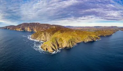
Aerial view of Slieve League – © Lukassek
Bunglass Viewpoint is the best option for travellers who want to experience Slieve League without undertaking a demanding hike. A purpose-built platform offers views of the cliffs’ contours, their streaked slopes and the ocean far below.
The view is already spectacular from the viewpoint, so there is no need to continue to the ridges to appreciate the scale of the landscape. This part of the site is particularly suitable for families, visitors short on time and those without the equipment required for high mountain terrain.
The main viewpoint is wheelchair accessible. Travellers requiring specific access should nevertheless contact the Visitor Centre in advance to arrange their journey to the upper car park.
Several routes allow visitors to explore Sliabh Liag. Their difficulty varies greatly: a short walk around Bunglass Viewpoint should not be confused with a ridge traverse or an ascent via the Pilgrim’s Path.
The coastal path begins near the viewpoint and continues for around 2.5 kilometres. The return walk generally takes between 2 hours 30 minutes and 3 hours, depending on walkers’ ability, breaks and weather conditions.
The Pilgrim’s Path, or Cosán an Oilithrigh, follows an ancient pilgrimage route. The linear route is around 3.2 to 3.5 kilometres long and climbs approximately 425 metres. Allow between 2 hours 30 minutes and 3 hours 30 minutes to reach the heights, depending on the route chosen and your fitness.
The trail crosses exposed mountain terrain, with wet, rocky and slippery sections. Hiking boots, water, warm clothing and waterproof protection are essential.
A more comprehensive loop of around 13 kilometres links several areas of the mountain. It generally takes between four and five hours and is suited to walkers accustomed to uneven ground and rapidly changing weather.
One Man’s Pass is a narrow, highly exposed ridge high on Sliabh Liag. It is not simply an extension of the tourist route from the viewpoint. It is for experienced, properly equipped hikers who can assess mountain conditions.
Wind, rain, mist and wet ground can make progress dangerous. Do not attempt it in poor weather, when visibility is reduced or in strong gusts. Anyone with a fear of heights, young children and inexperienced walkers should stick to less exposed routes.
There are no safety barriers along the mountain paths. Stay on the trails, keep well back from the edge and never head for an outcrop simply to take a photograph.
Sliabh Liag is more than its cliffs. The mountain has a long spiritual history and has been a Christian pilgrimage site for more than a thousand years. Its heights include remains associated with Saint Aodh Mac Bric, including the ruins of a small chapel and old stone shelters.
The name Sliabh Liag can be translated as “mountain of the grey flagstones”, referring to the large stones that make up its landscape. The site lies in a Gaeltacht region where the Irish language remains very present. Using the name Sliabh Liag therefore shows greater respect for local cultural identity, although the English form Slieve League is still widely used by travellers.
The landscape also retains more recent traces of history. A signal tower built in 1804 recalls the defensive network established during the Napoleonic Wars. A large “ÉIRE” sign, laid out during the Second World War, signalled to aviators that they were flying over neutral Irish territory.
A boat trip from Teelin harbour offers an entirely different perspective. From the ocean, the sheer scale of the cliff faces is even more striking and reveals the true size of the massif.
Trips are mainly offered during the warmer months and depend on sea conditions. Depending on the time of year, it may be possible to see dolphins, seals, seabirds or basking sharks. Their presence is naturally unpredictable and can never be guaranteed.
A sea trip can be combined with a visit to Bunglass Viewpoint, provided you allow enough time between the two activities. Excursions may be cancelled when swell, wind or visibility do not allow safe navigation.
The period from May to September generally offers the most favourable conditions, longer days and a more frequent shuttle service. It is also the busiest season.
For pleasant light and fewer visitors, choose early morning or late afternoon. Arriving early also leaves you with enough time should the weather deteriorate.
In autumn and winter, the atmosphere is particularly wild, but wind, rain and fog are more common. Daylight hours should be considered when planning any hike. Setting off late or relying solely on a phone torch for the descent is not recommended.
A visit to the cliffs can be combined with exploring Teelin and Carrick. Teelin harbour is the departure point for boat trips, while Carrick offers several useful services for travellers.
Further west, Glencolmcille has a rich cultural and religious heritage. Glencolmcille Folk Village presents traditional Donegal life through several reconstructed houses. Silver Strand beach at Malin Beg forms a spectacular horseshoe bay reached by a long staircase.
Towards Killybegs, Muckross Head is also worth a stop for its layered cliffs and coastal scenery. It is best to allow at least a full day for the peninsula rather than treating Sliabh Liag as a simple photo stop.
Yes, access to the natural site is free. The shuttle bus and parking at Ranger Station are charged for. Parking at the Visitor Centre is free.
Access to the upper car park is restricted during the high season. It is then advisable to park at the Visitor Centre and take the shuttle bus or walk up. Vehicles with special authorisation can access the viewpoint all year round.
The fares published for 2026 are €9 per adult, €8 for students and seniors, €7 per child and €28 for a family. Booking is advised during very busy periods.
Allow between 1 hour 30 minutes and 2 hours to reach Bunglass Viewpoint by shuttle bus and enjoy the views. A hike takes between three and five hours, depending on the route chosen.
No. This claim is often repeated, but several European cliffs are higher. Sliabh Liag is nevertheless among Europe’s highest accessible sea cliffs, reaching around 601 metres.
Yes. Sliabh Liag reaches around 601 metres, compared with a maximum of around 214 metres at the Cliffs of Moher. However, the comparison is between two landscapes with different geology and configurations.
No. This narrow, exposed ridge is for experienced walkers only. It should be avoided in strong winds, rain, fog or poor visibility.
Yes, the main viewpoint is accessible. It is advisable to contact the Visitor Centre before your visit to arrange access for an adapted vehicle to the upper car park.
Essential information to help you plan your visit, including key landmarks, access information, and booking options.
54.639850, -8.682501
1h30
Compare tickets, guided tours, and excursions available through our partner platforms.