

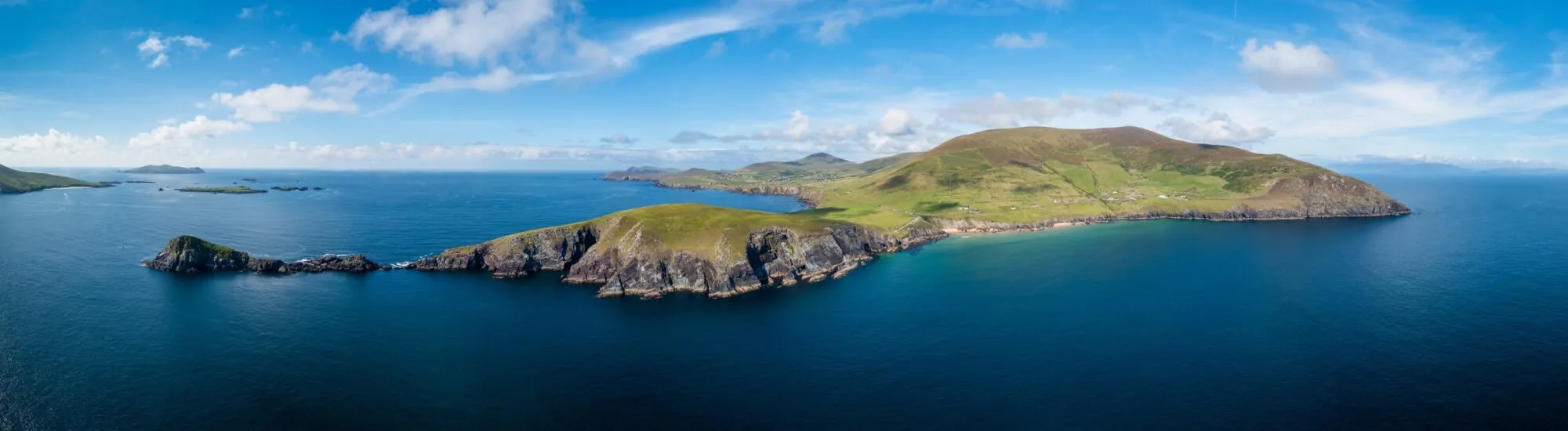
At the western tip of the Dingle Peninsula, Slea Head is one of those places where the road seems to run to the edge of the world. The headland overlooks the Atlantic Ocean and, when the sky is clear, offers spectacular views of the Blasket Islands.
Known as Ceann Sléibhe in Irish, Slea Head lies at the heart of a Gaeltacht region, where Irish is still spoken in everyday life. The site is crossed by the Slea Head Drive, a coastal route renowned for its cliffs, beaches, ancient remains and seascapes.
Despite what its terrain might suggest, Slea Head is neither a cliff to climb nor a walk with a defined starting point. It is a headland reached from the R559, with a number of small stopping places from which to take in the scenery.
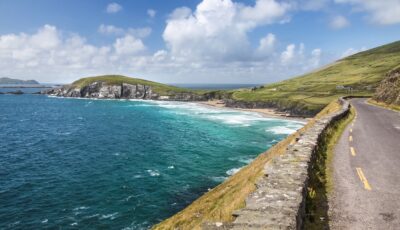
The Slea Head Drive – © cmfotoworks
Slea Head occupies the south-western part of the Dingle Peninsula, around 20 kilometres from Dingle town. The headland is made up of ancient layers of sandstone and conglomerate, tilted towards the ocean by millions of years of geological movement and erosion.
As the road approaches the headland, it narrows between the slopes of Mount Eagle and the Atlantic waters. A white crucifix beside the R559 marks one of the route’s most recognisable points.
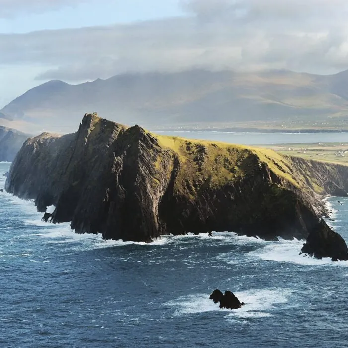
From the nearby viewing areas, the eye is drawn towards the Blasket Islands. Great Blasket, the largest island in the archipelago, stands out offshore, with the jagged outlines of the other islands appearing behind it.
On exceptionally clear days, it is also possible to make out the south Kerry coast and the distant silhouette of Skellig Michael on the horizon.
Slea Head gives its name to the Slea Head Drive, or Slí Cheann Sléibhe. This loop of around 47 kilometres begins and ends in Dingle town.
The route mainly follows the R559. It passes through Ventry, follows the Fahan cliffs, reaches Slea Head, then continues to Coumeenoole, Dún Chaoin and Ballyferriter before returning to Dingle.
It is possible to complete the loop in under two hours without stopping, but much of its appeal would be lost. Allow at least half a day, or a full day to visit the monuments, walk to the viewpoints and enjoy the beaches.
The Slea Head Drive forms part of the Wild Atlantic Way. Its route is marked by local signage, which is best followed rather than the directions suggested by some GPS apps.
Visitors should follow the loop clockwise, leaving Dingle towards Ventry. This arrangement helps limit encounters with coaches on the narrowest stretches.
The road legally remains two-way for residents, farmers and certain local vehicles. You may therefore still encounter oncoming traffic.
The lanes are sometimes so narrow that two cars cannot pass each other. Passing places at the roadside allow drivers to pull over and let others through. Do not use them for extended parking.
The peninsula is also used by cyclists, walkers, horse riders and livestock. Drive slowly, keep a safe distance and do not attempt to overtake where visibility is limited.
The loop is about more than the views from Slea Head. It passes through a remarkable concentration of landscapes and archaeological remains.
After Dingle, the road reaches Ventry, or Ceann Trá, whose long sandy beach edges a sheltered bay. It then passes close to Dunbeg Fort, an ancient fortification set on a rocky headland.
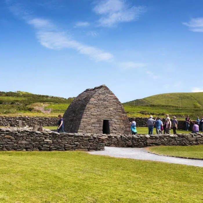
The Fahan area retains several clocháns, dry-stone structures often called beehive huts because of their shape. The precise dating of these buildings remains complex, and they do not all date from the same period.
After Slea Head, the road reaches Coumeenoole Beach. This small, enclosed beach is known for its powerful waves and for appearing in David Lean’s film Ryan’s Daughter. Its currents are dangerous: admire it from the shore rather than choosing it as a swimming spot.
A few kilometres beyond Slea Head lies Dún Chaoin, also known as Dunquin. This small, scattered village belongs to the Corca Dhuibhne Gaeltacht region.
Dún Chaoin is often described as Europe’s westernmost village, but this claim depends on the definition used and is not an official geographical title. Its real appeal lies in its landscape, Irish-speaking culture and proximity to the Blasket Islands.
The road down to Dunquin Pier forms a sequence of tight bends that has become one of the most famous images of the Dingle Peninsula. Motor vehicles are prohibited on the lower section: visitors must park higher up without blocking residents’ or emergency access.
Boats travel to Great Blasket from the pier during the maritime season, generally between spring and early autumn. Departures remain dependent on sea conditions.
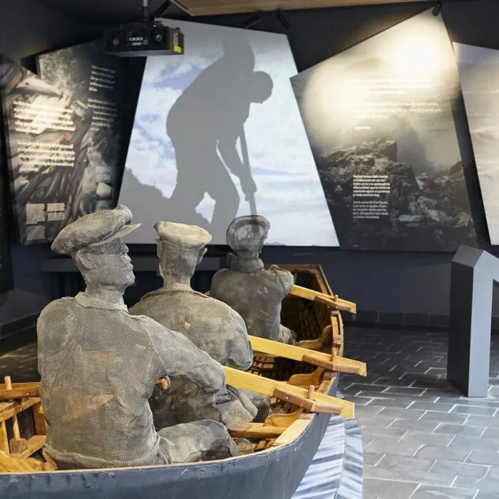
Nearby, the Blasket Centre traces the lives of the archipelago’s inhabitants before its final evacuation in 1953. It places the landscapes on view within their human, literary and cultural history.
Slea Head has no official trail for ‘climbing the cliff’. Several routes nevertheless pass through the surrounding area, including sections of the Dingle Way.
Walkers can also explore the areas around Dunmore Head, Coumeenoole and Clogher Head. These routes offer remarkable views, but sometimes cross private land or run alongside particularly exposed areas.
Respect signs, fences and farmland. Land that appears empty is not necessarily open to the public. Stay on recognised paths and close gates behind you.
The wind can be extremely powerful, even when conditions seem calm at road level. Keep away from cliff edges, keep an eye on children and avoid exposed paths in poor weather.
The Slea Head Drive can be explored by conventional or electric bike. The route offers a spectacular experience, but includes several climbs, blind bends and narrow sections used by cars and coaches.
Follow the same direction of travel as motorised visitors, setting off from Dingle towards Ventry. Reflective gear, a helmet and waterproof clothing are strongly recommended.
An electric bike makes the loop more accessible, without removing the challenges posed by the wind and traffic. Even with assistance, take enough water and check the battery range before setting off.
During high season, set out early in the morning to enjoy a quieter road. Conditions generally become busier from late morning to mid-afternoon.
Slea Head is accessible year-round, but the quality of the experience depends greatly on the weather. Low cloud can obscure the Blasket Islands and reduce visibility almost entirely.
Spring and early autumn often offer a good balance between visitor numbers and daylight hours. Summer brings more open services, but also heavier traffic on the road.
In July and August, start the loop before 9 am or in the late afternoon. You will avoid some of the coaches and find it easier to get a space in the small car parks.
Do not take the road during a severe storm, dense fog or reduced visibility. The scenery will be barely visible, and driving can become difficult on sections alongside the cliffs.
The viewpoints at Slea Head have only limited facilities. Some areas have no barriers, and the ground can become slippery after rain.
Do not approach the edge to take a photograph and never cross a fence. Gusts can be sudden and far stronger at the cliff edge than near your vehicle.
Park only in designated spaces. Stopping on the road to photograph the scenery quickly blocks traffic and creates a hazard on this narrow route.
Bring waterproof clothing, a warm layer and shoes with good grip. On the Dingle Peninsula, sunshine, rain and wind can follow one another within minutes.
Want to extend your visit without having to rush around? Here are a few well-located places to stay near the must-see attractions.
Essential information to help you plan your visit, including key landmarks, access information, and booking options.
suivre la R559 sur la Slea Head Drive, Dingle Peninsula, Dingle Peninsula
52.098075, -10.454183
1h30
Slea Head and the R559 are accessible year-round, 24 hours a day. However, travelling the loop at night, in dense fog or during a storm is strongly discouraged.
The attractions, museums, cafés and sea crossings along the route have their own opening periods. Several establishments reduce their opening hours or close in winter.
Recommended starting point: Dingle, towards Ventry
Direction of travel for visitors: clockwise
Loop length: around 47 km
The viewpoint is located along the R559. There is no visitor centre, toilet or food outlet directly on site. Services are available in Ventry, Dún Chaoin, Ballyferriter and Dingle.
Follow the ‘Slea Head Drive’ and ‘Wild Atlantic Way’ signs rather than GPS shortcuts. Some minor roads are too narrow or unsuitable for visitors.
Check the opening hours and admission requirements before you leave, especially during peak season or on Irish public holidays.
Access to Slea Head and the Slea Head Drive is completely free. No toll or ticket is required to travel the road or stop at public viewpoints.
Parking in the small designated areas along the road is generally free. Spaces are, however, very limited and should not be confused with the areas intended simply to allow vehicles to pass each other.
Some attractions along the loop charge admission, including private clocháns, Dunbeg Fort, the Blasket Centre and crossings to Great Blasket. Their prices should be checked separately.
If you do not wish to drive, guided minibus tours depart from Dingle. Prices vary according to the duration, group size and included stops.