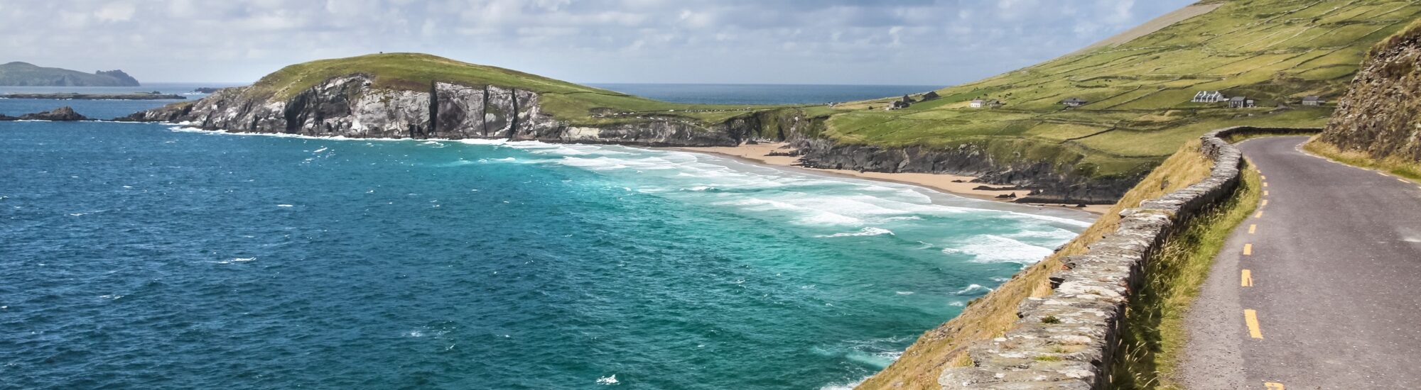
West of Dingle, the road winds between pastureland and the Atlantic. Stone walls divide the slopes, waves whiten the reefs and, offshore, the Blasket Islands emerge as the clouds clear. Slea Head Drive runs through this corner of County Kerry, where every bend changes the view: a sheltered beach, a windswept headland, a village whose signs bear an Irish name.
This scenic route forms a loop from Dingle, around the western tip of the peninsula. It is part of the Wild Atlantic Way and offers, over a relatively short distance, coastal scenery, ancient remains and the region’s living culture. Above all, allow plenty of time: the miles may pass quickly on a map, but far less so once you begin to look around.
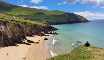
Slea Head Drive – © Kevin Dowling
Tourism organisations describe the loop as around 47 to 48 kilometres, with the distance varying according to the detours you choose. It follows the R559 in particular and generally begins with Ventry, west of Dingle. “Slea Head Drive” and “Wild Atlantic Way” signs then guide you along the route.
When planning your day, allow at least half a day for the drive and a few stops. A full day is better if you would like to walk, visit a heritage site, enjoy a leisurely lunch and explore the Blasket Centre. These are simply planning guidelines, to be adjusted according to traffic, weather and the places you choose to visit.
Drive Slea Head Drive clockwise, leaving Dingle towards Ventry. This is the direction recommended locally to ease traffic on the narrow sections. Follow the signs on the ground: a GPS may suggest a shortcut that does not follow the arrangement intended for visitors. Do not, however, assume that the entire loop is one-way; you may encounter oncoming vehicles.
Ventry, or Ceann Trá, makes for a pleasant first stop. Its bay and long beach tempt you out of the car before you have even reached the most spectacular stretches of the route. A short walk is enough to settle into the rhythm of the place: take in the hills across the water, feel the wind and leave the bustle of the start behind.
For those travelling with children, this stop breaks up the journey without turning the day into a sightseeing marathon. Simply keep an eye on the tide and the beach signage. Swimming conditions should be assessed on site, regardless of the colour of the water.
Continuing west, you reach the Fahan area, known for its clocháns, dry-stone structures often called “beehive huts”. Notice how the stones gradually draw closer together towards the top: here, architecture becomes an exercise in balance, without the need for monumental decoration to hold the eye.
Nearby, Dunbeg Fort is a promontory fort, set on a rocky outcrop overlooking the sea. To describe it simply as a circular Bronze Age fort would be misleading: its defensive form and history call for a more precise interpretation. To understand the remains, consult the information at the visitor centre and check access conditions before you go. On this coast, erosion can alter what it is possible to visit.
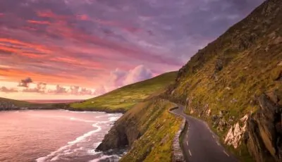
Travel around Ireland by electric car – Slea Head Drive – Image source – Envato
Around Slea Head, the coast opens out to the open sea. The Blasket Islands fill the horizon, while cliffs and grassy slopes frame the road. Light accounts for much of the spectacle: beneath cloud cover, the islands seem distant; a break in the clouds can suddenly reveal their outlines.
Stop only in designated places. Passing bays must remain clear for vehicles to pass each other, even when the view is worth a photograph. A passenger can enjoy the scenery while travelling; for the driver, the best panorama is the one admired once parked.
Coumeenoole Beach, also known as Com Dhíneol, offers one of the route’s most striking stops. Sand, rocks and waves create a landscape whose proportions change with the tide. Take time to observe it from above before heading down, depending on conditions and permitted access.
Do not plan to swim at Coumeenoole: the currents are dangerous. Follow the safety signs and keep a sufficient distance from the waves. For children, the visit can become a game of observation from a safe spot: spotting the lines of foam, the islands or the differences in colour between the rocks.
At Dunquin, or Dún Chaoin, the pier is reached by a winding lane descending towards the sea. Its silhouette has become famous, but it remains a working harbour and boarding point. Park in the authorised spaces higher up, then reach the points accessible on foot without obstructing harbour operations.
Crossings run to Great Blasket Island, the main island of the archipelago. Its permanent community was evacuated in 1953. An excursion does, however, require a separate itinerary: departures depend on the season and sea conditions. Book with an operator and check boarding arrangements; it is better to plan this outing separately than to squeeze it in between two photo stops.
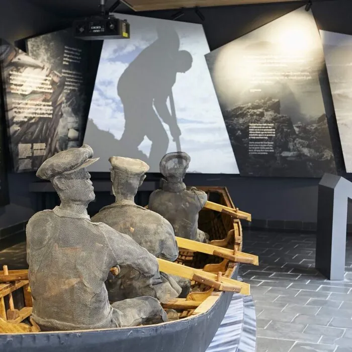
In Dunquin, the Blasket Centre, or Ionad an Bhlascaoid, tells the story of the island community and its remarkable literary legacy. A visit offers an insight into what it meant to live on these islands: family ties, language, departures and the daily relationship with the sea.
It is a particularly worthwhile stop when clouds conceal the islands or crossings are not possible. The landscapes glimpsed from the road then take on another meaning: behind the abandoned houses lie stories, voices and books.
After Dunquin, the route continues via Clogher and Ballyferriter, or Baile an Fheirtéaraigh. You pass through part of the Gaeltacht, where Irish plays an important part in local life. The names on the signs offer an initial clue to this identity: keep both versions of the main stops in your itinerary to recognise them more easily.
Depending on the route you choose, a detour to Gallarus Oratory rounds off the day. Its dry-stone construction invites a different appreciation of the builders’ craft. Leave time for the villages and breaks: not all the richness of Slea Head Drive lies at the viewpoints.
The main challenge lies in the narrowness of certain sections, the bends and the tourist traffic. Drive at a speed suited to visibility, keep your distance and anticipate oncoming traffic. Where possible and safe, use a suitable place to allow a faster vehicle to pass, without blocking access to properties.
If travelling in a motorhome, check local guidance before setting off: traffic restrictions may apply to larger vehicles. If driving on narrow roads concerns you, a guided tour from Dingle allows you to enjoy the views without having to watch every bend.
Bring a waterproof jacket, a warm layer and suitable walking shoes. Download a map to find your way, then give priority to local signage. To prepare your route and consult driving advice, see information from Dingle Peninsula Tourism.
Want to extend your visit without having to rush around? Here are a few well-located places to stay near the must-see attractions.
Essential information to help you plan your visit, including key landmarks, access information, and booking options.
R559, Dingle Peninsula, County Kerry, Republic of Ireland, Tourist sites in Ireland
52.134315, -10.369677