


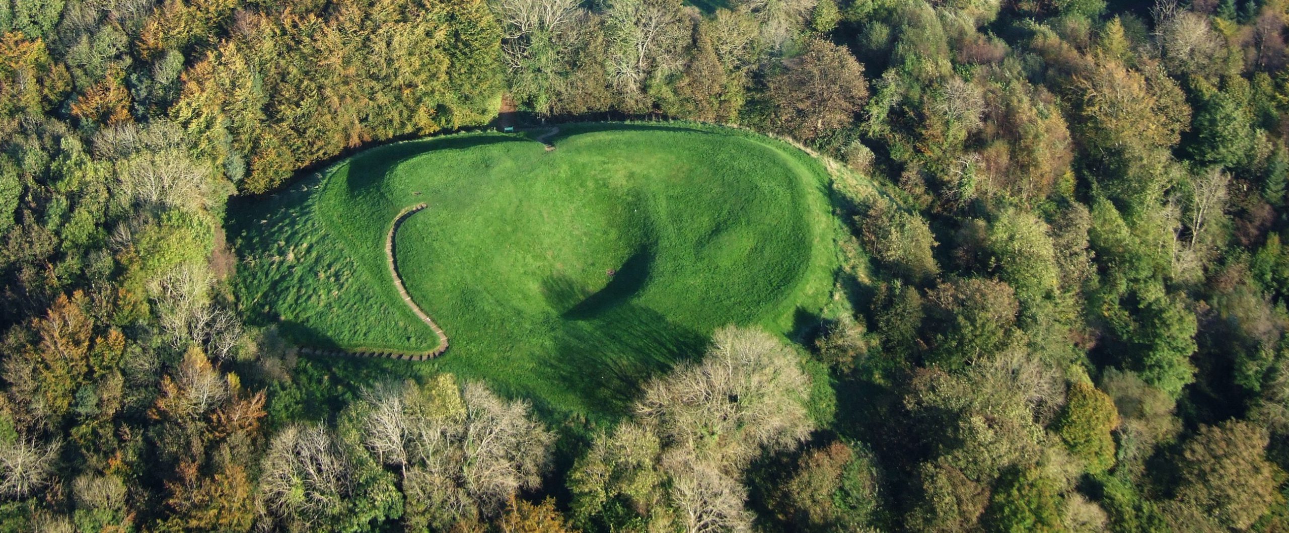
Mountsandel Fort is a prehistoric fort dating from the Mesolithic period, and reused during the Irish Middle Ages (10th to 11th centuries). Situated in Coleraine, County Derry, this fort takes the form of a gigantic grassy mound, hollowed out at its center, overlooking the River Bann. A must-see for lovers of mysterious monuments!
Mountsandel Fort is a kind of earthwork located on the bank of the River Bann, and resembles a hill hollowed out at the top.
It is surrounded by a deep defensive moat dating back to the 12th century. It is here that Ireland’s oldest houses have been found, dating back to 7,000 BC, as well as numerous carved flints and animal bone fragments, now on display at the Ulster Museum…
Archaeological digs have also revealed the presence of objects dating from the 12th and 13th centuries. An excavation in 1974 uncovered countless pieces of medieval pottery, including various utensils, cooking pots and pipes…
A visit to the fort is free, and offers fabulous panoramic views of Coleraine and the river. All you have to do is follow the little path specially laid out for the occasion!
Essential information to help you plan your visit, including key landmarks, access information, and booking options.
Mountsandel Road, Coleraine BT52 1TN, United Kingdom, Coleraine (County Derry) - Northern Ireland
55.116489, -6.663848
45 minutes


 4.00/5 (6 votes)