Benone beach
Benone beach is a sublime beach in Limavady, County Derry, Northern Ireland. This beach is unique in that it is linked to…


 Tourist attractions
 Irish Restaurants and Pubs
 Partner Accommodations
 Campgrounds and Lodging
Benone beach is a sublime beach in Limavady, County Derry, Northern Ireland. This beach is unique in that it is linked to…
The Temple of Mussenden is a pretty building dating from 1785, built on a cliff in Northern Ireland, close to a beach…
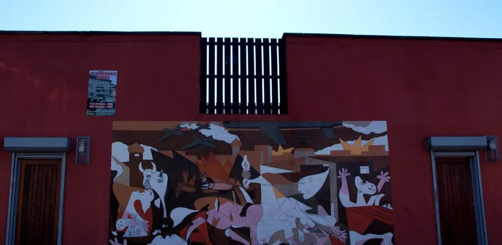
The Museum of Free Derry is a museum dedicated to the 30 years of Troubles in Northern Ireland from 1969 to 1998.…
If you're a good walker, don't miss the Sperrins, a mountain range in Northern Ireland renowned for its breathtaking views! [...]
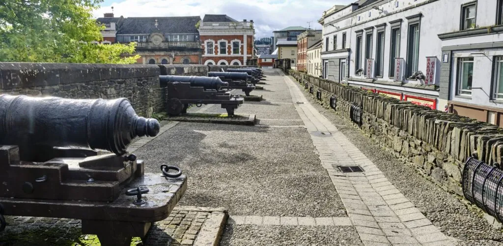
Did you know? Derry is a city whose origins are still present today. The famous “DerryWalls“, defensive walls dating back to between…
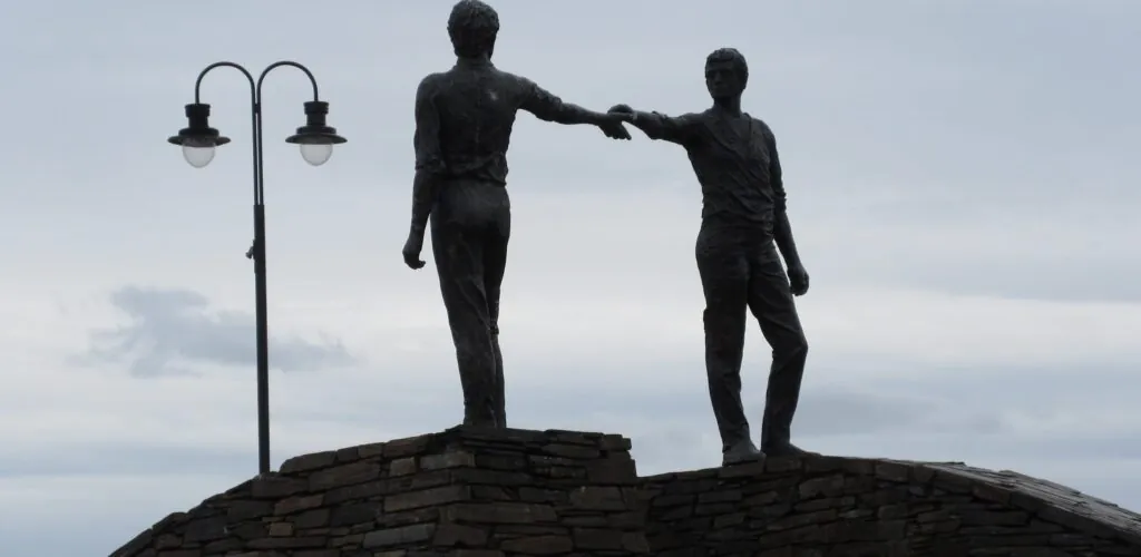
The Hands Across the Divide is a sculpture erected in the city of Derry (also known as Londonderry), on Carlisle Square... The…
How about a stroll along one of Northern Ireland's longest beaches? Downhill Beach is surprisingly rich and beautiful! [...]
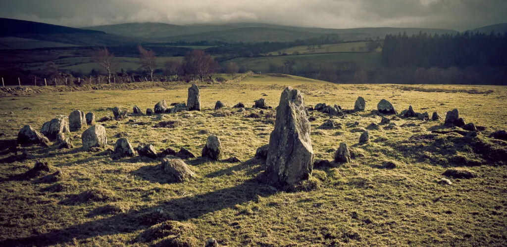
Aughlish is a Bronze Age megalithic complex comprising 6 stone circles and 2 alignments. The site is easy to reach and ideal…
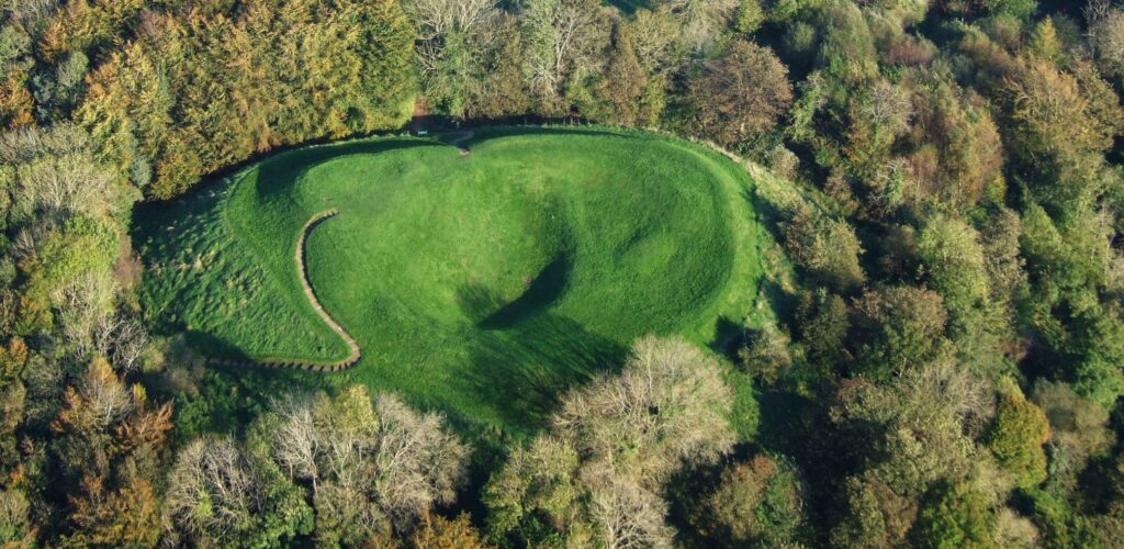
Mountsandel Fort is a prehistoric Irish fort in County Derry. Dating from the Mesolithic period, it takes the form of a grassy…
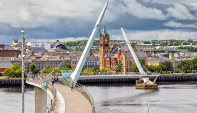
The Derry Peace Bridge is a brand new bridge spanning the River Foyle in the city of Derry in Northern Ireland... Inaugurated…
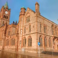

The expression Bloody Sunday refers to a sad episode in Northern Irish history. It refers to the events of Sunday January 30, 1972 in…
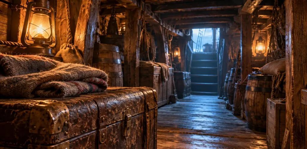
In Derry, the journey begins in a pub. Bennigan’s Bar is hosting The Coffin Ship, a theatrical experience inspired by voyages during…
County Derry, officially County Londonderry, occupies the north-west of Northern Ireland, between the Donegal border, Lough Foyle, the Atlantic coast and the uplands of the Sperrin Mountains. On Guide-Ireland, we mainly use “County Derry”, while retaining “Londonderry” where the official or historical context warrants it. This dual name is part of local political and cultural history, but it does not define a territory far larger and more diverse than the city of Derry alone.
The county brings together several very different landscapes: Atlantic beaches, cliffs, dunes, agricultural valleys, forests, rivers and mountains. Its northern part opens onto the Causeway Coastal Route, while inland it reaches the Sperrins. Between the two, Limavady, Coleraine, Maghera, Magherafelt and several villages provide gateways to a territory where nature, literature and history remain closely connected.
County Derry is one of Northern Ireland’s six historic counties. However, this traditional territory must be distinguished from the contemporary administrative structure: since local government reform, the county has no longer been a local government unit, and its territory is divided between several districts, notably Derry City and Strabane, Causeway Coast and Glens, and Mid Ulster.
This distinction is important when interpreting statistics and planning a trip. Current population figures are published by district rather than for the historic county as a whole: it would therefore be misleading to attribute the population of Derry City and Strabane to County Derry. The 2021 Northern Ireland census, for example, recorded 150,756 inhabitants in that district, whose boundaries do not correspond to those of the historic county.
For travellers, however, the county remains a relevant geographical reference. It links the city of Derry with the landscapes of the north coast, the Roe Valley, the Sperrins and the south-eastern countryside within one historic whole.
In the north, the county reaches the Atlantic along a spectacular coast dominated by long beaches and basalt landscapes. The Castlerock and Downhill area is one of the main gateways to these surroundings.
Mussenden Temple is its most immediately recognisable monument. Set above Downhill Strand, it overlooks a vast beach open to the Atlantic and offers views towards Donegal and the north coast. The temple belongs to the Downhill Demesne estate, whose ruins, gardens and walks place the monument within a broader landscape setting.
Nearby, Castlerock retains the character of a small seaside resort, while Benone Strand extends the wide sandy expanses westwards. This part of Derry also marks the western end of the Causeway Coastal Route, and can therefore be naturally included in an itinerary continuing towards Portstewart, Portrush and the Giant’s Causeway, in the neighbouring county of Antrim.
Set back from the coast, Binevenagh forms one of the most distinctive uplands in the north of the county. Its escarpment overlooks the plains around Limavady and offers extensive views over Lough Foyle, the coast and, on a clear day, the landscapes of Donegal.
This area helps illustrate the rapid transition from sea to inland landscapes. Just a few kilometres from the beaches, the scenery becomes more rural and rolling, crossed by the River Roe. The valley of this river forms a natural axis around Limavady and Roe Valley Country Park, where woodland, gorges and walks replace the broad open horizons of the coast.
Rather than trying to fit numerous sites into a single day, this part of the county is well suited to gradual exploration: the coast in the morning, followed by Binevenagh or the Roe Valley, then a return to Limavady or Derry. Distances remain manageable, but minor roads and scenic stops make an overly tight schedule unwise.
The south of the territory reaches the Sperrin Mountains, a vast region of hills and valleys that also extends into County Tyrone. The terrain is less dramatic than the major mountain ranges of western Ireland, but the sense of space and isolation can be remarkable.
The roads pass through peatlands, pasture, valleys and small villages, with few major urban centres. It is an especially rewarding area for walking, cycling, scenic drives and travellers seeking a more rural Northern Ireland.
Its archaeological heritage also recalls the long history of human settlement in these landscapes. Stone circles, tombs and other prehistoric remains appear in several parts of the Sperrins. The county page is not intended to detail each of these monuments; rather, they provide different entry points into local history and itineraries focused on the region.
The south-east of the county is inseparable from Seamus Heaney, the Nobel Prize-winning poet born near Castledawson in 1939. His work draws deeply on the landscapes, farm work, peat bogs, family memories and rural communities of this part of Ulster.
In Bellaghy, Seamus Heaney HomePlace provides an introduction to this literary heritage. Yet the interest of the area extends beyond the centre dedicated to the poet: exploring the surrounding countryside helps visitors understand the physical and human environment that shaped a significant part of his work.
This cultural dimension gives the county a particular depth. Rural Derry is not merely a space between the city and the coast; it is an internationally recognised literary landscape, where local identity can be read as much in words as in monuments.
Derry is naturally the principal urban and visitor centre of the north-west. Its walls, museums, the Bogside, the Peace Bridge and its contemporary history each justify dedicated content in their own right. The county page is therefore not intended to reproduce a detailed visit to them: here, the city should instead be considered as a base for exploring the surrounding area.
To the east, Limavady occupies an interesting position between Derry, Binevenagh and the coast. It provides quick access to Downhill, Benone and the Roe Valley without staying in a major urban centre.
Further south, Magherafelt and nearby towns provide access to a more agricultural Derry and to landscapes associated with Seamus Heaney. Coleraine, located on the Bann near the historic boundary with County Antrim, is a practical hub for exploring the north coast and continuing towards the Causeway Coast.
This distribution makes it possible to organise a stay by area rather than doing everything from Derry City, particularly if the aim is to explore the coast and rural interior.
The names Derry and Londonderry coexist, and their use may vary according to institutions, political traditions, communities and individuals. For the historic county, “County Londonderry” remains the official name, while “County Derry” is also widely used.
This issue is closely linked to the history of the Plantation of Ulster and to Northern Irish political identities. It therefore merits more than a simplified explanation or a position statement. Guide-Ireland has content specifically devoted to the Derry/Londonderry question; this county page deliberately limits itself to providing the context needed to understand why both names appear on maps, in documents and on signage.
The modern history of the territory was profoundly shaped by the Plantation of Ulster in the early seventeenth century. The creation of County Londonderry and the involvement of the City of London companies in the colonisation of the region left a lasting mark on land organisation, towns and local identities.
The following centuries saw overlapping economic changes, emigration, industrialisation, political divisions and national aspirations. In the twentieth century, Derry City became one of the major centres of the Northern Irish civil rights movement and later of the Troubles. The Battle of the Bogside, Bloody Sunday and the decades of conflict occupy an essential place in the contemporary history of the city and Northern Ireland.
These events nevertheless have dedicated content on Guide-Ireland and should not dominate the page devoted to the county. Here, they serve only to place the territory in context. The 1998 Good Friday Agreement provides the central political framework of the Northern Irish peace process, even though memories, identities and certain political issues remain present in contemporary society.
Two to four days allow visitors to combine several facets of the territory without turning the stay into a succession of journeys. An initial part can be devoted to Derry City, followed by a day on the coast around Downhill, Mussenden Temple, Castlerock and Binevenagh. With more time, the Roe Valley, the Sperrins or the Bellaghy area offer the chance to discover the county’s interior.
A car remains the most flexible way to reach rural areas, Binevenagh and the Sperrins. The train serves the Derry–Coleraine–Belfast route in particular and offers beautiful coastal scenery along some sections, while bus services connect the main towns.
The county also works very well as a transition between two major visitor regions. To the west, Derry opens towards Donegal and the Wild Atlantic Way; to the east, the coast joins the Causeway Coastal Route. Rather than viewing Derry as simply a stop between these two routes, allowing time for its coast, valleys and countryside reveals a Northern Ireland far more diverse than the image often associated with its city alone.