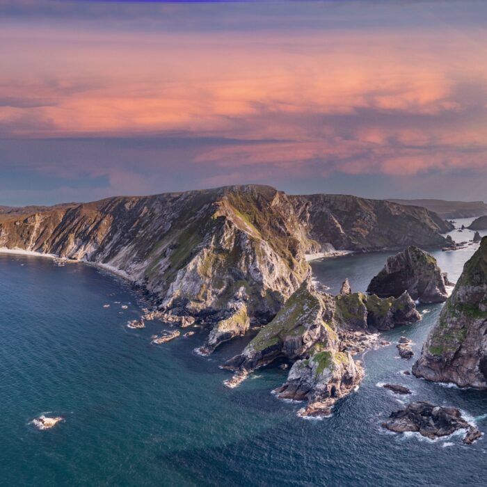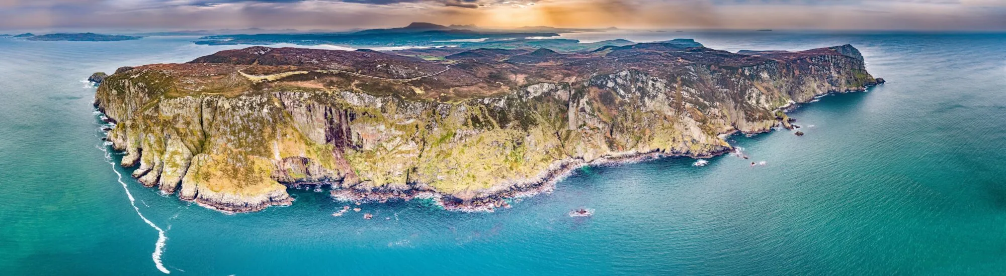
A few kilometres from Dunfanaghy, the Horn Head peninsula juts out into the Atlantic Ocean like a vast rocky sentinel. Its cliffs, rising to around 180 metres, are among the most spectacular coastal landscapes in County Donegal.
Here, the panorama remains largely wild. Heather-covered moorland ends abruptly above the ocean, while seabirds occupy the rocky ledges. Unlike some of Ireland’s major tourist sites, Horn Head has very few facilities: that authenticity is part of its appeal, but it also calls for great care.
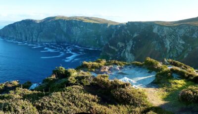
Horn Head – Ricardo Cabral -cc
The cliffs of Horn Head lie at the tip of the Horn Head peninsula, on Ireland’s north-west coast. They overlook the restless waters of the Atlantic and, when the skies are clear, offer sweeping views across Sheephaven Bay, the Donegal uplands and several offshore islands.
The scene changes constantly with the light and weather. In sunshine, the ocean takes on deep blue hues, bringing out the different layers of rock. When clouds gather, the cliffs take on a more dramatic atmosphere, heightened by the crash of the waves and gusts blowing in from the sea.
Horn Head is one of the stops along the Wild Atlantic Way. A discovery point offers views over part of the coastline without the need for a long walk. Parking is free, but spaces are limited, particularly on sunny summer days.
The road to Horn Head begins near Dunfanaghy and passes through landscapes of bogland, pasture and coastal heath. It is surfaced, but remains very narrow and winding. Meeting another vehicle can sometimes mean slowing down considerably or using a passing place.
Drive carefully, respect private property and never park in the middle of the road to take a photograph. Motorhomes and larger vehicles may encounter difficulties on certain stretches. Follow local signage and take weather conditions into account before heading onto the peninsula.
Several breaks in the landscape offer views of the ocean and cliffs. Even when the road appears deserted, remain alert for walkers, cyclists, sheep and oncoming vehicles.
To make the most of Horn Head, it is possible to take a walk of around 2.8 kilometres across the moorland. Depending on the route chosen and ground conditions, allow between 1 hour and 1 hour 30 minutes. The route presents no major technical difficulty, but crosses wet, boggy and sometimes slippery ground.
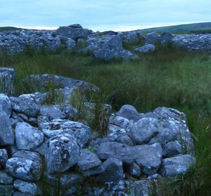
An old signal tower, built during the Napoleonic Wars, overlooks the headland. It can be reached in around 30 minutes from the parking area. The building is in ruins and should be viewed with care, without attempting to climb its walls.
A more recent observation post also bears witness to the monitoring of Ireland’s coastline during the Second World War. These structures recall the strategic importance once held by Horn Head, from where a vast stretch of the Atlantic could be watched.
The cliffs stand on very ancient rocks, including quartzite. Their present-day form is not solely the result of wave action: geological movements, ancient glaciation, water runoff, frost and Atlantic storms have gradually shaped the headland.
Erosion continues today. Salt-laden spray, water seepage and changes in temperature slowly weaken the cliff faces. This natural process can cause rockfalls or make certain edges unstable, even when the ground appears firm.
The Horn Head coastline also features caves, arches and sea caverns. Among them is the spectacular McSwyne’s Gun, a sea blowhole where water and air can be violently compressed by the waves. This phenomenon should be observed from a considerable distance: the surrounding area is dangerous and is not a safe place to walk.
Horn Head forms part of a coastal area protected at European level. The Special Protection Area linking Horn Head and Fanad Head supports important seabird colonies, which use the cliff ledges and crevices for breeding.
Species that can be seen include the common guillemot, razorbill, black-legged kittiwake, northern fulmar, European shag and peregrine falcon. The red-billed chough, recognisable by its brightly coloured curved bill, also frequents this coastline. The term “razorbill” here refers to a seabird capable of flight, also known as the common razorbill.
Atlantic puffins may also be seen during the breeding season, although their presence near viewing points is never guaranteed. Spring and early summer are generally the most favourable times to observe colony activity.
Binoculars or a telephoto lens allow you to enjoy the spectacle without disturbing the birds. It is essential to keep away from nesting areas, limit noise and never attempt to reach a ledge for a photograph.
Most of the site has been left in its natural state. The headlands have neither railings nor safety barriers and may end in a sheer drop. Some edges are hidden by grass or weakened by erosion.
Keep well back from the edge, even when the wind seems light. A gust can arise suddenly and unbalance an adult. Sitting on the cliff edge, stepping backwards while taking a photograph or crossing a fence is particularly dangerous.
Children must remain with an adult at all times. Dogs should be kept on a lead to keep them away from the edge, avoid frightening livestock and protect nesting birds.
In fog, heavy rain or strong winds, it is best to postpone your walk. Visibility can disappear quickly, and boggy paths then become very slippery. Visiting after nightfall is strongly discouraged.
A waterproof, windproof jacket is essential, even in summer. Waterproof walking shoes with good grip are recommended for crossing the moorland. It is also useful to bring water, an extra warm layer and binoculars.
Do not expect toilets, a café or a shop at the cliffs. It is best to prepare for your visit in Dunfanaghy, the most practical base for exploring the peninsula.
A picnic can be considered in a stable area well away from the edge, provided the wind allows it. Take all rubbish away with you and do not light fires on the moorland.
The main paths are uneven, wet and poorly suited to pushchairs or wheelchairs. Viewpoints near the road can nevertheless offer a first impression of the landscape without requiring a long walk, depending on available parking and visibility conditions.
A visit can be combined with a fuller exploration of the Horn Head peninsula and Dunfanaghy. The village has cafés, restaurants and several accommodation options before continuing your itinerary through northern Donegal.
Nearby, Marble Hill Beach offers a more accessible walk by the water. The Bridge of Tears, meanwhile, recalls the painful history of Irish emigration. Together, these sites make it possible to plan a day combining coastal scenery, heritage and local history.
Information on access and parking comes from Discover Ireland. The protection status and list of species of Community interest can be consulted through the National Parks and Wildlife Service. Information on the walk and the signal tower also draws on local resources from Dunfanaghy and Hiking Donegal.
Want to extend your visit without having to rush around? Here are a few well-located places to stay near the must-see attractions.
Essential information to help you plan your visit, including key landmarks, access information, and booking options.
Largatreany, Horn Head Peninsula, County Donegal, Republic of Ireland, Tourist sites in Ireland
55.223953, -7.982136
45 minutes