

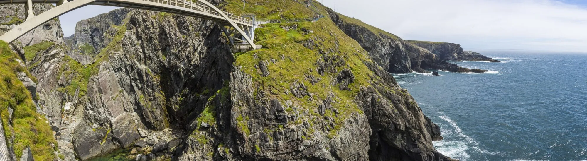
At the tip of the Mizen Peninsula in West Cork, the land seems to fall away abruptly into the Atlantic. Dark cliffs plunge into a turbulent sea, seabirds wheel above the rocks, and a spectacular arched bridge spans a gorge open to the ocean.
Often mistakenly described as a lighthouse, Mizen Head is in fact a former maritime signalling and fog station. The site was developed in the early 20th century to warn ships of the hazards along this particularly exposed coast.
Today, a landscaped route links the Visitor Centre to the historic station. Coastal paths, stairways, viewpoints and the footbridge offer a striking immersion in the landscapes of south-west Ireland. On a clear day, the view extends as far as the famous Fastnet Lighthouse, standing out at sea.
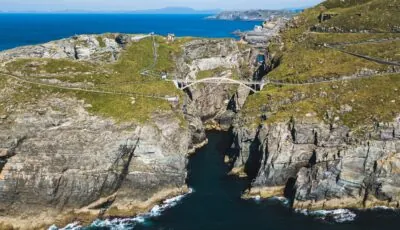
The Mizen Head bridge – © Jürgen Hamann
Mizen Head lies at the end of one of West Cork’s long peninsulas, around ten kilometres from the village of Goleen. This rocky headland is one of the most iconic sites along the Wild Atlantic Way.
It is sometimes described as Ireland’s most south-westerly point. This is largely a tourism slogan: Brow Head, a little further east, extends slightly further south. Nevertheless, Mizen Head remains one of the country’s great maritime headlands, alongside Loop Head and Malin Head.
Before modern navigation systems emerged, this stretch of coast was a difficult passage. Ships arriving from America encountered their first European land here, after several days or weeks at sea.
Reefs, fog, high winds and heavy swells made the approach dangerous, however. Mizen Head station was built to improve safety for seafarers passing offshore.
Mizen Head station entered service in 1909. Its principal function was not to produce a beam of light like a lighthouse, but to broadcast an audible signal when fog obscured the cliffs.
The first system used explosive charges. Two successive detonations were set off at regular intervals, allowing sailors to identify the station from the sea. The explosives were kept in a small secure building, still visible near the bridge.
The system was suspended for several years after some of the explosives were stolen in 1920. It was reinstated in 1924 and remained in use until 1969. Advances in radio, radar and other navigational instruments eventually made the system obsolete.
Mizen Head also played a role in transatlantic communications. The station helped monitor ships passing offshore and became an important point of contact between land and shipping routes.
Life on the headland remained particularly demanding. Keepers and their families had to contend with isolation, storms and damp. Access to the station was far more difficult than it is today, especially when weather conditions prevented safe travel.
The bridge is Mizen Head’s most famous image. It links two rock faces above a gorge into which the ocean rushes.
Contrary to figures sometimes quoted, the footbridge does not stand 300 metres high. It rises around 45 metres above the sea and spans a little over 50 metres. Those dimensions are more than enough to make the crossing impressive when the wind blows and waves crash below.
The first bridge was built in the early 20th century to make access to the station easier. Its arched design made it possible to cross the gorge without placing a support at its bottom.
After almost a century of exposure to sea spray and storms, the structure had to be replaced. Opened in 2011, the current bridge retains the overall appearance of the historic structure while using modern materials and techniques.
The footbridge is sturdy and fitted with guardrails. It is nevertheless not recommended for those who are very uneasy with heights. In high winds or dangerous conditions, access to the paths and bridge may be restricted.
The visit begins at the Visitor Centre, located beside the car park. Several areas present the peninsula’s geology, marine wildlife, the history of navigation and the daily lives of the former keepers.
The rest of the visit takes place outdoors. Landscaped paths descend gradually towards the cliffs and bridge. Several routes and viewpoints allow visitors to observe the coast from different angles.
The route includes slopes, numerous steps and sections exposed to the wind. You then have to climb back up to the Visitor Centre, so it is best to save some energy for the return journey.
Once across the bridge, the station’s former buildings can be explored. Exhibitions explain how the fog signal worked, the means of communication used by the keepers and the conditions in which they lived.
The Keeper’s Kitchen recreates part of their daily life. Other areas cover shipwrecks, transatlantic routes and the evolution of maritime safety techniques.
The visit is generally self-guided. Do not expect to climb a lighthouse with a guide or see a lantern fitted with lenses. Mizen Head’s appeal lies above all in its maritime heritage, its bridge and the power of its landscapes.
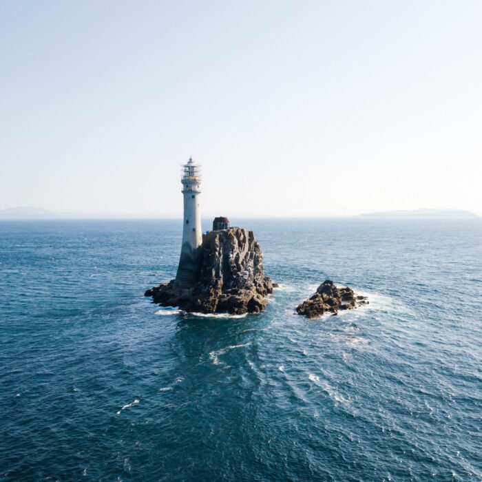
When visibility is good, it is possible to spot Fastnet Lighthouse offshore, built on a rocky islet around 13 kilometres from the coast.
Nicknamed “Ireland’s Teardrop”, Fastnet is said to have been the last piece of Irish land seen by many emigrants leaving for America.
Its tall granite tower has withstood Atlantic storms since the early 20th century. It should not be confused with Mizen Head station: Fastnet is the one with the large illuminated lighthouse visible offshore.
Depending on the light and atmospheric conditions, its silhouette may appear very clearly or disappear entirely into the mist. Boat trips also allow visitors to approach it from the ports of Crookhaven, Schull or Baltimore, weather permitting.
The cliffs of Mizen Head are home to many seabirds. Depending on the season, it is possible to see gannets, fulmars, cormorants, guillemots and various species of gull.
The waters of West Cork are also frequented by seals, dolphins, minke whales and, more occasionally, other cetaceans. Sightings can never be guaranteed, but the viewpoints offer good conditions for scanning the sea.
Bring binoculars and take time to watch the water’s surface, especially on relatively calm days. A group of birds diving in the same spot may indicate the presence of fish, sometimes followed by dolphins or marine mammals.
The vegetation on the headland must also withstand extreme conditions. Plants are low-growing and resistant to salt and wind, while the heathland takes on shades of yellow, purple and brown as the seasons change.
Allow between 1 hour 30 minutes and 2 hours to explore the site without rushing. A waterproof, windproof jacket is essential, even when the weather seems calm in neighbouring villages.
Your shoes should have sufficiently grippy soles. The paths are landscaped, but the steps and certain sections can become slippery in the rain.
The site is suitable for families, provided young children are supervised near stairways and viewpoints. The paths are secured, but they run through a cliff environment subject to sometimes powerful gusts.
Dogs are permitted provided they are kept on a lead and remain under control. However, the site is not fully accessible for people with reduced mobility because of the steps and terrain. The Visitor Centre and some upper areas are easier to access.
Tickets are sold only at the ticket desk, with no online booking. During summer, it is best to arrive early enough: access to the paths may begin to close well before the Visitor Centre’s closing time.
As Mizen Head is privately owned, the site is completely locked when closed. The bridge is not visible from the car park, and entering the paths outside opening hours is prohibited.
Mizen Head is mainly accessible by car. From Cork, the journey takes around 2 hours 15 minutes to 2 hours 45 minutes, depending on traffic and the route chosen. The roads become narrow and winding as you approach the peninsula.
From Bantry, allow around 1 hour 15 minutes. The village of Goleen is about 15 minutes away, while Crookhaven makes for a pleasant nearby stop.
Public transport does not serve the Visitor Centre directly. Bus Éireann route 237 reaches Goleen from Cork or Bantry, but several kilometres remain afterwards. Without a car, the easiest option is to book an organised excursion or a taxi in advance.
Parking at the Visitor Centre is included with admission. A café, shop and toilets are also available on site during opening periods.
To check the condition of the paths and any weather-related restrictions, consult the official Mizen Head website before setting off.
Essential information to help you plan your visit, including key landmarks, access information, and booking options.
à 10km de Skull, Schull, County Cork, Republic of Ireland, Tourist Attractions in Ireland
51.451218, -9.816361
2h00
The winter timetable may vary, and the site may close temporarily due to poor weather conditions. Always check the official website before travelling in winter.
In July and August, the paths generally begin to close from 4.30pm, even though the Visitor Centre remains open until 6pm. Arriving late may therefore prevent you from reaching the bridge and station.
Check the opening hours and admission requirements before you leave, especially during peak season or on Irish public holidays.
Special rates are available for groups of at least ten people:
Admission includes access to the Visitor Centre, exhibitions, coastal paths, bridge and former station buildings.
Tickets are not sold online. They must be purchased directly from the Visitor Centre ticket desk on the day of your visit.