


Your journey begins in which county ?
Spectacular coastlines, mountains, or getaways by the lake: Choose your starting point on the map or from the counties.
Choisissez sur la carte
Sélectionnez un comté pour ouvrir son guide.
Northern Ireland is located in the northeastern part of the island. The map also lets you explore the Republic of Ireland.
To Each Their Own Getaway
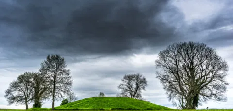
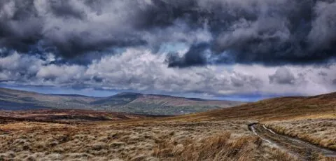
View the list of counties
Northern Ireland
Northern Ireland brings together, within a compact area, some of the most spectacular landscapes on the island of Ireland. Basalt cliffs, beaches open to the Atlantic, mountains, lakes, ruined castles and green valleys follow one another between Belfast and the Irish border.
This part of the island is sometimes overlooked in favour of the Republic of Ireland. Yet it deserves several days of travel. The Giant’s Causeway, the Causeway Coastal Route, the Mourne Mountains and the shores of Lough Erne are among its most famous sites, but the destination’s appeal also lies in its towns, industrial heritage and a history whose traces remain visible in the landscape.
Visiting Northern Ireland
A British territory in the north-east of the island of Ireland
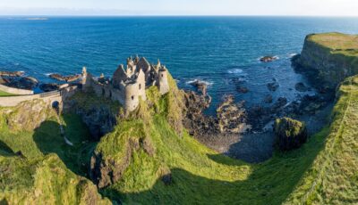
Aerial view of Dunluce Castle – © kilhan
Northern Ireland is one of the four constituent nations of the United Kingdom, alongside England, Scotland and Wales. It is therefore not part of the Republic of Ireland, although the two territories share the same island and have close historical, cultural and economic ties.
Its capital is Belfast. English is the most widely used language, while Irish and Ulster Scots also hold a recognised place in cultural life. Pound sterling is the official currency.
The relatively short distances make it easy to combine several different atmospheres during the same stay. It is possible to visit Belfast, reach the Antrim coast and then continue to Derry in a few days. A longer trip will allow you to add the lakes of Fermanagh, the Sperrins, the Ards Peninsula or the Mourne Mountains.
What to see in Northern Ireland
From the Giant’s Causeway to the Mourne Mountains
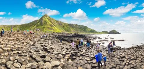
The north coast is home to several of the best-known places. The Giant’s Causeway, a UNESCO World Heritage Site, comprises around 40,000 basalt columns formed by ancient volcanic activity. Nearby, Dunluce Castle overlooks the Atlantic from a rocky promontory, while the Carrick-a-Rede rope bridge links the coast to a small islet.
The Causeway Coastal Route links Belfast to Derry, following part of the coastline. Depending on the detours taken, it covers around 120 to 185 kilometres. It passes through villages, beaches, valleys and several major natural sites. Bushmills, often mistakenly described as a town, is a village known for its historic distillery and its proximity to the Giant’s Causeway.
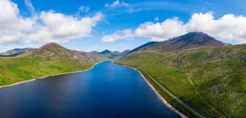
In the south-east, the Mourne Mountains offer excellent hiking terrain. Slieve Donard, their highest peak, reaches 850 metres. Further west, County Fermanagh stands out for its lakeland scenery, particularly around Upper and Lower Lough Erne.
Belfast and Derry, two unmissable stops
Towns shaped by history and contemporary creativity
Belfast has an important industrial and maritime heritage. The Titanic was built in its shipyards. Today, the city is home to Titanic Belfast, the covered St George’s Market, the Botanic Gardens, and numerous museums, pubs and concert venues.
The murals and former working-class neighbourhoods also provide an opportunity to explore the city’s political history. A guided tour helps visitors understand these places without reducing Belfast to the years of conflict. The Northern Irish capital is now a university and cultural city, known for its music scene, restaurants and repurposed former industrial buildings.
Derry, officially called Londonderry in some contexts, has one of Europe’s best-preserved city walls. Its 17th-century ramparts encircle the historic centre and offer a remarkable insight into the city’s development. The Peace Bridge, the Bogside district and filming locations associated with the series Derry Girls complete the visit.
Northern Ireland’s six historic counties
Antrim, Armagh, Down, Fermanagh, Londonderry and Tyrone
Northern Ireland traditionally consists of six counties: Antrim, Armagh, Down, Fermanagh, Londonderry and Tyrone. They are still widely used to describe the territories and plan an itinerary, even though local administration is now based on eleven districts.
Each county has its own identity. Antrim includes Belfast and much of the north coast. Down combines religious heritage, coastal villages and the terrain of the Mourne Mountains. Armagh is known for its orchards and ecclesiastical heritage, while Fermanagh is explored through its lakes and peaceful landscapes.
Tyrone and Londonderry reveal more rural areas, crossed by the Sperrins. The historic county of Londonderry also includes the walled city of Derry and part of the north-west coastline. The links provided above on this page allow you to explore the attractions of each county.
Understanding the history of Northern Ireland
A complex past that cannot be reduced to the Troubles
Northern Ireland was created in 1921, during the partition of the island. Its contemporary history has been profoundly shaped by tensions between nationalists, who were mostly in favour of a united Ireland, and unionists, who supported remaining in the United Kingdom.
The period known as the Troubles, from the late 1960s to the 1990s, brought several decades of violence. The Good Friday Agreement, signed in 1998, established a new political framework and greatly transformed the situation.
Today, the territory can be visited as a tourist destination in its own right. Nevertheless, its past remains present in memories, museums, neighbourhoods and vocabulary. Approaching these subjects with curiosity and respect makes it easier to understand the different British, Irish or mixed identities that coexist in Northern Ireland.
Planning a trip to Northern Ireland
Currency, driving and entry requirements in 2026
The currency used is pound sterling. Card payments are widely accepted, but some cash remains useful in small shops, markets or certain rural areas. Euros may be accepted near the border, but this is not obligatory.
Driving is on the left and road distances are indicated in miles. A car makes it easier to explore rural and coastal areas, although Belfast and Derry can be reached by public transport.
For French travellers and many other European nationals, a valid passport and a UK electronic travel authorisation, known as an ETA, are required for a short stay. Since 25 February 2026, this authorisation has effectively been checked before travel to the United Kingdom.
The requirement may also apply when a traveller reaches Northern Ireland by road from the Republic of Ireland. There is no systematic border control between the two territories, but UK immigration rules remain applicable. British and Irish citizens, as well as certain people legally resident in Ireland, benefit from exemptions.
As conditions may change, it is essential to check your situation on the official page about the UK ETA before departure.
Frequently asked questions about Northern Ireland
Essential information before you go
Is Northern Ireland part of Ireland or the United Kingdom?
It is located on the island of Ireland, but politically forms part of the United Kingdom. The Republic of Ireland is an independent state.
How many days are needed to visit Northern Ireland?
Three or four days are enough to discover Belfast and the Antrim coast. A week gives you more time to add Derry, the Mourne Mountains, the Sperrins and the lakes of Fermanagh.
What currency is used in Northern Ireland?
The official currency is pound sterling. The euro is used in the neighbouring Republic of Ireland.
Is an ETA required to travel to Northern Ireland?
French travellers generally need a UK ETA, including when entering Northern Ireland from the Republic of Ireland. Exemptions exist, notably for British or Irish citizens and certain legal residents of Ireland.