Located on Ireland’s western coast, in the province of Munster, County Clare brings together some of the country’s most striking landscapes. The Cliffs of Moher raise their dark walls against the Atlantic, while the Burren unfolds its strange limestone plateau among wildflowers, caves and prehistoric monuments.
But Clare is not limited to these two iconic sites. Its territory also includes seaside resorts, villages known for traditional music, the Loop Head Peninsula, the shores of the Shannon and a countryside dotted with castles, dolmens and ruined abbeys.
Visiting County Clare
A wild region between the Atlantic and the Shannon
County Clare, Contae an Chláir in Irish, covers approximately 3,450 km². Bordered by the Atlantic Ocean to the west, Galway Bay to the north and the Shannon Estuary to the south, it occupies a privileged position on the Wild Atlantic Way.
Clare had a population of 127,938 at the time of the 2022 census, according to the Irish Central Statistics Office. Its population is distributed among Ennis, Shannon, Kilrush, Ennistymon, Killaloe and numerous rural or coastal villages.
This low population density leaves plenty of room for the landscapes. In the north, the Burren’s limestone rock dominates. The west is shaped by Atlantic cliffs and beaches, while the eastern part of the county has gentler terrain around Lough Derg.
The Cliffs of Moher
A stone rampart facing the Atlantic Ocean
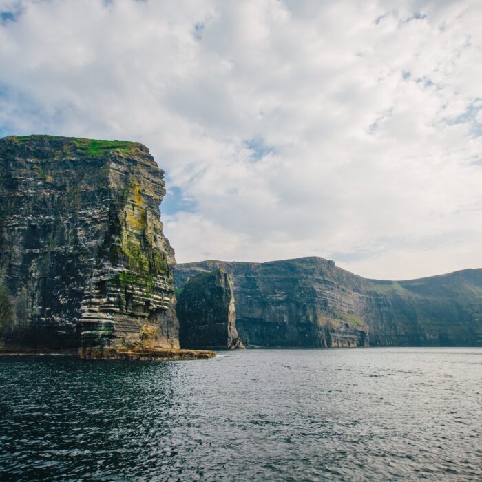
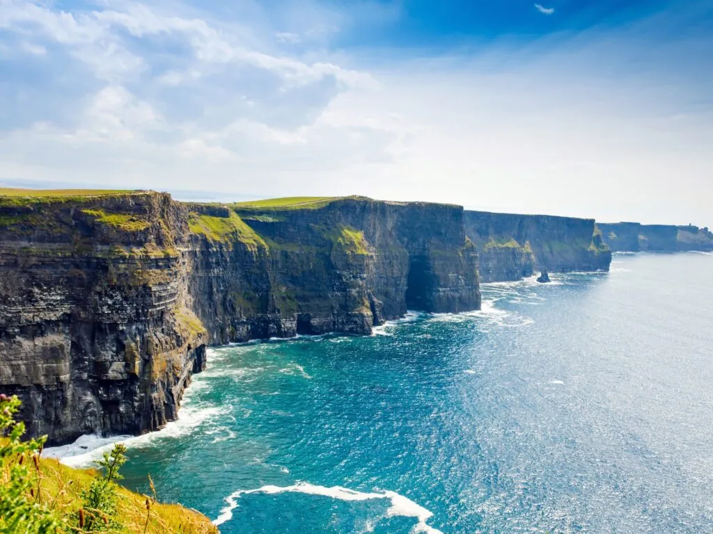
The Cliffs of Moher are the county’s most famous natural site. They extend for approximately eight kilometres between Hag’s Head and the area around Doolin. Their highest point reaches 214 metres above the Atlantic.
Their walls consist of successive layers of sandstone, shale and siltstone deposited more than 300 million years ago. Marine erosion gradually breaks off fragments of rock, constantly reshaping the profile of the cliffs.
On clear days, the view reaches towards the Aran Islands, Galway Bay and the mountains of Connemara. Conditions can nevertheless change very quickly. Fog, rain and wind sometimes completely transform the landscape within a few minutes.
The cliffs are also home to important colonies of seabirds. Guillemots, kittiwakes, fulmars and puffins can be observed during the breeding season. Boat trips provide an opportunity to appreciate the height of the cliffs from the sea.
In places, the trails run alongside unprotected cliffs weakened by erosion. It is essential to respect temporary closures, barriers and official routes.
The Burren
An astonishingly lively limestone desert
In the north of Clare, the Burren presents one of Ireland’s most unusual landscapes. Its name comes from the Irish Boireann, referring to a rocky place. Vast limestone pavements are separated by deep fissures known as grikes.
Despite its mineral appearance, the Burren has exceptional flora. Alpine, Mediterranean and Atlantic plants sometimes grow just a few centimetres apart. They find shelter in the fissures, where the rock protects them from the wind and retains moisture.
Part of this territory is protected by Burren National Park. Several routes allow visitors to explore the limestone hills, meadows and ancient traces of human settlement.
The Burren and the Cliffs of Moher together form a UNESCO Global Geopark. This recognition highlights both the area’s geological importance and the work carried out with local communities to preserve its heritage.
The Burren’s prehistoric sites
Thousands of years of history carved in stone
The Burren has been inhabited for several thousand years. Its territory contains megalithic tombs, ring forts, holy wells and the remains of former farming communities.
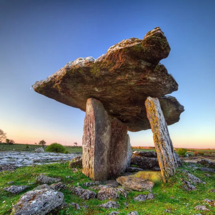
Poulnabrone Dolmen is the best-known monument. This portal tomb was used during the Neolithic period, between approximately 3,800 and 3,200 BCE. Its imposing capstone rests on several upright stones in the middle of the limestone plateau.
Archaeological excavations revealed the remains of several dozen people, along with objects placed beside the dead. The dolmen bears witness to the existence of organised communities long before the emergence of the first Irish kingdoms.
Caherconnell Stone Fort belongs to a much more recent period. This stone enclosure was probably built in the early Middle Ages and occupied for several centuries. It illustrates how the people of the Burren used and protected their land.
Doolin and traditional music
A small village that became a cultural reference point
Doolin lies between the Cliffs of Moher and the Burren. Despite its modest size, the village is known throughout Ireland for its traditional music sessions.
Several pubs regularly welcome fiddlers, flute players, concertina players and musicians who play the uilleann pipes. These gatherings have helped make Doolin an important stop for lovers of Irish music.
The village also has a small harbour. Ferries travel to the Aran Islands, and some excursions offer views of the Cliffs of Moher from the sea.
Inland, Doolin Cave contains a suspended stalactite more than seven metres long. The cave is a reminder that the Burren’s limestone subsoil is crossed by passages, underground rivers and vast cavities.
Lahinch and the Atlantic coast
Beaches, surfing and sea spray beneath the cliffs
Lahinch is one of Clare’s principal seaside resorts. Its long sandy beach stretches along the head of Liscannor Bay and attracts surfers, swimmers and walkers.
The Atlantic waves make surfing possible for much of the year. Several schools offer lessons and equipment rental. Currents and swells can nevertheless be powerful: local instructions and supervised bathing areas should always be respected.
Ennistymon lies a few kilometres inland. This small town is known for its rapids on the River Cullenagh, independent shops and traditional façades. It is an interesting base for reaching Lahinch, the Burren and the Cliffs of Moher.
Further north, Fanore has a beach surrounded by dunes, limestone hills and pastureland. The contrast between the sand, grey rock and ocean sums up the landscape of northern Clare.
Loop Head and western Clare
A wild peninsula between the Atlantic and the Shannon Estuary
The Loop Head Peninsula extends across the south-west of the county. Less frequented than the Cliffs of Moher, it offers equally impressive seascapes.
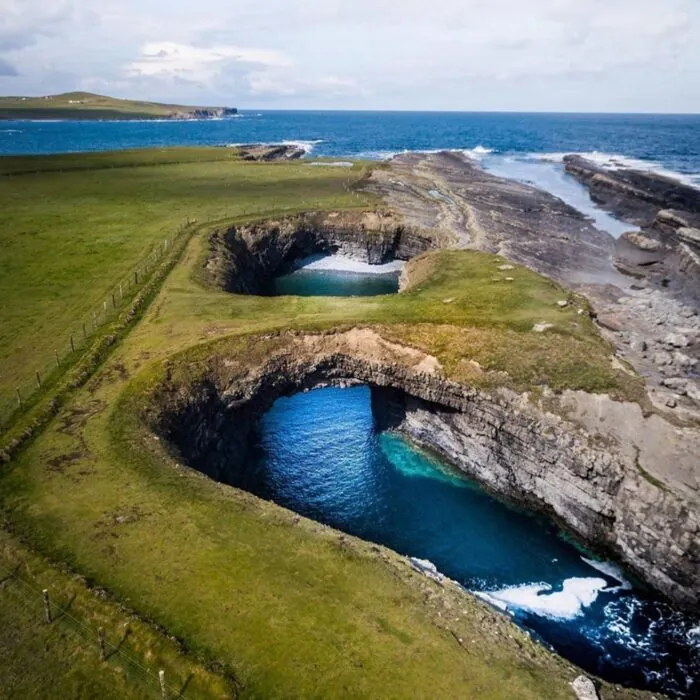
At its tip, Loop Head Lighthouse watches over the meeting of the Atlantic and the Shannon Estuary. The surrounding cliffs are carved with arches, caves and cavities formed by erosion.
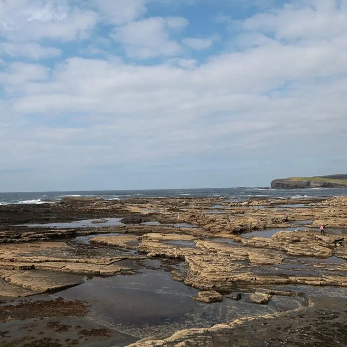
The town of Kilkee is set around a sheltered horseshoe-shaped bay. Its Pollock Holes are natural pools that appear at low tide. Access depends entirely on tide times and maritime conditions.
The Kilkee Cliff Walk offers views of the cliffs and coastal rock formations. Further south, the villages of Carrigaholt and Kilbaha retain a strong maritime identity.
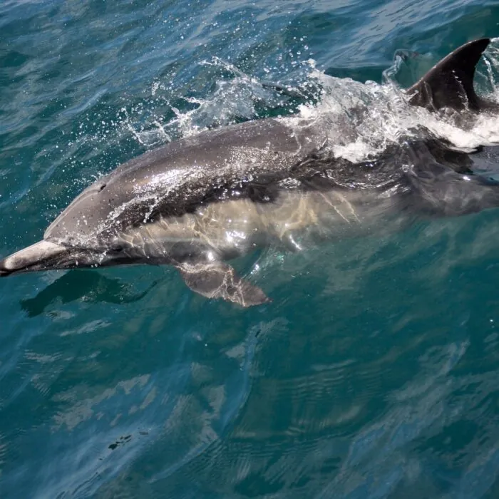
The waters of the Shannon Estuary are home to a resident population of bottlenose dolphins. Boat trips operate from Carrigaholt and other estuary ports, with no guarantee of sightings since the animals move freely.
Ennis
A market town at the heart of the county
Ennis is Clare’s administrative capital. The town developed around the River Fergus and a Franciscan monastery founded in the thirteenth century.
The ruins of Ennis Friary preserve several medieval sculptures and funerary monuments. They testify to the site’s religious and political importance before the dissolution of the monasteries.
The town centre is crossed by narrow streets lined with shops, cafés and pubs. Ennis also has a particularly active traditional music scene, supported by Clare’s musicians and the county’s many music schools.
Its central position makes it possible to reach the Cliffs of Moher, the Burren, Bunratty and the shores of the Shannon quickly.
Bunratty and Clare’s castles
Fortresses between Gaelic clans and Norman lords
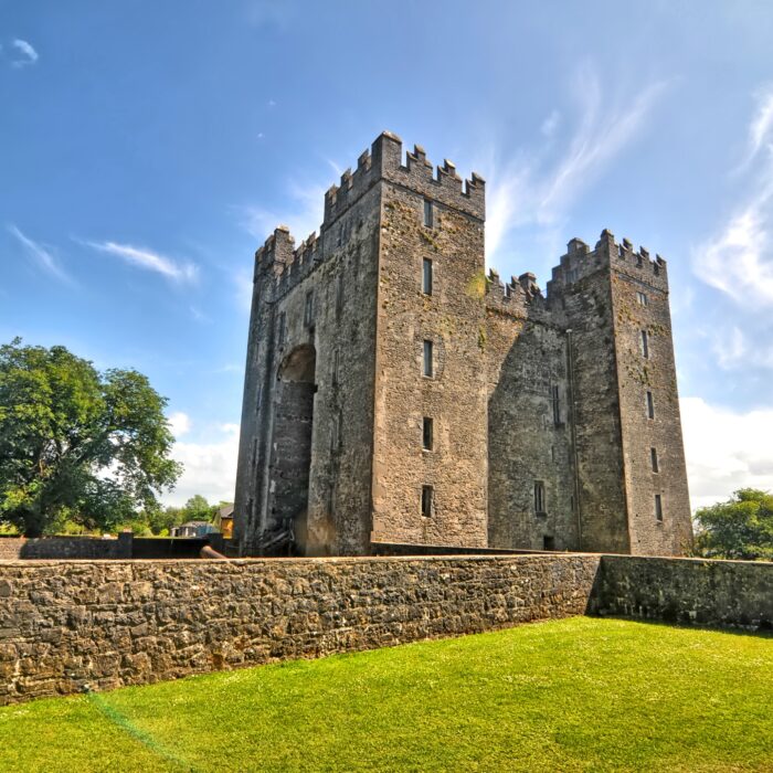
Bunratty Castle is one of the best-preserved medieval castles in Ireland. The present building was constructed in the fifteenth century on a site successively occupied by several fortifications.
The castle is associated with the MacNamara and O’Brien families, who were powerful in western Ireland. Its rooms are now furnished with furniture and objects evoking aristocratic life in the fifteenth and sixteenth centuries.
The estate also includes Bunratty Folk Park. This open-air museum brings together rural houses, shops and relocated or reconstructed buildings to present daily life in Ireland during the nineteenth and early twentieth centuries.
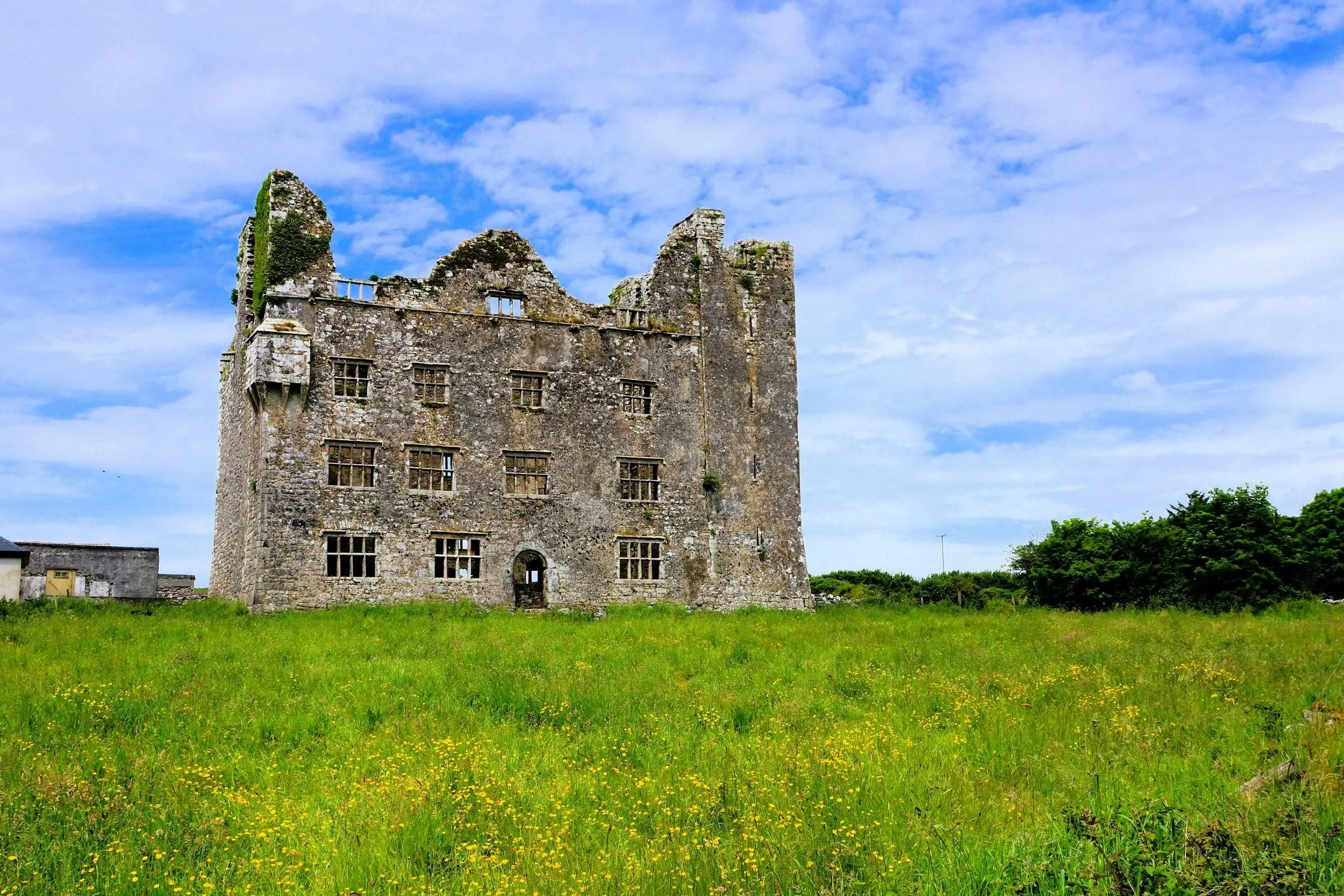
The county preserves many other castles. Leamaneh Castle rises in ruined form in the Burren, while Knappogue Castle and Dromoland Castle bear witness to very different periods and uses.
Killaloe and Lough Derg
Another side of Clare on the banks of the Shannon
In the east of the county, Killaloe lies on the banks of the Shannon, opposite Ballina in County Tipperary. The two towns are connected and now function as a single tourist destination.
Killaloe was associated with Brian Boru, king of Munster and later high king of Ireland in the early eleventh century. St Flannan’s Cathedral and several monuments recall the region’s religious and political past.
The town also marks the southern end of Lough Derg. This vast lake on the Shannon is suitable for sailing, kayaking, fishing and river cruises.
The landscape of eastern Clare is more wooded and less mineral than that of the Burren. The Slieve Bernagh hills, the lakeshore and the small rural roads offer a peaceful alternative to the coast’s major sites.
Scattery Island and the Shannon Estuary
A monastic island off Kilrush
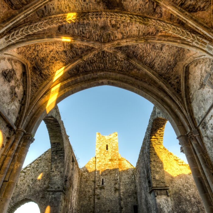
Scattery Island lies in the Shannon Estuary, a few kilometres from Kilrush. Now uninhabited, it preserves the remains of a former monastery, several churches, a round tower and an artillery battery.
The monastery is said to have been founded in the sixth century by Saint Senan. The island then occupied a strategic position on one of the main sea routes of western Ireland.
Seasonal crossings make it possible to reach Scattery from Kilrush. A visit combines religious heritage, military history and views of the estuary landscapes.
Traditional music in Clare
A culture still practised every day
County Clare occupies a major place in the history of Irish traditional music. Many renowned fiddlers, flute players and concertina players come from the region.
This tradition remains particularly vibrant in Ennis, Doolin, Miltown Malbay, Kilfenora and Feakle. Sessions held in pubs are not simply performances: they often rely on informal gatherings of musicians.
Every summer, Miltown Malbay hosts the Willie Clancy Summer School, devoted to traditional music, singing and dance. During the event, concerts, classes and sessions multiply throughout the town.



 +
+
 Tourist attractions
 Restaurants et pubs irlandais
 Hébergements partenaires
 Campings et hébergements