

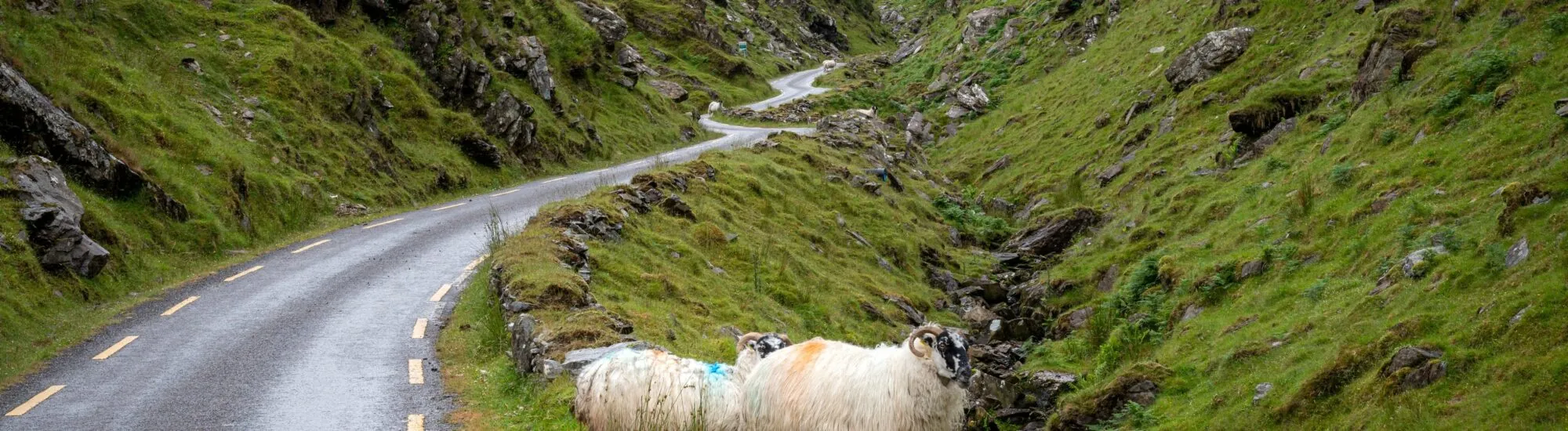
In the heart of the Iveragh Peninsula, far from the coaches and busiest viewpoints of the Ring of Kerry, a narrow road winds its way through the mountains. It crosses Ballaghbeama Gap, a wild mountain pass where rock, peat bogs and pasture create an almost mineral landscape.
This is no developed tourist attraction. There is no visitor centre, large car park or protected viewpoint. Ballaghbeama Gap is first and foremost a local road, used by residents and farmers. Its lack of infrastructure is part of its atmosphere, but it also calls for care and respect.
Ballaghbeama Gap, sometimes called Ballaghbeama Pass and Bealach Béime in Irish, lies between the Blackwater area to the south and the Glencar Valley to the north.
While most travellers follow the coastal route of the Ring of Kerry, this road heads into the peninsula’s mountainous interior. It passes through a succession of quiet valleys, peat bogs, pastureland and imposing rocky outcrops.
As the pass approaches, the slopes appear to close in around the road. The route runs between Knockaunanattin and Mullaghanattin, one of Kerry’s most recognisable mountains, with a pyramid-like summit.
The absence of villages and major development heightens the sense of isolation. A few houses, fences and herds nevertheless remind visitors that this is a living agricultural landscape, not an abandoned wilderness.
The road through Ballaghbeama Gap is surfaced, but remains extremely narrow for most of its length. There is not enough room for two cars to pass everywhere.
Occasional wider sections, known as passing places, allow oncoming vehicles to pass. The driver closest to a passing place may sometimes need to reverse for several dozen metres.
These areas must therefore never be used for parking. Stopping on a bend, in front of a farm entrance or in a passing place can block traffic and prevent local vehicles from getting through.
Visibility is not always as good as the previous text suggested. Some bends are blind, and sheep may appear directly on the road. Drive slowly, anticipate oncoming traffic and avoid sudden braking.
The route is not recommended for motorhomes, large vehicles or drivers unfamiliar with Irish single-track rural roads. Having a hire car does not remove the need to check any restrictions in the rental agreement, particularly those concerning especially narrow roads.
The drive between the two points usually used to define Ballaghbeama Gap takes around 25 to 30 minutes without stopping. It is, however, better to allow between 45 minutes and an hour to travel slowly and enjoy the scenery.
These timings do not include the journey to the pass from Kenmare, Sneem, Killorglin or Killarney. A full excursion including other sites on the peninsula can easily take up half a day.
There is no proper scenic car park at the summit. A few spaces occasionally allow a vehicle to pull off the road, but they are limited and may already be occupied. Before stopping, make sure your car does not obstruct traffic, access to land or farmers at work.
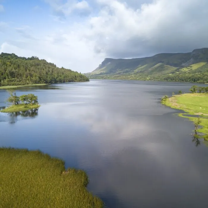
Ballaghbeama Gap’s main appeal lies in the landscape’s gradual transformation. Open valleys give way to a narrower passage, framed by boulders and slopes covered in short grass.
The weather radically changes the atmosphere. In sunshine, the road reveals the mountains’ varied shades of green, brown and grey. When cloud descends, the pass gradually disappears into the mist and takes on a far more austere character.
The most striking views are not necessarily found at the highest point. Vistas of the winding road, rocky slopes and surrounding mountains change throughout the route.
The site is particularly well suited to landscape photography. However, photographs should be taken from a safe spot, without standing in the middle of the road. Light traffic does not mean the road is empty.
Ballaghbeama Gap is popular with cyclists for its tranquillity and mountain setting. The crossing generally takes between one hour and an hour and a half, depending on the starting point, the rider’s ability, weather conditions and the weight of the bike.
The climbs are demanding in places, while the descents include tight bends. A well-maintained bike, fully working brakes and high-visibility clothing are essential.
The road remains open to vehicles. Cyclists must therefore be prepared to stop or use a passing place. The surface may also be wet, dirty or covered with gravel after heavy rain.
For a longer loop, Ballaghbeama Gap can be combined with Glencar, Moll’s Gap, Sneem or Ballaghisheen Pass. These routes, however, involve considerable distance and elevation gain. They are better suited to trained cyclists than occasional riders.
It is technically possible to walk along the road, but Ballaghbeama Gap is not a developed walking route. There are no pavements or continuous verges, and walkers can be difficult to see on bends or when mist descends.
A highly visible jacket, good footwear and constant vigilance are necessary. Walking in a close-knit group can make passing even more difficult: move aside as soon as a vehicle approaches.
The mountains surrounding the pass should not be climbed at random. Much of the land is private, fences must be respected, and unmarked routes require genuine navigation skills.
Mobile coverage is patchy and may disappear in some parts of the valley. Download an offline map before setting off, and do not rely solely on a route loaded in real time.
Services around the pass are very limited. There is no petrol station, public toilet or shop on the road itself. Set off with enough fuel, water and clothing suitable for rapidly worsening weather.
In dense fog, heavy rain, frost or strong winds, it is best to postpone the crossing. The road can become slippery and visibility can deteriorate suddenly.
Gates should be left closed if they were closed when you passed through, rubbish must be taken away, and animals should not be approached. Do not fly a drone near homes, herds or people without complying with Irish regulations.
To view a suggested route and download a map before setting off, local guide Emerald Outdoors offers a loop taking in Ballaghbeama Gap.
Want to extend your visit without having to rush around? Here are a few well-located places to stay near the must-see attractions.
Essential information to help you plan your visit, including key landmarks, access information, and booking options.
Curragh Beg, Ring of Kerry, Iveragh Peninsula, Iveragh Peninsula, Ring of Kerry
51.9842118180331, -9.868784444308089
1 heure
Crossing at night is not recommended because of the lack of lighting, the narrow road and the possible presence of animals.
Check the opening hours and admission requirements before you leave, especially during peak season or on Irish public holidays.