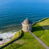
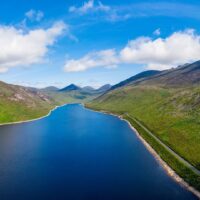
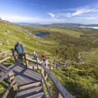
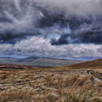
County Wicklow, Contae Chill Mhantáin in Irish, is one of the great natural destinations in eastern Ireland. Located immediately south of Dublin, it brings together mountains, forests, glacial lakes, beaches and historic gardens within a relatively compact area.
Known as the “Garden of Ireland”, Wicklow offers far more than a simple escape into the countryside. The monastic site of Glendalough, the roads around Sally Gap, the Wicklow Way and the estates of Powerscourt and Mount Usher make it possible to plan a complete stay combining hiking, heritage and coastal discovery.
Visiting County Wicklow
The Garden of Ireland on Dublin’s doorstep
County Wicklow belongs to the province of Leinster. It covers approximately 2,027 km² between the Wicklow Mountains, the Irish Sea and the neighbouring countryside of the counties of Kildare, Carlow and Wexford.
Its proximity to Dublin has encouraged the development of towns in the north and along the coast. The county had 155,851 inhabitants in the 2022 census, according to the Irish Central Statistics Office.
The nickname “Garden of Ireland” does not refer solely to the greenery of its landscapes. Wicklow also has a remarkable concentration of parks, aristocratic estates and botanical gardens benefiting from the relatively mild climate of the east coast.
Inland, the scenery becomes wilder. Roads cross peatlands, run alongside dark lakes and pass over wind-exposed mountain passes. This diversity explains why Wicklow is one of the country’s most popular hiking destinations.
Wicklow Mountains National Park
Ireland’s largest protected mountainous area
Wicklow Mountains National Park protects approximately 20,000 hectares of mountains, peatlands, forests and glacial valleys. It is Ireland’s largest national park by area.
The landscape is dominated by rounded summits and broad plateaus covered in heather. Reaching 925 metres, Lugnaquilla is the highest point of the range and the highest mountain in Ireland outside County Kerry.
The wildlife includes deer, foxes, badgers and numerous bird species. Upland peatlands are fragile environments capable of storing significant quantities of carbon and water.
Several roads cross or skirt the park, but many areas remain isolated. Fog, waterlogged ground and rapid weather changes can make hikes difficult, even when the altitude appears modest.
Glendalough
A monastic city between two glacial lakes
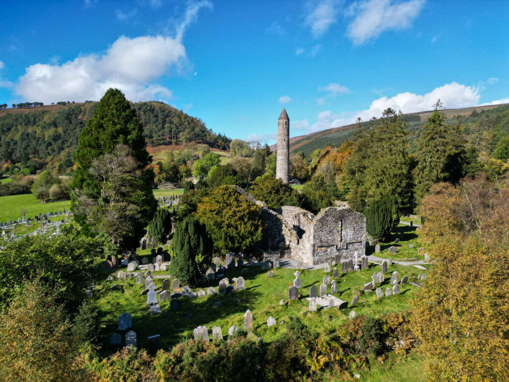
Glendalough is the county’s most famous historical site. Its Irish name, Gleann Dá Loch, means “the valley of the two lakes”. The site combines the remains of an important monastic community with a landscape of forests and mountains.
The monastery is said to have been founded in the sixth century by Saint Kevin, a hermit who came to seek solitude in the valley. The community subsequently grew to become one of medieval Ireland’s great religious and intellectual centres.
The site preserves several ruined churches, a cathedral, carved crosses and a round tower approximately thirty metres high. These towers probably served as bell towers, landmarks and storage places for valuable objects.
Beyond the monuments, Glendalough offers several hiking routes. The easiest walks follow the two lakes and pass through the woods. More demanding trails reach the heights of Spinc, overlooking Upper Lake and the entire valley.
Glendalough Nature Reserve protects, among other areas, 157 hectares of oak woodland extending around the Upper Lake and along the slopes of Derrybawn Mountain.
Sally Gap and the Old Military Road
A lonely road in the heart of the mountains
Sally Gap is a mountain pass in the centre of the Wicklow Mountains. Several roads meet there amid a vast landscape of peatlands, heathland and rounded summits.
The R115 follows part of the Old Military Road, built at the beginning of the nineteenth century by the British authorities. It was intended to make it easier for troops to enter the mountains, where insurgents took refuge after the 1798 Irish Rebellion.
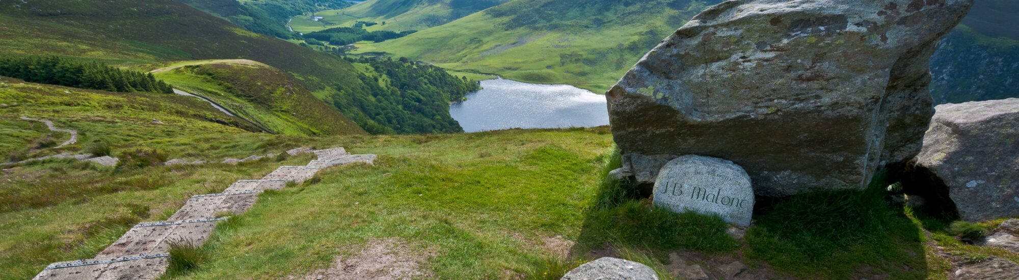
The route offers many views, particularly around Lough Tay. This private lake, surrounded by dark hills, is sometimes nicknamed “Guinness Lake” because of its shape and the contrast between its dark waters and a light sandy beach.
Further south, the road reaches Glenmacnass Waterfall before descending towards Laragh and Glendalough. The verges are narrow and patches of fog are frequent: stops should be made only in designated areas.
The Wicklow Way
Ireland’s first long-distance hiking trail
The Wicklow Way was the first officially waymarked long-distance hiking route in Ireland. It connects Marlay Park, south of Dublin, with the village of Clonegal in County Carlow.
Approximately 130 kilometres long, the route crosses the Dublin Mountains, the Wicklow uplands, Glendalough and several wooded valleys. It alternates between forest tracks, country roads, paths and stretches across peatlands.
The complete route generally takes several days. However, it is possible to hike shorter sections around Glendalough, Glenmalure or Powerscourt.
The Wicklow Way does not constantly pass through completely wild landscapes. Some sections use forest tracks or minor roads, but the route as a whole offers a remarkable crossing of the mountain range.
Powerscourt Estate
Historic gardens at the foot of the Great Sugar Loaf
Powerscourt Estate is located near the village of Enniskerry. The estate is renowned for its terraced gardens facing the Great Sugar Loaf, one of the most recognisable mountains in northern Wicklow.
The gardens feature pools, statues, flowerbeds, notable trees and different areas inspired by European and Asian traditions. Their current layout is the result of several centuries of landscaping.
The main house was badly damaged by fire in 1974 before being restored. It now houses shops, a café and various areas open to the public.
Powerscourt Waterfall is located in another part of the estate. At 121 metres high, it is generally presented as Ireland’s highest waterfall. It descends the slopes of Djouce Mountain amid a wooded park.
The gardens of County Wicklow
Estates that justify the nickname Garden of Ireland
Mount Usher Gardens is located in the village of Ashford. The garden was laid out from the nineteenth century onwards around the Vartry River according to the principles of naturalistic gardening. Its paths pass through wooded areas and plantings bringing together species from different parts of the world.
Near Bray, Killruddery House and Gardens has belonged to the same family since the seventeenth century. Its formal gardens, canals, wooded areas and extensive farmland have regularly been used as filming locations for cinema and television.
To the west of the county, Russborough House overlooks the landscapes near the Blessington Lakes. This eighteenth-century Palladian house has an important art collection and grounds arranged for walking.
Avondale House, near Rathdrum, was the home of Charles Stewart Parnell, a major figure in Irish parliamentary nationalism. The woodland estate now hosts Beyond the Trees Avondale, an elevated walkway leading to a panoramic tower.
Bray and Greystones
Two coastal towns between Dublin and the mountains
Bray is the county’s largest town. Developed as a seaside resort in the nineteenth century, it retains a long seafront promenade lined with Victorian buildings.
Bray Head overlooks the south of the town. A trail leads to its summit and the large cross overlooking the bay. On a clear day, the view extends towards Dublin, the Wicklow Mountains and the Irish Sea.
Greystones lies further south. The town has a marina, a pebble beach and a lively centre. Its recent development has not entirely erased its former maritime identity.
The coastal trail linking Bray and Greystones is famous for its views of the cliffs and railway line. However, it may be partially open or closed because of landslides and safety works. Its condition should be checked before setting out.
Wicklow town
A harbour town shaped by its former prison
Wicklow town is the county’s administrative capital. Located on the coast, it developed around its harbour and the estuary of the Vartry River.
The name Wicklow is thought to be of Norse origin, a legacy of the Viking presence in the region. Its Irish name, Cill Mhantáin, means “the church of Mantan” and refers to a tradition associated with Saint Patrick.
Wicklow Gaol tells the story of the town’s former prison. Thousands of prisoners were held there before being executed, released or deported to the British penal colonies, particularly Australia.
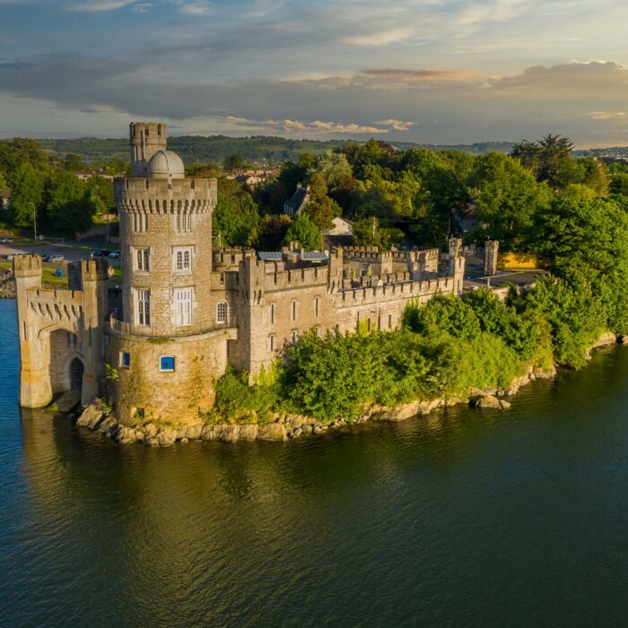
The harbour, the ruins of Black Castle and the coastal walks complete a visit to the town.
Arklow and southern Wicklow
A maritime tradition on the Avoca
Arklow is one of the main towns in the south of the county. Located at the mouth of the Avoca River, it has a long history associated with fishing, shipbuilding and port activities.
The town was founded or developed by the Vikings, as suggested by its Norse-origin name. Its maritime heritage remains visible around the harbour and in local historical collections.
Inland, the Avoca Valley is known for its wooded landscapes and former mining activity. The village of Avoca also retains a weaving tradition developed since the eighteenth century.
The Meeting of the Waters is where the Avonmore and Avonbeg rivers meet before forming the Avoca. The site was celebrated by the Irish poet Thomas Moore at the beginning of the nineteenth century.
The beaches of Wicklow
A coastline opening onto the Irish Sea
The county has more than sixty kilometres of coastline. It alternates between cliffs, sandy beaches, pebble beaches and small harbours.
Brittas Bay is the most famous beach. Its long sandy expanse is bordered by an extensive dune system. It attracts many visitors during fine weather but remains pleasant for walking out of season.
Magheramore Beach lies south of Wicklow town. Wilder in character, it is popular for water activities and walks. Swimming nevertheless depends on sea conditions and the possible presence of currents.
Silver Strand is a small cove at the foot of the cliffs. Access traditionally crosses private land and may change, so conditions should be checked before visiting.
The Blessington Lakes and western Wicklow
A vast reservoir surrounded by hills
The Blessington Lakes, also known as Poulaphouca Reservoir, form Ireland’s largest artificial lake. The reservoir was created in the 1940s to generate electricity and supply the Dublin region with water.
Its indented shores stretch between hills, forests and farmland. Several viewpoints offer views of the lake, particularly around Blessington and Russborough House.
Western Wicklow has a more rural character than the coast. The towns of Blessington and Baltinglass serve as bases between the mountains and the plains of Leinster.
Baltinglass preserves the ruins of an important Cistercian abbey founded in the twelfth century. The site lies on the banks of the Slaney, in a landscape very different from the peatlands in the centre of the county.
Hiking and outdoor activities
A vast adventure playground near Dublin
Wicklow is one of Ireland’s main hiking destinations. Routes range from family walks around Glendalough to more demanding ascents of Lugnaquilla, Djouce Mountain and Tonelagee.
The Great Sugar Loaf offers a relatively short hike, but its upper section crosses rocky and steep terrain. Its isolated position provides broad views of the coast and the northern part of the county.
The forests also offer walking and cycling routes. Ballinastoe is particularly known for its woodland trails and mountain-biking routes.
The lakes, rivers and coastline allow visitors to enjoy kayaking, paddleboarding, sailing and fishing. Some activities require supervision or permission, while weather conditions may lead to their cancellation.


 +
+
 Tourist attractions
 Irish Restaurants and Pubs
 Partner Accommodations
 Campgrounds and Lodging