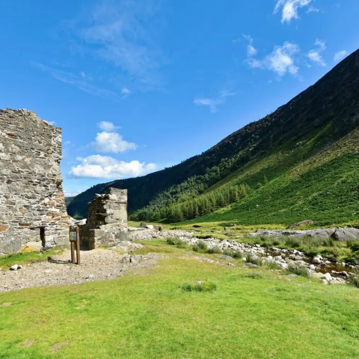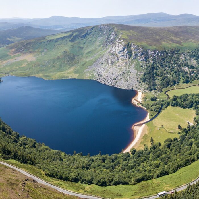
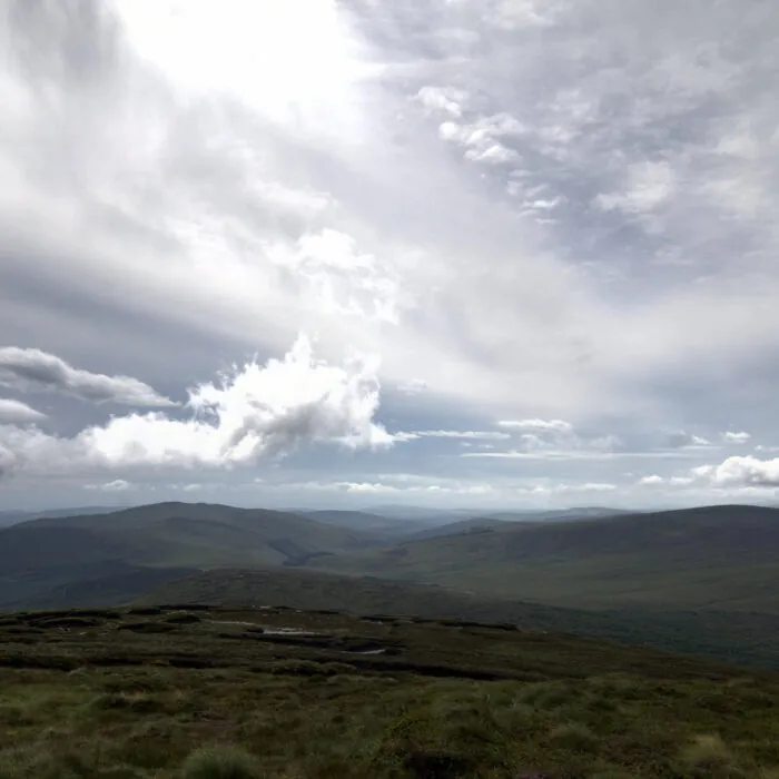


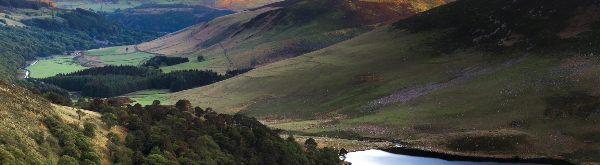
The Wicklow Mountains, or Mountains of Wicklow, form a vast wilderness south of Dublin. Rust-coloured heather moorland, upland peat bogs, glacial valleys and dark lakes combine to create one of Ireland’s most iconic landscapes. Much of this area is protected within the Wicklow Mountains National Park, the country’s largest national park.
The range reaches its highest point at Lugnaquilla, at 925 metres. Its altitude may seem modest, but it should not be underestimated: rugged terrain, mist and changeable weather can give the Wicklow Mountains a distinctly Alpine character.
Less than an hour from the Irish capital, the Wicklow Mountains offer a striking change of scene. Roads gradually leave Dublin’s suburbs behind and enter a world of silent moorland, deep forests and rounded mountains.
The Wicklow Mountains National Park covers almost 23,000 hectares. It protects, among other features, extensive blanket bogs, glacially shaped valleys and several habitats essential to Irish wildlife.
Deer, foxes, badgers and Irish hares inhabit these uplands. Overhead, peregrine falcons, buzzards and other birds characteristic of the highlands can sometimes be seen.
The Wicklow Mountains are not defined by a single viewpoint. This vast area brings together a wide variety of natural, historical and archaeological sites.
The 121-metre-high Powerscourt Waterfall can also complement a visit to the area. Please note, however, that it lies on the private Powerscourt estate, outside the national park, and there is an admission charge.
The park offers routes for a range of abilities. At Glendalough, the paths along the Lower Lake are relatively accessible. The Spinc routes climb higher and reveal spectacular views over the Upper Lake and the glacial valley.
Long-distance walkers can follow the Wicklow Way. This waymarked trail links Marlay Park, south of Dublin, with Clonegal in County Carlow. It extends for around 127 kilometres and is generally completed in seven days or more.
Climbing Lugnaquilla is considerably more difficult. The summit plateau can quickly become impossible to read when cloud descends. A map, compass and sound navigational skills are essential: a mobile app is not enough in an area where phone coverage can be patchy.
Driving remains the most practical way to explore the range. The R115, also known as the Old Military Road, crosses part of the mountains between Dublin, Sally Gap, Glenmacnass and Laragh.
Built between 1801 and 1809 by the British authorities, this former military road was intended to make it easier to move troops through a region that was then used as a refuge by Irish rebels.
The road is narrow and exposed to the elements. Drive carefully, particularly in rain, fog or winter conditions. Parking spaces are limited, and it is forbidden to block a road, private property or emergency access.
Walking and climbing are permitted, provided wildlife, vegetation and any seasonal restrictions are respected. Cyclists must stay on forest roads and surfaced tracks: off-road mountain biking is prohibited.
Sailing, canoeing, kayaking, paddleboarding and inflatable craft are not permitted on the park’s lakes, except with special authorisation. Horse riding, hunting, foraging and the use of drones without a permit are also prohibited.
Swimming is not formally prohibited, particularly in Glendalough’s Upper Lake, but visitors do so at their own risk. There are no supervised swimming areas. The water remains very cold, even in summer, and the lakebed becomes abruptly deep close to the shore.
Fishing is subject to strict rules. On the Upper Lake, it is permitted from the shore between 15 March and 30 September, using artificial lures. It is advisable to check the park’s updated rules before setting out.
In the Wicklow Mountains, the weather can change within minutes. Clear skies can quickly give way to mist, rain and strong gusts. Bring waterproof clothing, walking boots, water, food and an offline map.
There are no staffed shelters in the most remote areas. Toilets and the main facilities are concentrated around the visitor centres and car parks at Glendalough.
In the event of a mountain accident, call 112 or 999 and ask for mountain rescue. These emergency numbers may work even when normal mobile coverage appears to be unavailable.
Essential information to help you plan your visit, including key landmarks, access information, and booking options.
près de la R759 ou de la R115, Wicklow Mountains National Park, Wicklow Mountains National Park (County Wicklow) - Republic of Ireland
53.081856, -6.393902
The national park is open all year round, day and night. However, some car parks, facilities and trails may close temporarily for weather-related, operational or safety reasons.
Park information office at Glendalough:
Opening hours may change. Check the alerts published on the official website before setting off, particularly in the event of storms, works or fire risk.
Check the opening hours and admission requirements before you leave, especially during peak season or on Irish public holidays.
Admission to Wicklow Mountains National Park is free. No ticket is required to use its trails.
Parking at Glendalough may, however, be charged:
Glendalough is particularly busy at weekends and on sunny days. Arriving before 10 am generally helps to avoid queues and makes it easier to find a space.