

At the heart of the Wicklow Mountains, two solitary roads meet amid bogland, rounded peaks and glacial valleys. Sally Gap is neither a developed attraction nor a single viewpoint, but a mountain crossroads surrounded by some of eastern Ireland’s wildest landscapes.
Free to access, the area is best explored by car, motorbike or bicycle. The road passes through Wicklow Mountains National Park and leads to Lough Tay, Glenmacnass, Glendalough and Blessington. The scenery is spectacular, but the narrow roads, lack of services and highly changeable weather mean it is important to plan your route.
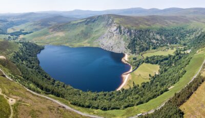
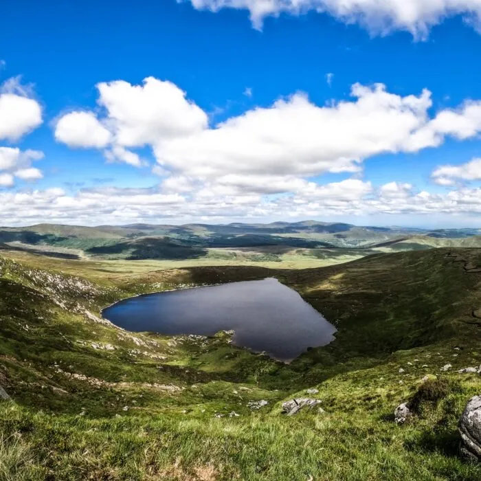
Lough Tay and Luggala Mountain near Sally Gap – © Michael Bogner
Sally Gap lies at an altitude of around 500 metres in County Wicklow. It is the junction of the R115, known as the Military Road, and the R759. The former crosses the mountains from north to south, while the latter links the Roundwood area to the east with Blessington and the Liffey Valley to the west.
There is no visitor centre, monument or official viewing platform here. Its appeal lies in the road itself and the surrounding scenery: upland bogs, heathland, streams, deep valleys and peaks often shrouded in cloud.
Sally Gap is therefore more of a stop on a scenic route than a destination requiring a two-hour visit. A few minutes are enough to take in the scenery at the junction, though one to three hours can be spent exploring the road and its various points of interest.
Sally Gap is often rendered in Irish as Bearnas na Diallaite, meaning “the gap of the saddle”. This name is, however, based on a false etymology that appeared in 20th-century publications. It assumed that the English word Sally derived from saddle.
According to the official Irish placenames database, Logainm, the historical name is Bearna Bhealach Sailearnáin. Its final element may derive from an Irish word associated with willow, referring to a “place where willows grow”.
The English name Sally Gap appears on a County Wicklow map published as early as 1760. It therefore predates the construction of the present Military Road.
The R115 follows part of the Great Military Road, one of Ireland’s most remarkable historic roads. Around 58 kilometres long, it was built by the British authorities between 1801 and 1809.
Following the failure of the Irish Rebellion of 1798, several insurgents took refuge in the Wicklow Mountains. The terrain, bogland and lack of transport routes made pursuing them particularly difficult. The military road was intended to allow troops to move more quickly through these previously inaccessible areas.
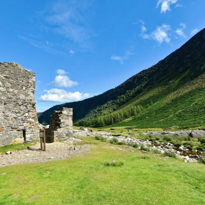
Barracks were built at various points along the route, including Glencree, Laragh and Glenmalure. Although the road has lost its military role, its route still makes it possible to cross much of Wicklow’s mountain scenery today.
The Sally Gap landscape is distinguished by its vast expanses of blanket bog. Formed over several millennia in a wet climate, these habitats store significant quantities of carbon and support vegetation adapted to nutrient-poor, waterlogged soils.
Cottongrass, sphagnum mosses, heather and grasses create an ever-changing mosaic of colours. Spring’s green tones give way to the purple flowers of heather, followed by the russet and golden hues of autumn.
The landscape may look open and easy to cross, but the bog can be deep, unstable and waterlogged. Do not leave recognised paths or venture at random across the heathland. These environments are both fragile and potentially dangerous.
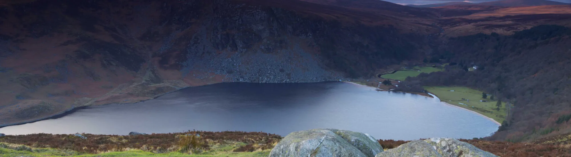
Lough Tay is often presented as Sally Gap’s lake, but it is not located at the crossroads itself. To see it, follow the R759 towards Roundwood for several kilometres.
The lake lies below, at the foot of Luggala Mountain. Its very dark water and small pale sandy beach have earned it the nickname “Guinness Lake”, as their contrast recalls a pint of stout topped with foam.
There are several stopping places along the R759. The JB Malone Memorial viewpoint offers one of the most popular views over the lake and also provides access to the Wicklow Way and routes on Djouce Mountain.
The land directly surrounding Lough Tay is partly part of the private Luggala estate. Do not cross fences or use access routes marked as private. The view can be enjoyed from the road and officially open trails.
Lough Dan lies south of Lough Tay, in a valley crossed by the Avonmore and Cloghoge rivers. It forms part of the same landscape, but is not directly visible from the Sally Gap crossroads.
It can be glimpsed from certain high points and walking routes. Access requires more preparation than for Lough Tay, however, particularly because of private property and the limited number of parking areas.
It is therefore inaccurate to say that the Sally Gap road directly overlooks Lough Tay and Lough Dan. The two lakes are separate stops on a wider route through the Wicklow Mountains.
A car is the easiest way to explore Sally Gap. From Dublin, the R115 can be reached via Rathfarnham, Glencree and the Wicklow uplands. This road passes through increasingly open landscapes before reaching the crossroads.
One particularly rewarding route is to continue along the R759 towards Lough Tay and Roundwood, then head on to Glendalough. This loop combines the Military Road, bogland, the Guinness Lake viewpoint and the ancient monastic settlement of Saint Kevin.
In the other direction, the R759 descends towards the Liffey Valley and the Poulaphouca Reservoir, often known as Blessington Lakes. The R115, meanwhile, continues towards Glenmacnass and Laragh.
Journey times can be considerably longer than the distance suggests. The roads feature bends, narrow stretches, free-roaming animals and, at times, oncoming vehicles on a restricted carriageway.
There is no proper tourist car park at the Sally Gap crossroads. A few lay-bys and small pull-in areas are available along the roads, but capacity is limited.
Park only where your vehicle can be completely clear of the carriageway. Never block a gate, private entrance or emergency access. The grassy verges can be very soft and may conceal ditches: avoid driving onto them.
To admire Lough Tay or begin a walk, it is best to use the spaces near the JB Malone Memorial. They fill up quickly at weekends and on sunny days.
Contrary to what some guides suggest, Sally Gap does not have an easy short walk starting from an official car park. The crossroads is surrounded by narrow roads, private property and bogland with no clearly laid-out paths.
Walking along the R115 or R759 can be dangerous. There are often no verges, and drivers may see pedestrians late, especially on bends or in fog.
For a proper hike, choose a nearby waymarked route instead. The JB Malone Memorial provides access to the Wicklow Way and trails around Djouce Mountain. Glendalough also offers several signposted routes, from short forest walks to the more demanding Spinc trails.
The roads around Sally Gap are highly popular with road cyclists. The long climbs, open scenery and fast descents make it one of Wicklow’s most spectacular areas.
The route should not be underestimated, however. The elevation gain is substantial, weather conditions can change quickly and services are scarce. A benchmark sporting circuit from Blessington is around 100 kilometres long and includes almost 1,700 metres of climbing.
Suitable equipment, waterproof clothing, water, food and repair supplies are essential. On descents, cyclists must remain alert for loose gravel, animals and vehicles that may sometimes occupy much of the carriageway.
Spring and summer bring the longest days and the best chance of clear views. Autumn gives the heathland beautiful colours, while winter can transform the peaks completely.
Fog can sometimes reduce visibility to a few metres. Rain, wind, frost and snow can also make the roads difficult or even impassable. Before setting out in winter, check weather forecasts and local road information.
Avoid relying solely on a navigation app. Some suggested routes may use very narrow roads or roads unsuitable for your vehicle. Download your map before setting off, as mobile coverage remains patchy in the mountains.
Crossroads coordinates: 53.1376, -6.3113.
Access to Sally Gap is free at all times, subject to road conditions. No ticket or booking is required. However, there are no toilets, cafés, shops or information centre at the crossroads.
Fill up with fuel before entering the mountains and bring water and a waterproof jacket. The nearest services can be found in Roundwood, Laragh, Blessington or Enniskerry, depending on your route.
Recreational drones are not permitted in Wicklow Mountains National Park. Dogs must be kept on leads to protect wildlife and livestock. It is also essential to leave no litter and not light fires on the bogland.
Lough Tay is the best-known scenic stop nearby. The JB Malone Memorial offers a fine view of the lake and Luggala Mountain.
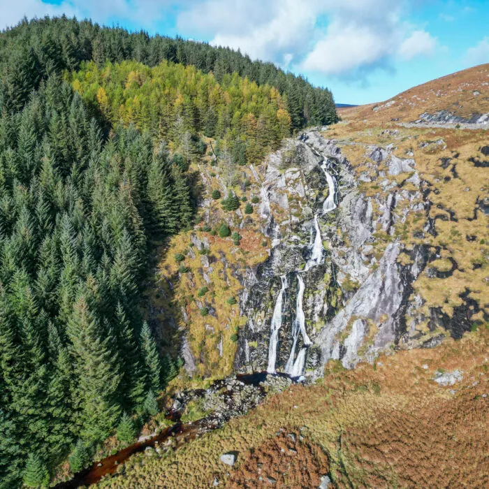
Following the Military Road south, Glenmacnass Valley reveals a waterfall that is easily visible from a stopping area. Parking is limited and the road remains very busy: caution is essential.
Further on, Glendalough brings together a monastic settlement founded in the 6th century, two glacial lakes and nine waymarked trails. The village of Laragh is a convenient stop for lunch or a break before getting back on the road.
Is Sally Gap free to access?
Yes. Sally Gap is a road junction in the Wicklow Mountains. It is free to access and no booking is required.
Is there an easy walk at Sally Gap?
No, the crossroads does not have a dedicated waymarked walk. To walk safely, choose the official trails on Djouce Mountain, the Wicklow Way or at Glendalough.
Can you see Lough Tay from the crossroads?
No. Lough Tay is several kilometres further east, along the R759. The JB Malone Memorial offers one of the best views over the lake.
Essential information to help you plan your visit, including key landmarks, access information, and booking options.
à l'ouest de la R115, Wicklow Mountains National Park, Wicklow Mountains National Park (County Wicklow) - Republic of Ireland
53.137186, -6.309942
2h00