

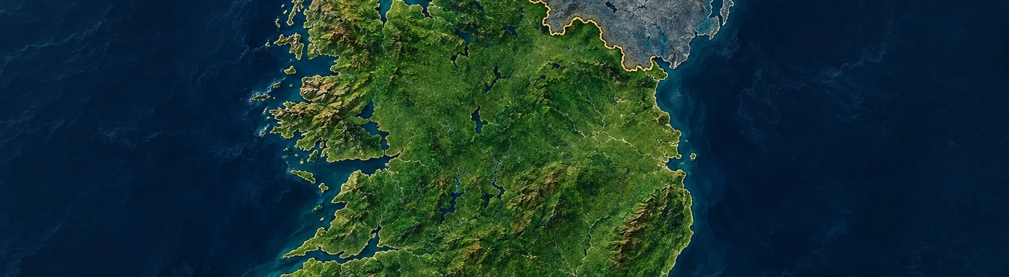
On some roads in north-west Ireland, the Irish border reveals itself only in a small detail: a speed limit displayed in miles rather than kilometres, or a price suddenly shown in pounds sterling. No wall divides the landscape. Yet this line separates two jurisdictions and cuts through more than a century of memories. The partition of Ireland left 26 counties in what is now the Republic of Ireland and six in Northern Ireland, a constituent part of the United Kingdom.
On a map, the outline may seem straightforward. On the ground, it never has been: towns, farms, families and identities cannot simply be arranged on either side of a line. Why was Ireland divided? To understand, we must look back to the struggles for self-government, unionist resistance in Ulster and the decisions made in London between 1920 and 1922. The Anglo-Irish Treaty of 1921 confirmed the separation; the British law that set out its framework had already been passed the previous year.
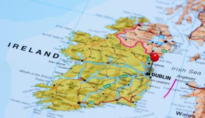
Map showing the partition of Ireland – © Dmitrijs Kaminskis
Since the Act of Union came into force in 1801, Ireland had been incorporated into the United Kingdom of Great Britain and Ireland. Its Parliament disappeared, and Irish affairs were largely directed from Westminster. During the 19thth century, several movements called for greater autonomy. The Home Rule project did not initially envisage full independence: it aimed to create Irish institutions capable of managing domestic affairs while keeping the island within the United Kingdom.
This prospect appealed to much of the nationalist population, which was predominantly Catholic. It alarmed many unionists, however, especially in north-east Ulster, where they were particularly numerous. Generally Protestant, they were committed to union with Great Britain and connected to an industrial economy geared towards the British market. They feared becoming a minority in a self-governing Ireland dominated by Catholic nationalists.
The crisis intensified when the third Home Rule Bill was introduced in 1912. Hundreds of thousands of opponents signed the Ulster Covenant to declare their refusal to accept a self-governing administration based in Dublin. The Ulster Volunteer Force was formed in 1913 to defend the union, including by force of arms. In response, nationalists founded the Irish Volunteers.
The First World War suspended the implementation of Home Rule, passed in 1914. But the idea of temporarily or permanently excluding part of Ulster from the future self-governing system had already entered the debate. The question was no longer simply whether Ireland would gain autonomy: it was now necessary to determine whether that autonomy would apply to the whole island.
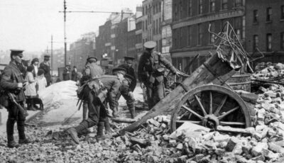
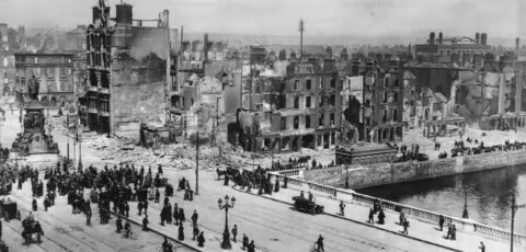
Easter Rising – Public domain
The Easter Rising of 1916 did not overthrow British authority, but the repression that followed profoundly transformed public opinion. In the general election of December 1918, Sinn Féin won a large majority of Irish seats, with the notable exception of much of unionist Ulster. Its elected representatives refused to take their seats at Westminster and established Dáil Éireann in Dublin in January 1919.
The same period marked the beginning of the Irish War of Independence. The IRA fought British forces as two political claims to legitimacy clashed: that of the United Kingdom and that of the republic proclaimed by the nationalists. London then sought an institutional solution that could partly meet demands for autonomy while protecting unionists in the north-east.
The British Parliament passed the Government of Ireland Act 1920, presented by the House of Lords Library, in December of that year. The legislation provided for two self-governing territories within the United Kingdom: Northern Ireland and Southern Ireland. Each was to have its own Parliament and government. A Council of Ireland was also envisaged to manage certain shared matters and, potentially, encourage closer relations at a later date.
Northern Ireland was made up of six of Ulster’s nine historic counties: Antrim, Armagh, Down, Fermanagh, Londonderry and Tyrone. The province’s other three counties — Cavan, Donegal and Monaghan — were attached to Southern Ireland.
The choice of six counties followed a political logic. A Northern Ireland confined to this area had a unionist majority considered sufficiently secure to ensure the durability of its institutions. Including all nine counties of Ulster would have created a larger territory, but one with a much larger Catholic nationalist population. Even within the six counties selected, however, the boundary left substantial nationalist minorities, notably in Counties Fermanagh and Tyrone and in the city of Derry.
Northern Ireland’s institutions began operating in 1921, with a Parliament established in Belfast. In Southern Ireland, the arrangements proposed by London failed almost immediately: the overwhelming majority of elected representatives supported the revolutionary Dáil and refused to recognise the new Southern Parliament. The system designed by the Government of Ireland Act therefore truly applied only in the North.
The border between the two jurisdictions officially came into force on 3 May 1921. Northern Ireland established its institutions, while negotiations between Irish and British representatives sought a way out of the War of Independence for the rest of the island. At that point, the border was not yet one between two independent states: it became an international border with the birth of the Irish Free State at the end of 1922.
The Anglo-Irish Treaty was signed in London on 6 December 1921. It provided for the creation of the Irish Free State, a self-governing dominion comprising the 26 counties of the South and West. The text formally gave Northern Ireland the option of joining the new state, while granting it the right to opt out.
Unsurprisingly, Northern Ireland’s institutions chose to remain within the United Kingdom after the Free State was officially established in December 1922. The treaty therefore did not create partition, but it confirmed it and organised the new relationship between the two territories.
The treaty did, however, cause a deep rift within the independence movement. Its supporters saw it as a decisive step towards sovereignty. Its opponents objected in particular to retaining the link with the British Crown, the oath of allegiance and the abandonment of the aim of a republic encompassing all 32 counties. This split led to the Irish Civil War of 1922–1923.
The treaty provided for the creation of a commission to examine the border, taking account of the wishes of local populations and economic and geographical realities. Many nationalists believed that areas that were predominantly Catholic or favoured joining the Free State would be transferred southwards. Some even imagined that Northern Ireland, deprived of a substantial part of its territory, would become too economically fragile to survive.
The Boundary Commission worked between 1924 and 1925. Its conclusions, however, appeared far more limited and complex than expected: several areas might have been transferred in both directions. Following press leaks, the British, Irish and Northern Irish governments reached an agreement. The existing border was ultimately retained unchanged.
The border crosses countryside, minor roads, farmland and, at times, closely connected communities. It follows neither a perfect religious divide nor an obvious geographical boundary. Some roads cross from one territory to the other several times over a short distance, while certain farms lie in the immediate vicinity of the line.
This route created many practical difficulties. Families, markets, services and transport networks had long operated on an all-island basis. Partition now introduced two administrations, two legal systems and, gradually, different economic policies.
Partition did not neatly separate two homogeneous populations. A substantial Catholic nationalist minority remained in Northern Ireland, while Protestants and unionists lived in the Free State. The early years were marked by violence, displacement and profound insecurity, particularly in Belfast.
In the North, power remained dominated by unionists for a long time. Discrimination, notably in housing, public employment and political representation, fuelled a lasting sense of injustice among part of the Catholic population. These tensions alone do not explain the outbreak of the Troubles in the late 1960s, but they are a central part of its historical context.
The Irish Free State gradually strengthened its autonomy, adopted a new Constitution in 1937 and officially became a republic in 1949. Northern Ireland remained within the United Kingdom. It retained its regional Parliament until 1972, when London imposed direct rule at the height of the Troubles.
The border then became heavily militarised in many areas. Checkpoints, closed roads and the presence of the British Army transformed everyday life. For several generations, crossing the border was nothing like the unobtrusive passage experienced by travellers today.
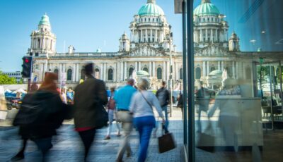
Belfast City Hall – © William
The Good Friday Agreement, signed in 1998, established that Northern Ireland’s status can change only with the consent of a majority of its population. It also recognises the legitimacy of both aspirations: remaining in the United Kingdom or pursuing a united Ireland by democratic means.
The agreement also developed cooperation between North and South and allows Northern Ireland’s inhabitants to identify as British, Irish or both. The border has not disappeared in legal terms, but it became far less visible in the landscape after the main security controls ended.
The United Kingdom’s withdrawal from the European Union brought the border back to the centre of political negotiations. The Republic of Ireland remains a member of the European Union, while Northern Ireland is part of the United Kingdom. The arrangements reached seek to avoid the return of a hard land border while organising the necessary checks on goods.
For travellers, crossing by road between the two territories generally remains unobtrusive. No major border post consistently marks the change of country. A few details suddenly take on very practical importance: prices switch from euros to pounds sterling, road speed limits are expressed in miles per hour in the North, and road signs change in style.
In Dublin, the General Post Office and Kilmainham Gaol shed light on the revolutionary movement and its consequences. Belfast offers a more direct understanding of Northern Ireland’s history: City Hall, neighbourhoods marked by murals, the peace walls and museums devoted to the conflict show how profoundly the constitutional question shaped the city.
Derry also holds an essential place. Its walls, the Bogside neighbourhood, the Free Derry Wall and the Museum of Free Derry tell the story of discrimination, the civil rights movement and the violence that followed. In the border countryside, the apparent absence of a dividing line is itself instructive: it bears witness to how far things have come since the decades of checkpoints and militarisation.
The island of Ireland today comprises the Republic of Ireland and Northern Ireland. The term ‘Southern Ireland’ is imprecise and can be confusing: the Republic does not cover only the south of the island, and Ireland’s northernmost point is in fact in County Donegal, in the Republic of Ireland.
Speaking of the ‘two Irelands’ may be convenient, but the phrase simplifies a complex reality. Many inhabitants see the island as a single historical and cultural entity, even when they uphold different national affiliations. Competing identities, fears and political projects produced this border. It can now be crossed without stopping, but its effects remain in the institutions, debates and family histories on both sides of the island.