

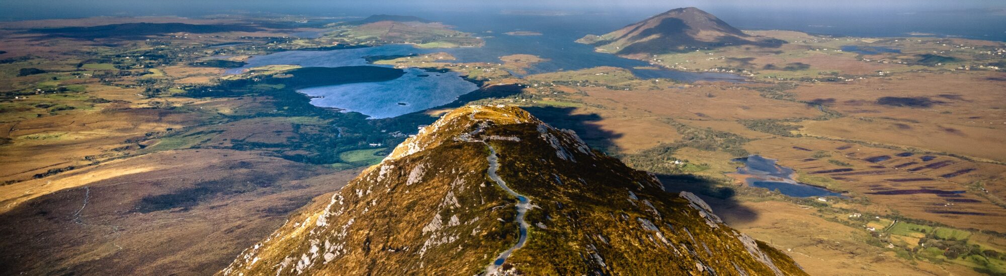
Diamond Hill is one of the most accessible and spectacular walks in Connemara National Park. From the visitor centre in Letterfrack, a waymarked trail crosses bogland before climbing to a rocky summit overlooking the Atlantic coast, the Twelve Bens and the Kylemore valley.
Despite its modest height of 442 metres, Diamond Hill is a proper little mountain. The lower loop is suitable for most walkers, while the full ascent requires a good level of fitness, suitable footwear and reasonably favourable weather.
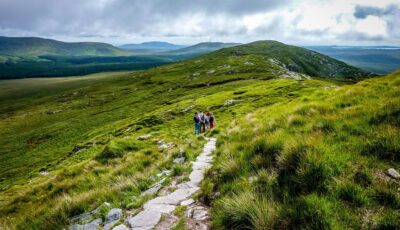
Climb towards Diamond Hill – Jan Mennens – CC BY-SA 2.0
The English name Diamond Hill does not appear to refer directly to its triangular shape. Instead, it is thought to come from the quartz crystals found in the mountain’s pale rock. After a shower or in low-angled light, these fragments can create small glints reminiscent of a diamond’s sparkle.
The mountain is made chiefly of quartzite, a particularly hard-wearing rock that also characterises several nearby peaks. Its rocky slopes stand out clearly against Connemara’s dark bogs and heathland.
In Irish, Diamond Hill is known as Binn Ghuaire, which can be translated as “Guaire’s peak”. The name is said to be linked to Guaire Aidne mac Colmáin, a 7th-century King of Connacht remembered in Irish tradition for his hospitality and generosity.
Diamond Hill lies in the north-western part of the Twelve Bens range. However, it appears as a relatively isolated peak compared with the range’s main mountains.
At 442 metres, it is considerably lower than Benbaun, the highest point in the Twelve Bens, which reaches 729 metres. Its well-maintained, fully waymarked trail nevertheless makes it far more accessible than the higher neighbouring summits, which require navigational skills on rocky and boggy ground with no official paths.
Diamond Hill therefore provides an excellent introduction to Connemara’s mountain landscapes. It allows visitors to admire the Twelve Bens without undertaking a long, technically challenging walk.
The walk begins near the Connemara National Park visitor centre, close to the village of Letterfrack. The route follows gravel paths, wooden boardwalks, stone steps and rockier sections in turn.
Two trails allow walkers to choose their level of difficulty. The Lower Diamond Hill Trail, marked in blue, is a three-kilometre loop. The Upper Diamond Hill Trail, marked in red, extends the walk to the summit.
The two routes share part of their course. At the junction, walkers can return to the visitor centre via the lower trail or continue the ascent by following the red arrows.
The lower trail is around three kilometres long and usually takes an hour. It crosses heathland and bogland on a well-maintained path before reaching a high point known as Big Rock.
This walk already offers fine views over Letterfrack, the Connemara coast and the surrounding hills. It is a good option for families, occasional walkers or visitors short on time.
The route is officially graded as moderate. Although the boardwalks make it easier to cross wet areas, there are still a few climbs and uneven sections. A standard pushchair will not be able to complete the entire loop.
To reach the summit, continue from the blue trail onto the Upper Diamond Hill Trail. The upper section is officially 3.7 kilometres long. Including the approach and return to the visitor centre, the full route covers around 6.5 to 7 kilometres.
The National Parks and Wildlife Service recommends allowing around 2 hours 30 minutes for the return walk. Three hours is more realistic if you wish to walk at an easy pace, take breaks and enjoy the views.
The slope becomes considerably steeper after the junction. The trail climbs via a series of steps and switchbacks to the ridge. Some sections can be slippery after rain, while the wind often strengthens as you approach the summit.
The red trail is officially graded as hard. There are no scrambling sections, but it requires a reasonable level of fitness and suitable equipment. The descent follows the other side of the summit before rejoining the boardwalks and the lower trail.
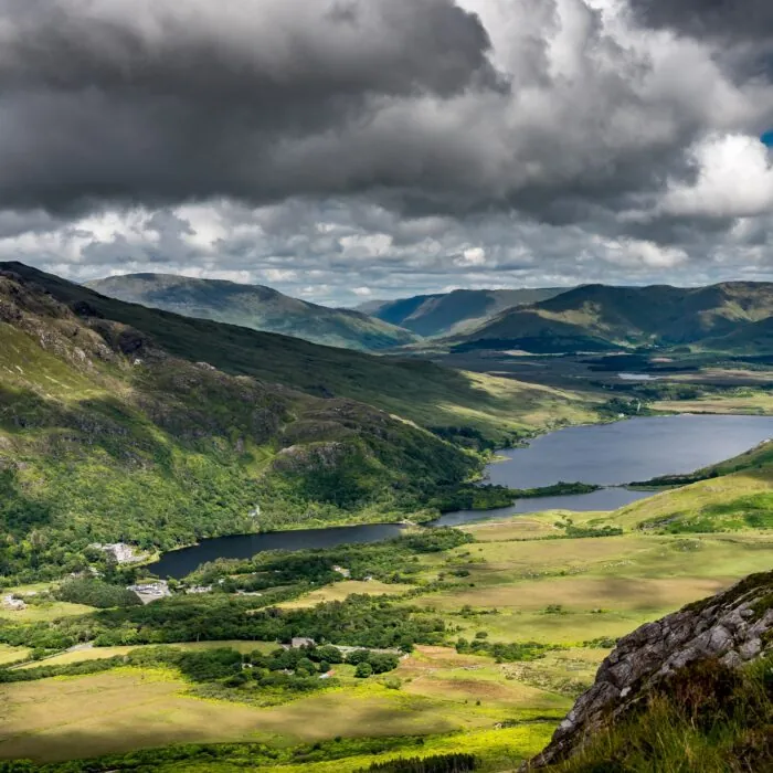
In clear weather, the summit offers one of the most comprehensive views in Connemara. To the east rise the various peaks of the Twelve Bens, whose quartzite ridges cut across the skyline.
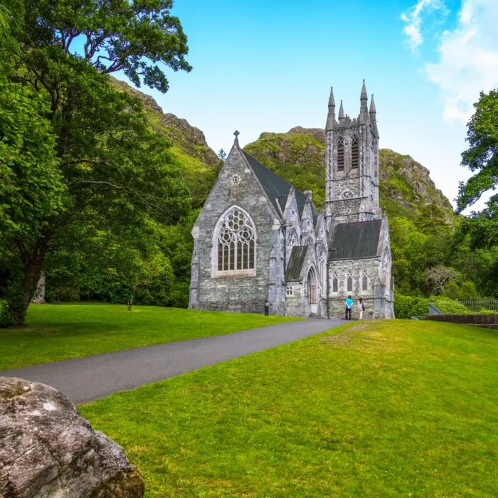
To the north, Kylemore Lough and the neo-Gothic buildings of Kylemore Castle come into view. The Gothic Church at Kylemore and parts of the estate can also be seen when visibility is good.
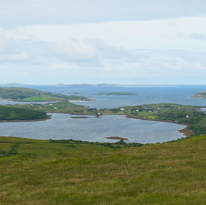
To the west, the view extends over Ballynakill Harbour and the Atlantic coast. The islands of Inishbofin, Inishturk and Inishark may be visible offshore. Further north, the slopes of Tully Mountain can be made out and, in the distance, those of Mweelrea.
The landscape changes constantly as clouds pass overhead. Within a few minutes, the mountains can disappear into mist before reappearing in almost unreal light.
The lower trail can be suitable for children who are used to walking. Its waymarking is clear, and the boardwalks make part of the route quite fun. Good footwear, water and waterproof clothing are still essential.
The summit ascent should be considered more carefully. There are many steps, the ridge is exposed and gusts can be strong. Young children must remain under an adult’s supervision at all times.
It is best to avoid the upper trail when cloud covers the summit, the wind is strong or a weather warning is in place for County Galway. The lower trail then allows you to enjoy the landscape without venturing onto the most difficult sections.
Connemara’s weather can change quickly, even in summer. Bring hiking boots or walking shoes with grippy soles. Waterproof, windproof outerwear is essential for the upper trail.
Also take water, a light snack and a warm layer. Sun protection can be useful when the sky clears, as the route offers little shade. In summer, midge repellent can make the lower, wetter sections more comfortable.
The boardwalks were built to protect the bogs and limit erosion. It is essential to stay on the trail, take all litter with you and respect the national park’s fragile vegetation.
The walk starts at the Connemara National Park visitor centre, on the N59 just outside Letterfrack.
It is around 15 kilometres from Clifden. From Galway, the distance is between 82 and 93 kilometres, depending on the route taken. Westport is approximately 53 kilometres to the north.
There is a large free car park near the visitor centre. Entry to the park, parking and access to the trails are free.
Letterfrack is also served from Galway and Clifden by Bus Éireann route 419 and Citylink route 923. From Westport, Bus Éireann route 423 reaches the area. Timetables should be checked before travelling, particularly on Sundays and out of season.
After the walk, the village of Letterfrack has a few cafés, pubs and restaurants. It is also a convenient base for exploring northern Connemara.
The Kylemore estate is less than ten minutes away by car. It includes Kylemore Castle, the Gothic Church and a large enclosed Victorian garden. Further west, the road leads to Tully Cross, Renvyle and several beaches along the Atlantic coast.
Experienced walkers can head for the Twelve Bens, but these mountains generally have no waymarked trails comparable to that on Diamond Hill. A map, compass and solid navigational experience are therefore essential.
Location: Connemara National Park, Letterfrack, County Galway.
Height: approximately 442 metres.
Lower Diamond Hill Trail: 3-kilometre blue loop, around one hour, moderate level.
Full ascent: approximately 6.5 to 7 kilometres, 2 hours 30 minutes to 3 hours, hard level.
Price: access to the park, trails and car park is completely free.
Trail opening: year-round, except for exceptional closures due to weather, safety or maintenance work.
Visitor centre in 2026: open Wednesday to Sunday from 9 am to 5.30 pm until further notice, as well as on public holidays falling on Mondays. It is closed on Mondays, Tuesdays, 25 December and 26 December. The trails remain accessible when the centre is closed, unless otherwise advised by the park.
Facilities: car park, toilets, café, picnic tables, playground and information area near the trailhead. Some facilities have their own opening hours.
Dogs: permitted under their owner’s responsibility and must be kept on a lead so as not to disturb wildlife or other walkers.
Drones: prohibited in the national park without special permission.
Safety advice: check Met Éireann forecasts and notices issued by the park before setting out. Do not take the upper loop in strong winds, poor visibility or bad weather conditions.
Want to extend your visit without having to rush around? Here are a few well-located places to stay near the must-see attractions.
Essential information to help you plan your visit, including key landmarks, access information, and booking options.
Addergoole, Letterfrack, Letterfrack
53.547702, -9.914722
3h00