Located west and southwest of Dublin, County Kildare combines ancient heritage, rapidly developing towns and vast rural landscapes. Its fertile plains have shaped one of the world’s most important equestrian traditions, while its bogs, canals and historic estates offer a more peaceful face of eastern Ireland.
Kildare is also the land of Saint Brigid, one of Ireland’s great spiritual figures. Her legacy is joined by the Fitzgerald castles, major horse-racing venues, the monuments of Castledermot and the mysterious landscapes of the Bog of Allen.
Visiting County Kildare
A historic region within Dublin’s orbit
County Kildare, Contae Chill Dara in Irish, belongs to the province of Leinster. Its name means “the church of the oak” and refers to the tradition that Saint Brigid founded a religious community near a great oak tree in the fifth century.
The county covers approximately 1,695 km². It is characterised by relatively flat landscapes crossed by the River Liffey, the Barrow, the Grand Canal and the Royal Canal.
Kildare had 247,774 inhabitants at the 2022 census, according to the Irish Central Statistics Office. Its population has increased by 11% since 2016, driven in particular by its proximity to Dublin and the development of transport links.
This growth has not completely erased the county’s rural character. Between its main towns lie extensive farmland, stud farms, forests and wetlands. Kildare thus offers an interesting contrast between contemporary Ireland and landscapes steeped in history.
Kildare town and Saint Brigid
The spiritual heart of one of Ireland’s patron saints
Kildare town holds an important place in Irish religious history. According to tradition, Saint Brigid founded a monastic community there in the fifth century. It welcomed both women and men and became one of the principal religious centres of medieval Ireland.
Saint Brigid’s Cathedral now occupies part of this former monastic landscape. The present building dates mainly from the thirteenth century, although it was extensively restored in the nineteenth century.
Nearby stands a round tower approximately thirty metres high. Built in the Middle Ages, it is one of the few Irish round towers whose summit remains accessible when opening conditions allow.
The town also preserves a well associated with Saint Brigid. The site continues to attract visitors and pilgrims, particularly around 1 February, the saint’s feast day and the date corresponding to the ancient celebration of Imbolc.
The Solas Bhríde centre provides information about her legacy, Celtic spirituality and Brigid’s place in contemporary Irish culture.
The Irish National Stud
At the heart of Ireland’s equestrian tradition
The Irish National Stud is one of the county’s best-known attractions. This national stud farm lies near Kildare town, amid land that has long been devoted to breeding racehorses.
The visit offers an opportunity to see the stallions, mares and, depending on the season, foals raised on the estate. Presentations explain how a stud farm operates and the place of the thoroughbred in Ireland’s sporting and economic history.
The site also includes the Japanese Gardens, created at the beginning of the twentieth century. Their route symbolises different stages of human life through bridges, paths, lanterns and plant compositions.
St Fiachra’s Garden offers an environment more inspired by Irish landscapes. Rocks, wetlands, trees and native plants create a more natural setting.
The Curragh
A vast plain devoted to horses
The Curragh is a broad, open plain between Kildare town and Newbridge. Its name comes from the Irish an Currach, meaning marshy ground or wet plain.
For centuries, this area has been associated with horse breeding and training. Its limestone soil, grass and vast unfenced expanses provide suitable conditions for thoroughbreds.
The Curragh Racecourse is the country’s main flat-racing course. It hosts several major races, including the Irish Classics. On race days, the atmosphere contrasts with the calm that usually prevails across the plain.
The county is also home to the racecourses at Punchestown and Naas. This exceptional concentration explains its nickname, Thoroughbred County, or the “county of the thoroughbred”.
The Curragh also has a military history. Troops were stationed there from the nineteenth century onwards, and a military camp remains active in the area.
Maynooth
A university town dominated by the Fitzgeralds
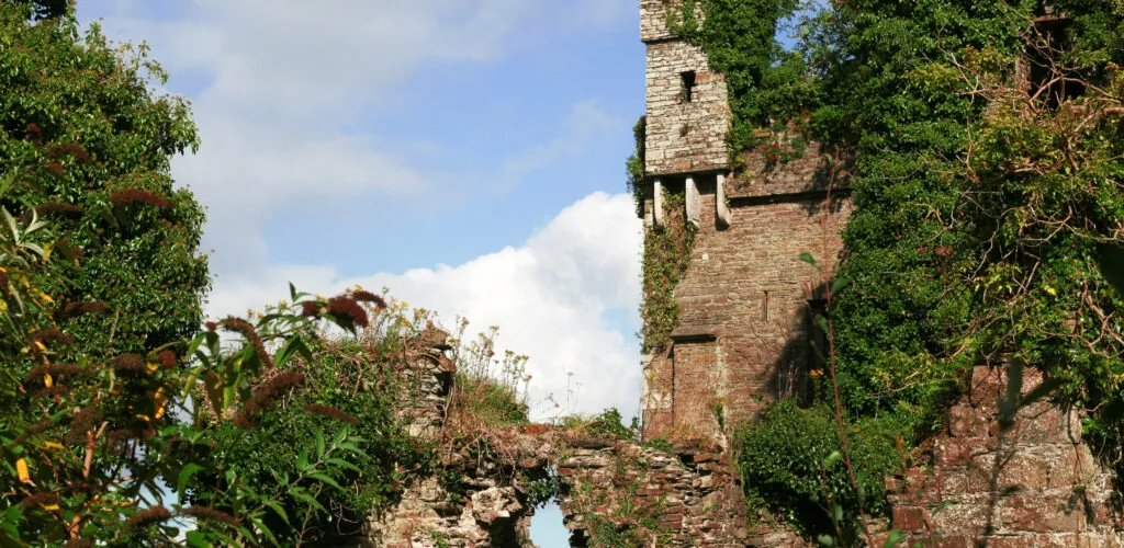
Maynooth lies in the north of the county, close to Dublin. The town is known for its university, religious educational institutions and the ruins of its medieval castle.
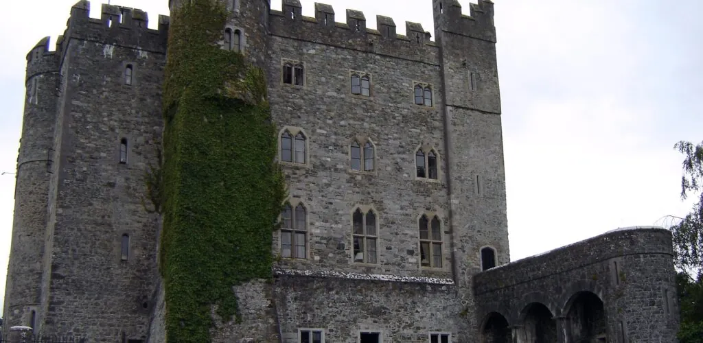
Maynooth Castle was founded at the beginning of the thirteenth century. It became the principal residence of the Kildare branch of the powerful Fitzgerald family, whose members exerted considerable influence over Irish political life.
The fortress reached its height in the fifteenth and early sixteenth centuries. It was badly damaged in 1535 following the rebellion of Thomas Fitzgerald, known as Silken Thomas, against King Henry VIII.
The keep and part of the gate survive today. An exhibition presents the history of the castle and the rise of the Fitzgeralds.
A short distance away are the campuses of Maynooth University and St Patrick’s College. The gardens, Gothic Revival buildings and college chapel give the town centre a distinctive architectural identity.
Castletown House and Celbridge
A Palladian mansion on the banks of the Liffey
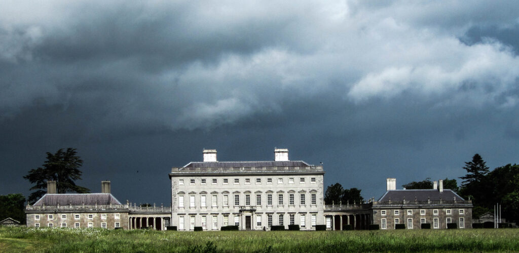
Castletown House stands in Celbridge, in the north-east of the county. Built from 1722 for William Conolly, speaker of the Irish House of Commons, it is considered one of Ireland’s earliest great Palladian houses.
Its architecture was intended to reflect its owner’s wealth and political power. The house is surrounded by an extensive estate laid out beside the Liffey.
The interiors include several reception rooms, a grand staircase and the Long Gallery, decorated in the Pompeian style in the eighteenth century.
Access arrangements for the house and car parks may change depending on works and management decisions. It is therefore advisable to consult the information from Heritage Ireland before visiting.
Celbridge is also associated with Arthur Guinness, founder of the famous brewery. He was born in the area in 1725 and spent part of his youth there before establishing his brewery in Dublin.
Naas and Newbridge
Two dynamic towns in the centre of the county
Naas is Kildare’s administrative capital. This former market town has developed considerably under Dublin’s influence, while retaining several historic buildings and a lively shopping centre.
Its Irish name, Nás na Ríogh, means “meeting place of the kings”. The town was once apparently associated with the rulers of Leinster.
Naas is a convenient base for reaching Punchestown Racecourse, the Grand Canal and the main attractions in the centre of the county.
Newbridge, meanwhile, developed around its military and industrial history. The town is particularly known for Newbridge Silverware, a company specialising in tableware, jewellery and decorative objects.
The site also houses the Museum of Style Icons, which displays clothing and objects associated with various figures from cinema, music and popular culture.
The Bog of Allen
A vast bogland in central Ireland
The Bog of Allen is an extensive area of bogland stretching across several counties in the Midlands, notably Kildare and Offaly. It gradually formed after the last ice age.
For centuries, peat was extracted, dried and then used as fuel. This exploitation profoundly altered the landscape and weakened its ecosystems.
Yet intact bogs support specialised flora and fauna. Sphagnum mosses, cotton grass, insects and birds depend on these waterlogged environments.
They also play an important role in carbon storage. When drained or exploited, organic matter accumulated over millennia decomposes and releases some of this carbon into the atmosphere.
Lullymore Heritage & Discovery Park helps visitors better understand the bog’s natural and human history. Boardwalks cross different habitats while exhibitions explore peat formation, its exploitation and the lives of local communities.
Castledermot
A village shaped by its monastic past
Castledermot lies in the south of the county, near the border with Carlow. The settlement developed around a monastery founded by Saint Diarmuid before the ninth century.
The site preserves a round tower, several high crosses and carved stones. These monuments bear witness to Castledermot’s religious importance in the early Middle Ages.
The ruins of the Franciscan friary are nearby. Founded in the thirteenth century, the institution was built on or near an older monastic site.
Castledermot also has the remains of a castle and several features associated with its medieval past. The concentration of monuments makes it possible to explore much of the heritage on foot.
Moone and its high cross
A masterpiece of medieval Irish sculpture
Moone’s high cross is one of the largest in Ireland. More than five metres high, it was probably carved between the eighth and tenth centuries.
Its panels depict various biblical scenes, animals and geometric motifs. These sculptures helped convey religious stories to a population that did not necessarily know how to read.
The cross stands among the ruins of an ancient monastic site. Its rural setting and remarkable state of preservation make it one of Kildare’s more discreet heritage treasures.
Athy and Ernest Shackleton’s legacy
A riverside town at the gateway to southern Kildare
Athy was built at the confluence of the Barrow and the Grand Canal. This position once made it an important centre for trade and the transport of goods.
The town is associated with Ernest Shackleton, the Irish explorer born near Kilkea in 1874. He led several expeditions to Antarctica and remains famous for rescuing his crew after the sinking of the Endurance.
The Shackleton Experience, housed in Athy’s former Market House, presents his life, expeditions and several objects linked to polar exploration.
The River Barrow and the old towpaths also allow visitors to explore the surroundings on foot, by bicycle or on the water.
Kildare’s canals and greenways
Discovering the county along the waterways
The Grand Canal crosses much of Kildare, passing notably through Sallins, Robertstown and Athy. Once used for transport, it is now a place for walking, boating and fishing.
The towpaths have gradually been developed for walkers and cyclists. Their limited elevation makes them accessible to a wide range of visitors.
The Royal Canal crosses the north of the county around Maynooth, Kilcock and Leixlip. It too offers long, peaceful stretches between villages, farmland and wooded areas.
In the south, the Barrow Blueway follows the river and canal between several settlements. It offers a rural landscape very different from the urbanised areas near Dublin.
Forests and natural areas of Kildare
Walks through woodland, hills and bogland
Donadea Forest Park occupies the grounds of a former estate belonging to the Aylmer family. Its trails pass through woodland, run beside a small lake and lead to the remains of a house and church.
The Hill of Allen rises above the plains in the centre of the county. It is associated with Fionn Mac Cumhaill and the Fianna in Irish mythology. According to tradition, the hero established his camp on this hill overlooking the surrounding area.
Mullaghreelan Forest, near Castledermot, offers further routes in the south of the county. Its wooded paths provide views of the Kildare countryside and the nearby hills of Carlow.
These areas do not have Wicklow’s dramatic relief, but they offer accessible walks and a more peaceful way to discover rural Ireland.